Lazy Man and Evening Star Mines

Stillwater Field Office BLM


(map link)

The bit of geocaching at the mining areas on the way up to Mable Mountain seemed quite successful, so I set out to find a couple more before stopping by the library in Hawthorne and then finding a new camp with easy access to Corey Peak. They were actually on the menu for the day I drove in, but the faint roads that lead to them proved so hard to see that I went right past before knowing it. With a lot more care, I got stopped in the right places on the way out. Since absolutely no one would care if I parked at the side of the road, I decided against challenging off road parking spots and didn't repeat throwing the car into a sand trap. First up, Lazy Man. I approached it from a hill that had been cut, but not for a road.

00: mining area
Buildings and other structures and tailings from the Lazy Man Mine, worked around the 1930s?, lie below.

01: mine all around
The mine spreads out all around the hill.

I headed down the hill, trackless on the south side, to have a look at the buildings and other structures. First a couple buildings.

02: building with rocks around the base
I'm going with explosives bunker for this one.

04: small building with wooden chimney and rock covering
Another building is well insulated with rock and given a wooden chimney, but isn't big enough to lay down in.

Then I checked out some mine shafts that follow the nearly vertical vein far down into the ground. The Nevada Bureau of Mines and Geology had been around, but not marked the scariest looking holes.

07: ladder into the earth
The top of a shaft. I would guess this is more recent than 1930s.

08: looking along the ladder
They go deeper than the light, something more than three storeys.

09: another mine top
A little less structure, but still a ladder and a wooden rails for a ramp that go further than the light down into the ground.

Then I headed on to the ruins. These could have been part of a nearly 100 year ago operation.

11: plain square building base
Ruins are the thick rock wall bases of buildings big enough to live within.

13: rock and timber
This apparent chaos of rock and timber looked elaborate with different floor levels and interior walls.

15: collapsed
Another mine by the tailings with its hole collapsed has been fenced off for my safety.

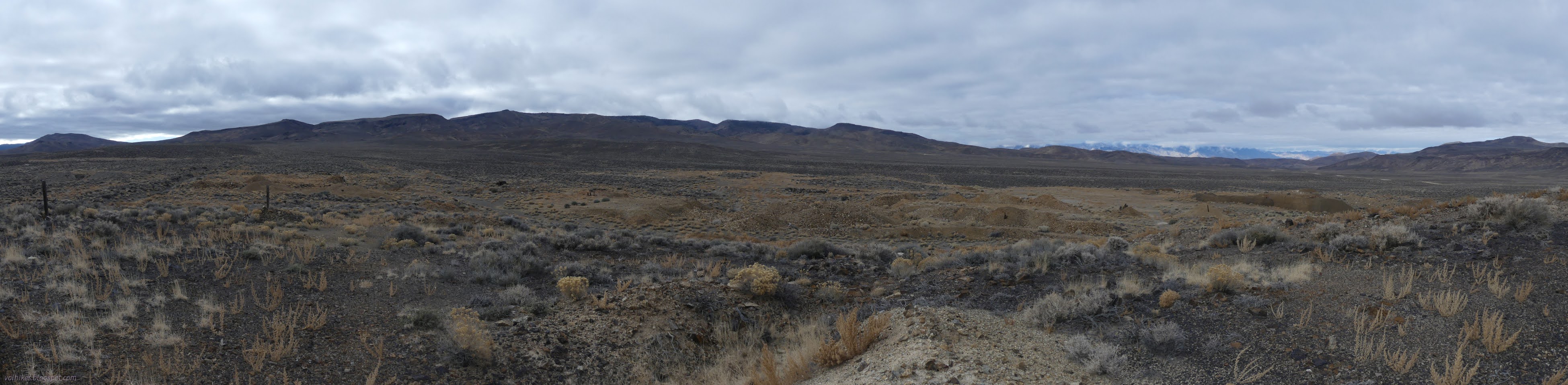
There was only about half a dozen vehicles through the valley while I was there. The last one was quite noisy.

16: helicopter fly by
Helicopters always make me wonder why.

Along the way, I did find the geocache, then followed the road back out to the main road. It was a bit of a wash more than a road, so no wonder I'd missed it.

17: blue sky showing
The weather finally started to clear.

Then it was on to a second spot.

I still couldn't see the road, but stopped anyway and found it once I was standing on it. "The old remains" promises rock walls of what might have been a cabin once. It's a little short of the Evening Star Mine and a few others. I figured I would see this ruin and at least the first mine.

19: gravel track
The road is easy enough to see when standing on it. I guess the sage is just too tall to see it from the main road.

20: cotton balls
Happy puffs from one aster plant. It even had a few flowers on still.

21: more blue sky
Getting clearer still, like the weather folks were promising. The day had started with a few snow flakes!

The ruin was off up a side canyon a little short of the mining area. It is barely big enough to be a cabin. Many of the small house folks have mansions compared to this cozy spot, but it is big enough to lie down in.

24: rock wall
The ruin marked by a nearby geocache.

25: all of the building now
There's not much to this little building now.

I decided I wasn't done yet and headed up the rest of the way to the first mine.

26: folded rock layers
Geology along the way with folded rock layers!

27: tailings ahead
Evening Star Mine ahead.

The Evening Star Mine has multiple wood structures along with a collection of holes in the ground. Oh, and the mystery of the book cases was about to be solved.

28: walls on the rocks
On a high flat, there's some complete, thick walls still.

31: collapsed building
Buster Keaton is done with this movie set. The completely collapsed building has a nice wall and big window and a bunch of those "book cases".

32: boxes in the road
The next vehicle through will probably flatten a bit of the wall on this most complete building.

34: most complete building
Another view of that most complete building. Not all of the walls are placed so they can have bookshelves.

I headed up higher to see that top building.

35: flat and collapse
The road to this high building has also collapsed.

36: fallen walls
Closer up, it is a similarly constructed and collapsing building.

37: top of a hole and collapsed hoist
This was where the mining went on as evidenced by a collapsed hoist at the top of a shaft.

38: mine view
You can see most of the Evening Star Mine from up here along with Corey Peak.

Although it was far from flowering, I had to marvel at a common and tiny wild buckwheat growing in the scary looking soil.

39: tiny plant
One of many tufts of wild buckwheat growing in the old road.

I checked out other shafts as I wandered down again.

40: mining shaft
A ladder for this one.

41: deep hole
Looking down from outside the barbed wire. Nice wall construction. Not so good ladder.

And the mystery of the "book cases"? Well, that's solved by simply reading the walls.

42: bomb shipping containers
Just your average, ordinary shipping container for a 7 inch, 100 pound, bomb. Do not upend. Do not stack more than 6 high.

Welcome to Hawthorne! This sort of thing is stored nearby in well spaced bunkers. I decided that was enough mining for the day and headed back. There are more not too much further.

*photo album*


©2023,2024 Valerie Norton
Written 19 Feb 2024


Liked this? Interesting? Click the three bars at the top left for the menu to read more or subscribe!


Comments

follow by email

popular posts:

Jennie Lakes: Belle Canyon and Rowell Meadow

Mount Lassic

Lost Coast: Cooskie Creek Route

If the Map's Wrong, Fix It!