Boulder Loop: Middle Boulder Lake, Cement Banks, and East Boulder Lake
Klamath National Forest
(green lines, map link)
DAY 1 | DAY 2 | DAY 3 | DAY 4 | DAY 5 | DAY 6
Morning at Telephone Lake. It's a funky looking thing. Perhaps the two lobes look a bit like a telephone receiver with enough foreshortening? I would run into clues for another reason to call it Telephone Lake later. The water is significantly below the rim and below the high water mark.


I took off down the trail. It's all rather badly burned. Hoofprints marked where the equestrian went. I got upset at how much milling and messing up the trail he did until noticing that the milling prints are the two toed ones of cows. Cows are trying to lead hikers on this trail astray at a few strategic points. The horse prints managed not to be lured and neither was I.

I'm sure there's nice cow path around to Middle Boulder Lake with all the cows that are allowed to graze up there. I went all the way down to the junction.


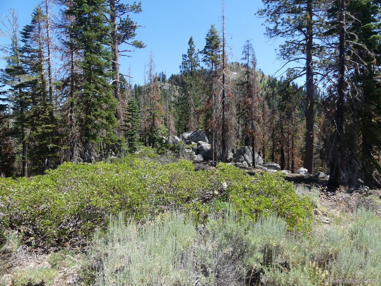
After a little struggling to decide upon trail vs. erosion gully vs. cow path, the hiking got much nicer. It's still in the footprint of the 2021 Haypress Fire, but it wasn't devastating to the forest.


I could hear cow bells as I approached Middle Boulder Lake. They were down under the trees and I ignored them as I went. I was focused on finding the large cairn piles as the trail crosses the meadow when the bells started getting louder. I looked over to see a wide line of cows and calves all running toward me as if they expected treats. I shouted out, "What is this?" and like a single organism, they all pulled up, turned on their heels, and ran even faster the other way. Cows. What was that?

The trail doesn't actually go all that near to Middle Boulder Lake, so I wandered that way on my own. I was ignoring the cows again and they were down among the alders near the outlet doing more normal cow things.


Then I got back to struggling to find the trail through the meadow. To compound the challenge, it's less used after the lake. I was actually trying to find a junction. I could spot my trail further on as it crosses the sage covered hillside. It's the spring covered meadow where it is hard to find. I thought I'd gotten to the junction, but it might have been further up. That extra distance might have let me miss a few of the springs in the meadow, but I managed not to hit any mud and could step over the flows. I grabbed some more water before leaving those springs expecting a dry few miles ahead. It wasn't all that dry.


I actually had a little more planned than following the trail around to the next lake. I was aiming at an Earthcache set by "Klamath-FS" that highlights the Cement Banks Geologic Area, where glacial activity deposited a thick layer of natural cement. Sadly, I would only be the second person to log GC41AZW An Icy Past: Cement Banks since it was created in 2012. Part of the reason for the low response rate will be that after miles of hiking to get near the location of the Earthcache, one then turns and walks cross country for about ¾ of a mile with various warnings that getting there might be hard and even dangerous. I was passing by, so it didn't cost anything much to have a look.


I got near the suggested launch point for off trail travel and found a distinct trail. It curved around more to the right than I expected and ended at a camp with furniture built of natural materials. Not quite what I was expecting, but given there's water within a quarter mile in either direction, it's a good place for it. I started along faint trail then made my own way continuing on along the ridge. Through the trees and heading very north, eventually getting around the first point along the ridge, I got out into the open. Not much grows on the cement.


Once on the cement, it was easy walking out to the point indicated by the Earthcache. It's not a sidewalk by any means, but without forest clutter, everything is easier to walk.
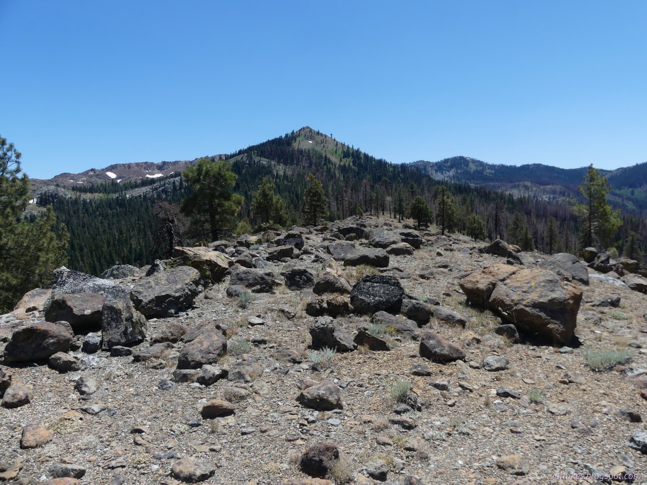

It takes getting to this very northern end to really see that it is cement here. The top is not entirely solid anymore, but the edge shows how everything is crudely glued together.

I admired the rocks. There's an especially nice serpentine (the green is actually peridtite) and that rather hard red sandstone I'd been walking past (actually another igneous rock) and bunches of granite (actually granodiorite, but it's a similar rock). It wasn't until I read the web site that I realized that they are all igneous (volcanic origin) rocks. I headed back after pondering the answers to the questions posed by the Earthcache. There was still more to do with the day.
I came upon a little spring with a trickle of water right next to the trail. It looks gently adjusted, rocks added to make the pool a little larger and such. Go a little further and there are sources that are much easier to use.


Further on, I came to a spot where snow still sat across the trail. It was so hot, I plastered myself across the frozen face of it, but that didn't last long. Snow really is cold! I snacked in the chill in its vicinity instead. There were a few flowers blooming late around it.


There's not much left to getting to East Boulder Lake after the snow. The trail pops over the last little bit of ridge and drops down through sage brush to the edge of a meadow. There it vanishes. Most probably go along the edge of the sage to the trail below. I spotted the site on the north side of the lake and mentally called dibs before wandering south to see what I might be missing.


There's a large camp on the southwest side of the lake and it was taken by a large group of boys who did a good deal of running about that side of the lake. I headed back around to the north side and sat in the shade of a tree on the north side of the lake listening to the gentle lapping of water on the rocks.

Of course, if you can hear the gentle lapping so easily, it's probably a little too close to the water. I followed a thin trail up the hill checking for a legal campsite. The next tree had a site and built fire ring. The tree after had a nice flat spot that's been used. The tree after that was up on the ridge where there were more spots and a bit of wind. I chose the one just below the ridge.
But I wasn't yet ready to settle down for the day. There wasn't enough afternoon left to go exploring lakes around Little Mill Creek, but there was plenty of time to drop down and see the waterfall and maybe Little Boulder Lake.


And would I go all the way down to see Little Boulder Lake? I was thinking no, but I'd go down to see if there are better angles on the waterfall.


The trail enters the forest and I sat on a rock debating going to Little Boulder Lake. It's not like I'm on a quest to see them all, which apparently is a thing people do. It's not a very big lake. There's no trail. It's hot. I was very certain I couldn't be bothered and wouldn't go and got up for the return climb. Then I promptly turned the other way because, well, why not? It's right there. I went down the trail a little further and crossed over a meadow to a spot that's clearly frequently used as a crossing with use trail up the other side. From there, I followed old road up to the little named pond.


So that was quick and easy. Unfortunately, on the way back, it all went off the rails. You see, I was on a little piece of obviously old road. The map shows a spur of old road on this side of the creek down by the trailhead, although it has a barrier at the start to discourage use. On the map, it ends with a trail that cuts over to the main trail, but after that end is a proper gate. You know, where the road doesn't exist anyway. In certain seasons, you wouldn't want to cross this creek, so perhaps this road exists, sort of, on this side of the creek all the way from the bottom to wherever it was going. Where it was going could well be that lake above with a 5 foot dam on it. There's a little bit of obvious trail on this side of the creek at the top that could be a remnant of a route. I would follow it up!

So I did. After the meadow, the road climbed and was pretty decayed across the slope. Then it took a rather direct upward slant until I found some more traveling south. Then it hit a meadow and I could see two very distinct possible routes it might be taking. Taking one found a ford through some alder trees that was looking suspiciously old road-like. However, as I climbed up through the trees after, things were looking more like an old mule trail. I had lost the road, but I did eventually come out at the end of the visible trail on the west side of East Boulder Creek just below the lake. A fairly successful exploration.

Now I was ready to do that laundry (in a bag well away from water sources) I'd neglected the day before and settle into camp.
same trip, next day ⇒
*even more photos in the album*
©2023 Valerie Norton
Written 1 Sep 2023
Liked this? Interesting? Click the three bars at the top left for the menu to read more or subscribe!


Comments