BFTA Trinity Alps: Trail Gulch Tie Trail
Klamath National Forest
Shasta-Trinity National Forest
(green line, map link)
DAY 1 | DAY 2 | DAY 3 | DAY 4 | DAY 5 | DAY 6-7
The Bigfoot Trail Alliance actually builds in a rest day in the middle of their long trail work stints and this was the day. Do anything you like! Hang out in camp or hike out somewhere as you see fit. Still, the Forest Service personnel along with us were not getting a rest day. They were tasked with getting the trail from Long Gulch Lake to Trail Gulch Lake in order. Technically, this is the rest of Long Gulch Lake Trail (5505) to the saddle, Trail Gulch Tie (5503) across the top to a second saddle, and a bit of Trail Gulch Trail (5502) down. The spur to actually access Trail Gulch Lake is apparently not a system trail, but it's been signed. This seemed like a reasonable hike for the day, so I grabbed loppers and headed off. I should have got a limb saw too.

Trails from cattle combined with the arrows pointing a bit too far to the left made the first part confusing. The folks ahead in the picture above are stuck on cow path, but they'll connect up with real trail in a few more feet. The real trail, judged by the way the dirt has compacted, is a hard right after crossing the meadow around the lake outflow. It winds upward with spurs all over the place, curtesy of the cows.

There's a small camp adjacent to the trail as it starts to climb. We were just getting moving when we came upon a log. Get it a bit prepped for cutting, but others were doing the cutting. Soon after a second log and get it more completely prepped for cutting, but others were doing the cutting. Not long after that, there was a log that had dropped along the trail, the top breaking into 8-12 foot sections and the bottom being about 40 feet of log with one end blocking the trail. We prepped that for cutting. Clearing it was a bit of work with lots of limbs and two of these sections to shove off. Then no one had come and we were looking at that log with just the end on the trail. We were four strong and decided that it wouldn't have to be cut if it could be pivoted. I thought it was looking a bit toward the edge of what we might be able to do and got situated so I could give it a strong push with my legs. In fact, I wanted to get a bit under it to try to reduce the friction the weight on that end would create with ground and rocks. The rest seemed more confident and just got ready to push (and that with a downward component...). One, two, three, and off it went in a nicely controlled manner.
And there was yet another tree around the hairpin turn. It was beginning to look like it might be a busy day. We got it prepped and waited. I eventually headed off finding a few bits to lop here and there and some nice views, but not much else. Not too busy a day after all.


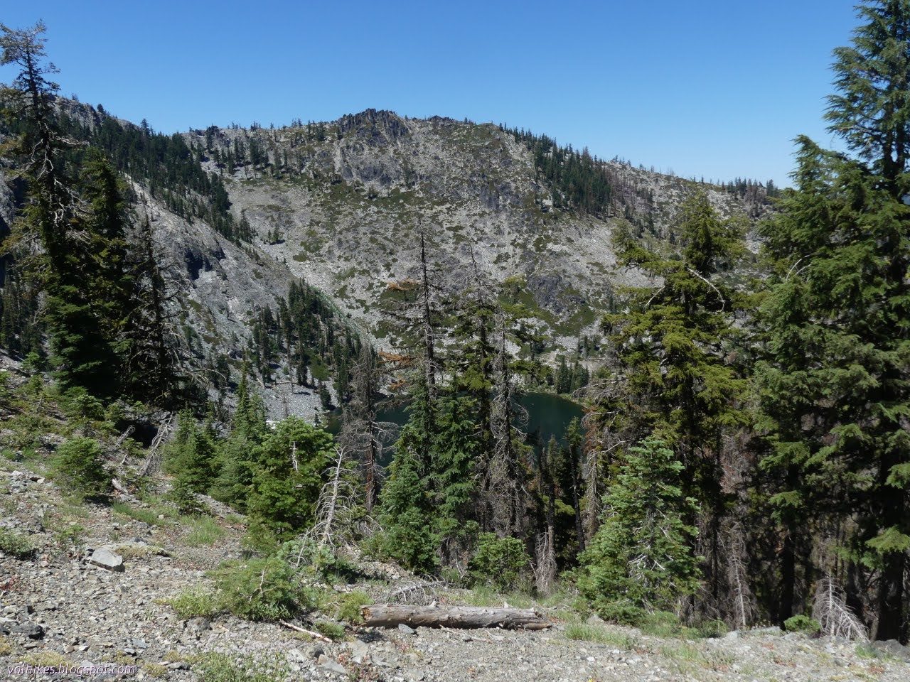
I stopped for snacks at the saddle. USGS tells a story that, once upon a time, the trail continued downward from here into the valley below. There's no sign of it now, just the one that continues high on the ridge.


Rees popped up and promptly pointed out Mount Lassen (almost invisible in the haze), then moved around because trees were in his way and pointed out Mount Shasta. The trees were trying to block that mighty peak. I had a moment of having to wrestle with the idea they weren't essentially in the same direction. I've been looking at them from too far away.


We took off along the trail again. There was a massive log to prep for cutting with loads of branches cluttering the trail. After that, the green exchanged for a moonscape brought on by the Haypress Fire of 2021. Little trees, and even getting toward medium trees, had curled around in the heat and now hung over the trail. This was the part where I really needed a limb saw. I'd lifted one small tree hanging over the trail on the way up and it broke easily when pushed against gravity. These weren't so compliant. Most of what I could do was kick off the major collection of sticks (and miss the switchback the Forest Service topo forgot to warn me about, thus having to put a few sticks back). When green started again, I could trim a bearberry that was trying to root branches across the trail. It does some good.

When almost to the next saddle, there's two trails that lead downward into North Fork Coffee Creek. I was alerted to them by the sign claiming it was 1 more mile to Trail Gulch Lake. They are faint splits off from the trail we were working. It seems excessive to have two here and none on the far side, but there it is.
Report from earlier hikers in our group was that there were a few small and medium trees to clear, but otherwise it was pretty good. There was one area where fire had turned everything to a grey mass, but the trail gets enough use that it is clear through it.


Trail got really clear at the junction with the spur to the lake. A sign pointed the way from the middle of the travel scarred dirt. I followed it, crossing the creek and pausing by a meadow. There's a geocache there.

My search was interrupted just before it began when a small mammal ran to the rocks for shelter. I was able to snap a few photographs before it ran off again for a less human infested hiding spot.

When it ran off, I signed the geocache and headed over to the lake. It was occupied by both campers and day equestrians.

Goal achieved, I snacked and headed back. The log cutters were getting to the last of the logs and a few more heat twisted little trees.

I finally saw both signs for both trails that head down on the way back. One was broken and likely burned (probably for the Schlomberg Cabin site) and one was reasonably new pointing the way to Steveale Meadow.

They'd got a lot of those overhanging trees bent by the fire as they went through. It was nice walking that freshly cleared trail back. We got a review the next day from one of the campers at Trail Gulch Lake that it was the cleanest trail he'd ever been on.
same trip, next day ⇒
*even more photos in the album*
©2023 Valerie Norton
Written 23 Aug 2023
Liked this? Interesting? Click the three bars at the top left for the menu to read more or subscribe!


Comments