Ma-le'l Dunes North
Humboldt Bay National Wildlife Refuge
Click for map.
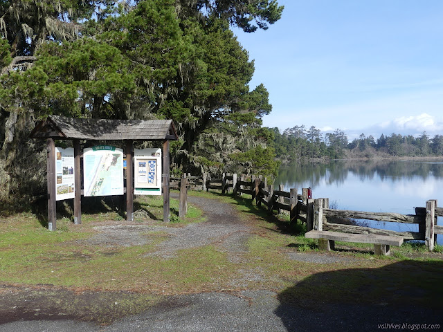
The Lanphere and Ma-le'l Dunes are one of three sites that were recently designated as National Natural Landmarks. The designation does not imply that you can actually visit them, and for Lanphere Dunes a visit requires a permit or guided tour. Ma-le'l Dunes are split in two by the nearby gun club with the south section being BLM land that is open daily. The north section is part of the Humboldt Bay National Wildlife Refuge and only open from Friday through Monday. As it was Friday and I had already visited the south section on a geocaching wander, I made my way up the rough road to the parking at the north end.

I brought Rachel's tall rubber boots along since I've noticed these areas get full of puddles, but then left them and just put on my usual shoes, which turned out to be the better choice. They've got very nice trails throughout and the recent heavy rain has left no puddles along them. I decided to walk the trails staying generally right to first wander the shore pine and Sitka spruce forest, then across the dunes and wetlands and along the beach before coming back across the dunes and wetlands to return. There is a great variety in a little space.
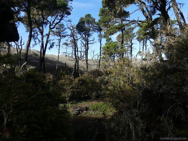
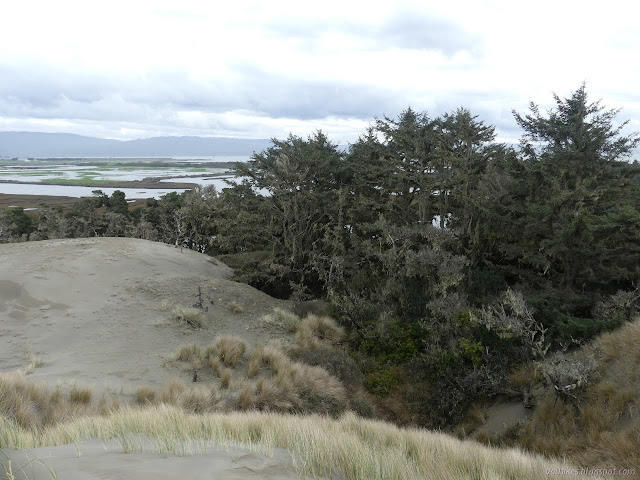
As I followed along the flat, graveled path on the edge of the Mad River Slough, I couldn't help noticing that the trees on the outside edge seemed to be in the process of falling in. Some are tilted far out over the water with branches dipping in, but just because it is slow that doesn't mean it isn't happening. Further along, I started noticing the giant wave of sand bearing down on the other side. The tops of dead trees stick out near the top and the ones near the bottom are showing some distress.


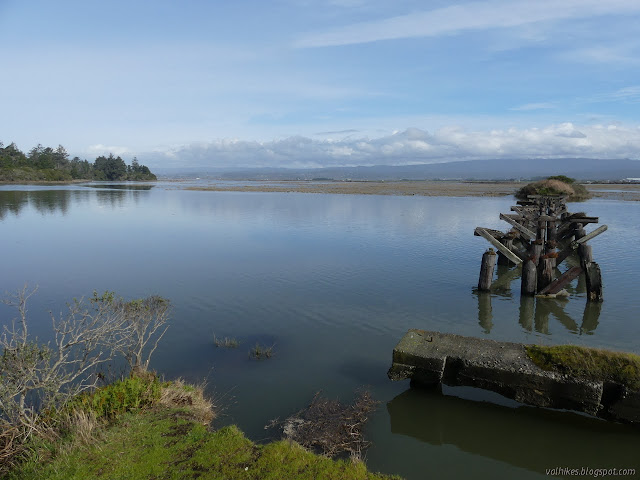
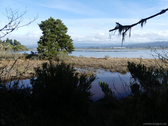
As I followed the Tsoutsgish Trail to the end, its status as an old road became quite obvious as it ended at a washed out bridge. I was surrounded by water although the maps seem to indicate a bit more dry land. The tide was just about high and for the winter tides at that moment, that meant just over 8.5 feet.

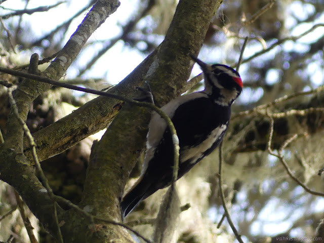
I turned back to follow the closer leg of the Dap Loop Trail up away from the slough and into the forest. It's not that far up as I got surrounded by the shore pines and Sitka spruce. There's quite a lot more to it. The ground is covered in little manzanita and reindeer lichen. The middle level has all sorts of bushes.


The storm brought a little damage as I found a tree broken and hanging over the Viqhul Trail, the next one along. It is another that goes out and just stops, but I wasn't going to miss it for going nowhere. I squeezed past the branches as at least a couple others had already.

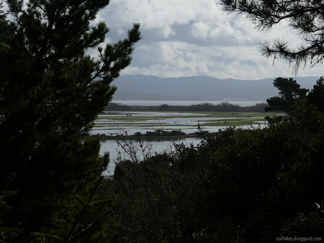
The trail rolls along, up and down just a little bit, and swings once more along the edge of the sand dunes. It is not so tall here, but still rolling along with the same effect on the trees it encounters. It swings away again and runs into the slough, which was getting ever closer to the 8.74 foot high.
So I turned around again and returned to the slightly obstructed junction.
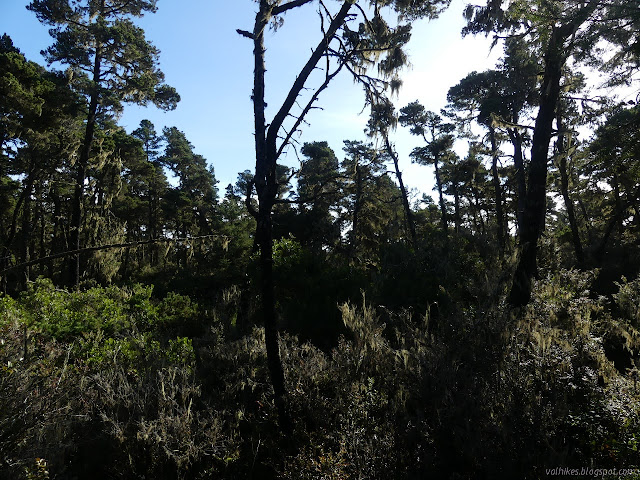
I continued around the Dap Loop Trail just to finish it off, then turned right back. It is a very short trail after all. The forest seemed wetter along that section.

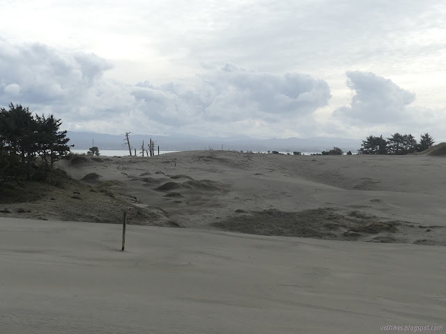
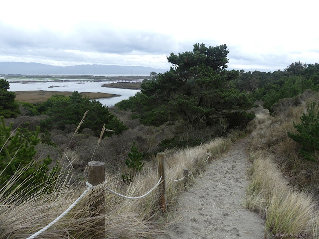
Hout Trail climbs up the sand at a steep slope and the prints on it were all facing the other way. There is a rope along one side. It probably doesn't work as a handrail, by might be helpful to haul oneself up. I didn't try it. It really doesn't look strong enough. It levels off as it comes into the sand field. The signs say to keep to the trails or the dunes, so once on the dunes, I did what a few before me had also done and started to explore, first up to a high point on my right, then down to a low point and a row of signs. They were, of course, the ones indicating one must have a permit to continue on. I carefully avoided the sand verbena, which right now is a few leaves and stems poking out of the sand.


I climbed back up and caught the trail as it headed off in an entirely different direction. It was hard at first to spot the posts marking the way, but then I didn't know they would be there.
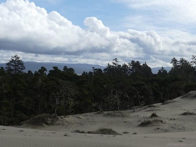
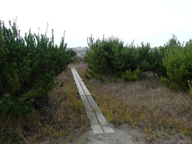
Trail was obvious again once it hit the new tree growth on the far side of the sand dunes. It crosses wetlands, but there is no worry about wet feet as there is some very solid bridging.
Then I was on the beach. The tide seemed high, but was definitely going out. The tide only came up to 7.81 feet on the ocean side, which is still rather high. It's almost a foot higher than the average for the highest tide.
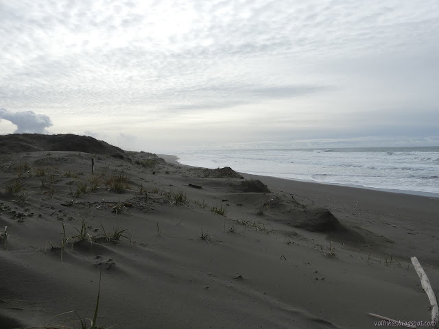
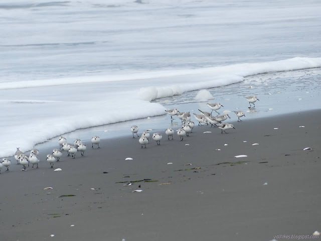
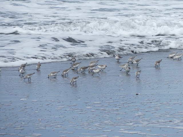
I turned and headed north expecting to go however far a half hour or so got me, then paused to watch the little birds at the edge of the surf. They rush in and then the waves coming in finishes fighting the wave going out and nears them, they suddenly wheel and run away, then in a continuous run bank around to follow the water back out. They would stop briefly near where the water turned around to look for tasty morsels, then zoom off to a lower section of the beach as it was exposed. Then the run back again, a few fluttering because they didn't get started soon enough.
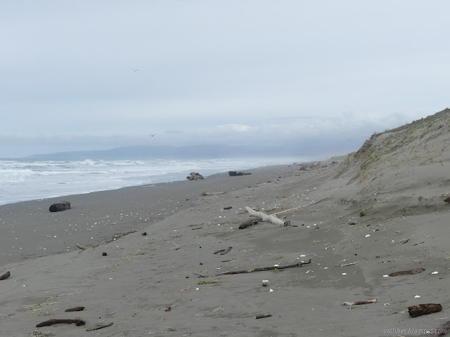
The signs requiring a permit for entry line the beach along Lanphere Dunes as well. I only spent about 20 minutes walking the sand before turning around.

When I returned, I passed by the two trails and continued south a little way, too.


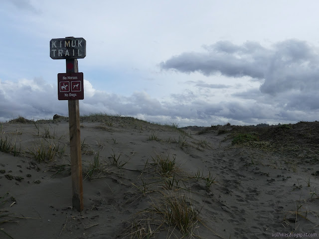
I got back to the nearest of the two trails. There really isn't that much distance between the two. I started along Kimuk Trail noting that the footprints no longer indicated I was going against all traffic.


Back on the sand dunes, I started wandering again. I had seen some suspected high points on the first crossing but hadn't visited them. This time I did visit them.

I gave into the urge to climb to top of the very highest bit of sand. I followed some footsteps around the grass and up.


I got down again and went to rejoin the trail across the dunes. It actually manages a good bit of view out over the Mad River Slough, the bridges, and Humboldt Bay as well. There is a rope lining the trail again. It is on the outside, raising the possibility it is meant to keep people from wandering over the side. It is a bit short to prevent falling.


I got back and the parking lot that I thought was full before had nearly doubled the number of cars. They lined it all around. It was quite an excellent spot to explore especially after so much work has been put in to remove invasive species. There's still work to be done to help the dunes to the south.
©2021 Valerie Norton
Written 31 Jan 2021
Liked this? Interesting? Click the three bars at the top left for the menu to read more or subscribe!


Comments