Dry Lagoon and Stone Lagoon, California Coastal Trail explorations
Humboldt Lagoons State Park
Click for map.
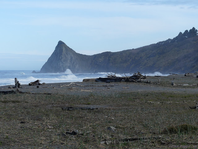
I was thinking I might try to write up a guide to hiking the California Coastal Trail through the Redwood National and State Parks, where quite a lot of it actually is trail. Then I reflected how much better I knew the southern parts of that especially as I found out there's a little trail before getting to Crescent City north of the Last Chance Section. Then I realized that there are parks nearby to the south of the redwood ones and... where does it go there? It only gets the briefest thought on the Patrick's Point State Park map, out on Agate Beach. It is actually marked on the Humboldt Lagoon State Park map, but with holes. Mostly it follows along the sand spits that wall off the lagoons from the ocean. There is one bit of proper trail to get around Sharp Point that I have actually hiked before, albeit in a hurried fashion. The north end of that is one of the holes. I already knew that was real for official trail. There are bits of use trail after, though. Surely someone has pushed their way through? Also, I just really wanted to take the spur trail out to Sharp Point. Finally, I wanted to investigate another hole in their mapped trail south of Dry Lagoon. I found an as hiked track from 2016 that continued along the beach but it looks a bit tight along that rocky shore. From there, it is beach all the way to the Agate Beach Trail at Patrick's Point.

The tide was high, about 6.7 feet and it wouldn't get much higher, so I didn't bother to check the segment to the south. I could see lots of splash on the rocks as I made my way north through the sand. Lots of water out in the Dry Lagoon, too. It is winter and it's been wet. I was expecting plenty of mud once I got on the trail, too.
At the first opportunity to climb, the trail starts up into the hills around Sharp Point. There's no sign to mark this, either, but the trail is quite clear. I felt no need to cheat and consult the GPS enabled map at all on this second time hiking it.
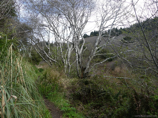
It's a nice trail with the vegetation cleared away from the sides. That which is trying to grow back is full of thorns, so I expect it takes a bit of work. There are wooden platforms and trail reinforcements trying to deal with the muddy spots with varying degrees of effectiveness. I was glad to have water resistant shoes on.

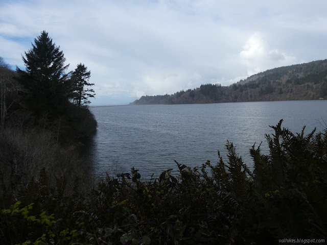
As the trail swings around to a south face, there are huge trees mostly of Sitka spruce and the trail is nice and dry. Further around, the drop away again and it is alders and brush. There is the hint of a visual of Stone Lagoon, at least until the spring leaves fill it in. Across a bridge falling into disrepair are more hints. Mostly, it is a bit of a green tunnel.

At the narrow point of the hills, there is a trail that heads off to the west. This is the trail to Sharp Point. This is not an official trail. Since it was basically high tide, I decided the time to go was then and not later. The vegetation is not cleared back quite so far nor away from the top and there are plenty of logs to go over and around. Once out of the trees, it winds a bit extra getting to the saddle.


Once out there, I found the trail doesn't just go to Sharp Point but right on up to the top. I took great care in the last few feet of it.

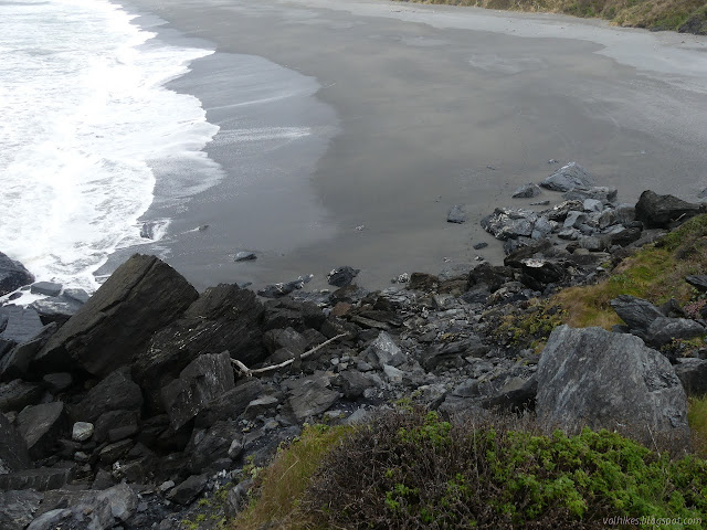
I came back down even more carefully to the saddle, which has a pretty good view too. Then I gave in to the temptation to drop down one of the little trails that went on down to the beach on the north side. I found strange things that had been thrown out of the sea about halfway down. I knew they were from the ocean because they had barnacles on them. The bottom third became problematic for travel as my trail just dumped me into a stream and the stream was flowing over a very soft mud. I was down, but there was no going back that way.

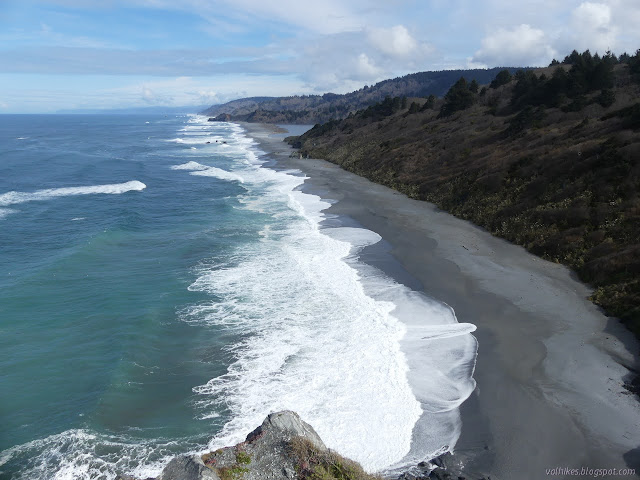
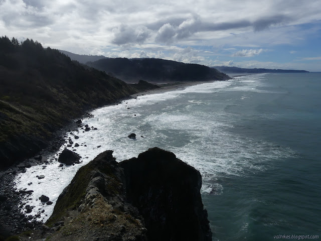
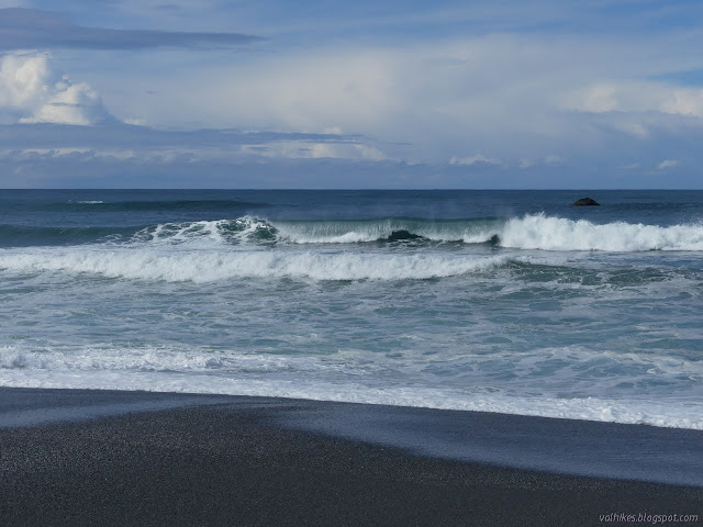
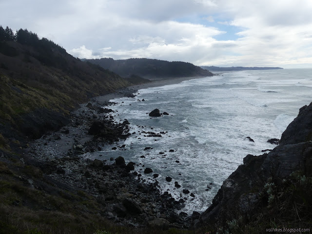
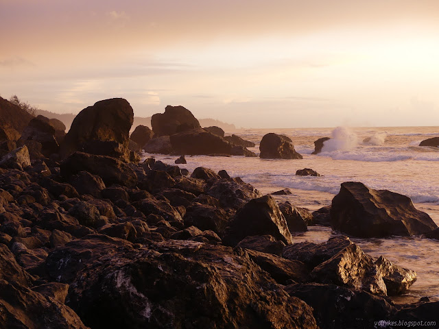
I headed up the beach really hoping finding the trail would work out even though I suspected that doing so would be harder from the beach side than the rest of the trail side. The ocean was rolling some beautiful barrels with its waves.


I got to where there should be trail, but the looking could wait. I headed along the sand spit. The narrowest and shortest part is there on the south end and it showed evidence that a few waves had recently been washing right over the top and into the lagoon.
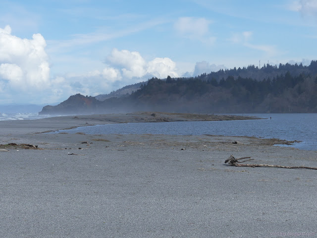

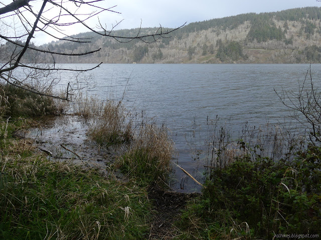
I spotted the road up on the other side of the lagoon. That is where most visitors come from and where maps indicate hikers have to go, but it looks like the county wants the trail to go up the Gyon Bluffs, so I kept on walking the beach to the end. I didn't spot a trail although it looks like someone might have done it once or twice.
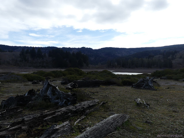
I found a pair of mystery posts at that end of the beach, but the tall one was no longer so perfectly vertical. They certainly didn't mark any trail up as it was a small cliff. I returned, stopping by the parking area and then walking the trail through the dunes by the lagoon. The sand hills served to mute the waves a bit.

At the far end of the sandspit, I just found the start of the hills and no trail. Disappointing although expected.

I followed around the edge looking for something and it didn't take long to find it. Most of the trail was being used to get up on that first little point, but some continued back around the lagoon and it was well enough used to be somewhat established through the blackberries. With blackberries, that does mean a few random branches to push away anyway. Then it was somewhat established through the nettles. I hadn't noticed the nettles and I paused before stepping into them. They stung right through my trousers occasionally.
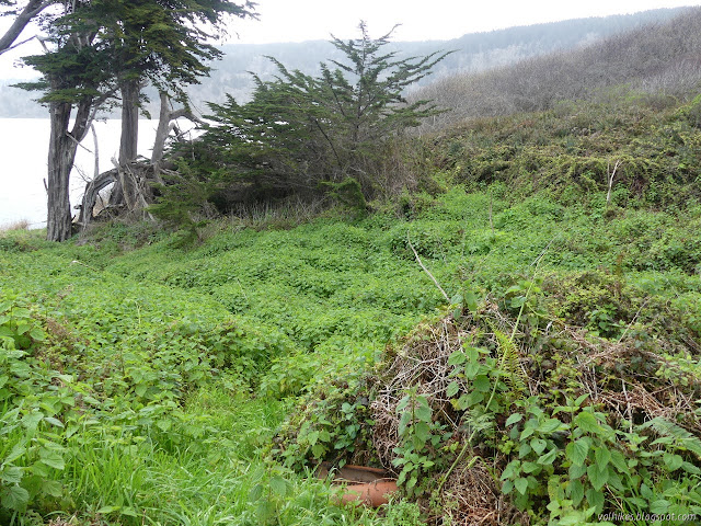
My path get less used, which meant an even thicker field of nettles on the way to some cypress trees. I found someone's shelter, buried deep under a bush, but not much more of trail going around the lagoon. I tried going higher. There was some pretty good trail that way, but I'm pretty sure it's bear trail. The clue is in the bear scat and the way everything that turns off in the direction I wanted to go became bear height in a few feet. Still, it was a tall space I was working through so surely people go that way? If they do, they're fools like me pushing to see what route might be there because it just got to resembling bear trail more and more. After too long of slow moving, I was looking over a little canyon running with water and full of brush that would present a difficult passage. I went a little higher. Going higher seemed to work best. If I go high enough, there's a top and I can go anywhere without actually crossing a brush choked gully. I didn't get that high.

I gave up and turned back. I kept trying more direct routes, but eventually just had to go the way I'd come. And then another stalk across the nettles. The stings were already bad enough to keep my mind off thorns even when they were coming at my face. Which is worse? Short pain, but actual injury from thorns or the long pain that usually lacks an actual injury?

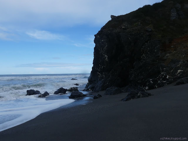
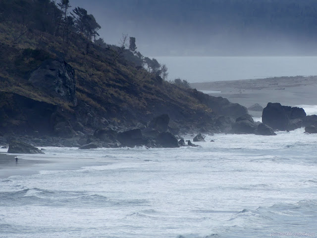
So I headed down the beach back to Sharp Point. With the tide out, I had easy access to the rockfall coming off the point itself. I got up that easily enough , although I did almost lose a hiking pole dropping it down a chimney. It was a lot more stable than the collapsing mud and rock shards I came down. I found paths further up.

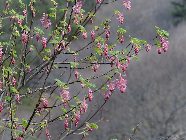
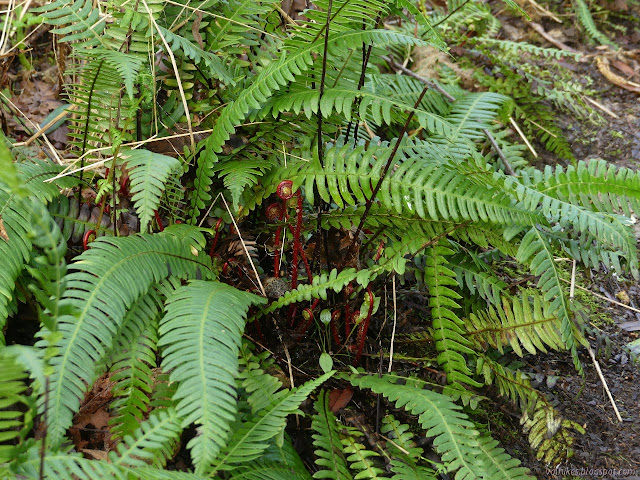
Having got to the saddle once more, I had an easy time reconnecting with the trail to follow it around. At the junction, the main trail was blocked by a tree and I let it steer me to the camp without too much thought. I did look over the blocked trail just enough to spot the first trillium of the season next to it.

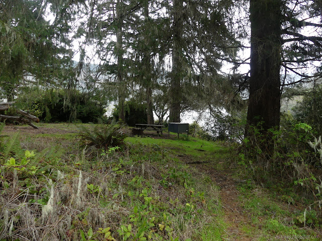
I hadn't explored the camp before, so it was on my list of places to visit. There's a bridge over a small creek and then a campsite. Some sites are better than others, and that one hardly has any room to put a tent. There are six and they all have picnic tables, bear boxes, and an iron fire ring. There's more room in the next two and the last three are practically connected in a triangle. In between is a pit toilet and by the lake is a launch with picnic tables for day use.

Explorations complete, I headed back to see about the rest of the trail. There is the first view of Stone Lagoon that won't get blocked by spring foliage, then it starts to drop, gets very soggy with creek water, drops some more and gets very soggy with lagoon water. I almost lost a shoe in the deep mud when I didn't step on the sticks people have tossed down.
I cleared my throat and there was suddenly the noise of a large animal heading the other way. I just missed the bear. Admittedly, turning a corner about 30 feet away on a narrow trail probably isn't the best spot to meet a bear.

I tried the little trails. Sure, a bear had just gone along one, but it was long gone. They break off to try to make a way around frequently, but the one with the best use goes up. I tried up for a bit, but didn't try nearly so hard as on the other side. It was slimming down to a bear trail, mostly. I passed a bit of irrigation tubing which was also making me hesitate to continue. I tried some of the side trails, but they quickly go nowhere. At least there were fewer thorns and no nettles. The nettles I'd already encountered were still making themselves known. They tend to go for about a day.


I sat on a log beside the lagoon and snacked. Humboldt Lagoons State Park actually states this trail "washes away" in the winter, but it is clearly just flooding. In the winter, the water table rises around here. (It says so on one of those interpretive signs along Hammond Trail, one about half a mile south of Strawberry Creek. I think there's another copy in Samoa Dunes somewhere.) It's quite a significant rise and leads to pools all around the dunes but I expect it raises the lagoon too. Based on tracks on AllTrails for last year, this trail was finally passable sometime in mid-July and flooded again right at the end of November. That's no more than 5 months of the year it was useable, which is sub-optimal. Just a little bit. Of course changing it would take money and the park has closed the walk-in camp south of the parking lot due to budget constraints, so that's clearly in short supply. (The boat-in/hike-in camp by Ryan's Cove is open and there is a self-pay spot by the visitor center to use it.) I headed back.


Once back to the sand, I headed toward the water. The tide was coming back in, but still not much more than half a foot high. It as minus half a foot at the lowest. I headed for the rocky section south of the lot. There were quite a few people out enjoying it.


The park states the trail, which is to say beach, "washes out" in winter here too. This is probably true. For now, it would take a very low tide and a gentle sea and some care over the rocks to cross it. If wading is acceptable, there is a little room without too much care over the rocks. I headed back. It closes at sunset after all.
©2021 Valerie Norton
Written 14 Mar 2021
Liked this? Interesting? Click the three bars at the top left for the menu to read more or subscribe!


Comments
The state park says that what we now call Dry Lagoon was drained for agriculture around 1900, but is now being restored. How's it looking?
I didn't see any indications of restoration, but maybe I shouldn't. I'm not seeing anything about it online, just references to it as restored. Ponds are usually unstable, filling in over time. Whatever trenching was dug to drain it is probably long gone and winter pools and summer marsh to dry might be its natural state.