Bonanza Bill and Tige Rim
Apache National Forest
(map link)
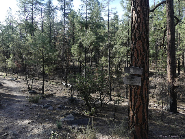
I wanted to hike the Tige Rim and was told the road should be good enough if you pick your rocks carefully. Turns out, there were two spots that I was a little worried I only got past because I was going downhill. One rolling solid rock piece of road with a very narrow, large rock covered bypass was bad enough that it stuck in the back of my mind throughout the hike as I worried about how I would safely get up it. Everything was soft sand shortly before I got to the parking just over the state line in Arizona, but the actual parking area was good enough. My first order of business was the distraction of a state line marker, or so I thought, just south of the road.

Cool, a forest reserve post. I realized it wasn't marked "MP" and a number like a few to the south. Then again, those are 41 and 42 and then just about the right amount of space to fill in 43-47 in between. They would be easily accessible to check if traveling the Bonanza Bill Trail twice as far as I was, but I wasn't. So I got sorted for doing the traveling of it I was planning to do.

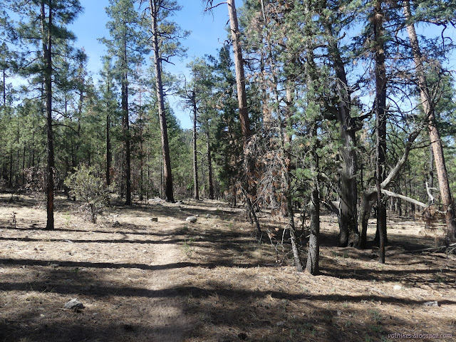
I wandered gently downhill through the trees noting that burn dangers appeared to be minimal for now. It was nearly a mile to the junction. I had decided to stick to Bonanza Bill at first, leaving the climbs to the shade and the downhills in the sun. My impression from the map was that there was more up-and-down on it than on Tige Rim.

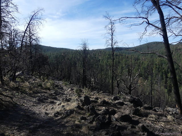
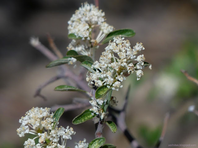
The trail started on a downhill on the north side of a canyon and the burn there was pretty severe. Having not seen it before the fire, I could enjoy that there is a bit more view and wildflowers coming up.

At the bottom, the creek had done a bit of scouring of the area. A tributary comes in. I noted trail going up the creek and up the tributary before finally realizing that the official trail is climbing again in a direction downstream. The trail is getting shortcut in a couple places and at least one switchback is well on its way to getting lost on the way up.


I came to a second trail junction, this with Hinkle Trail. I wanted to take the short diversion to see the spring. It was an excellent diversion, but if I had wanted water, I went about it all wrong by following the trail to the spring. The spring is along a creek bed and where the trail crosses, this is a small cut through a few feet of dirt to what looks like sandstone. Not much further, it turns into an impressive deep cut through some hard rock.

I got to where the spring is shown and looked way down the canyon. There is water down there. If it is welling up from a spring, I certainly don't know, but I would hate to be trying to get it from up top directly. The map shows a coral a short way further so I was assuming there was a camp by the spring. In testimony to have difficult it is to get that water, there wasn't much sign of camping although there is some.


From the Hinkle Trail, the landscape starts to get a little more interesting, even if it is a little hidden by trees.

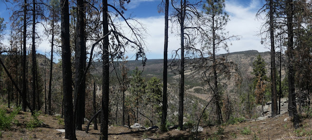
I was busy climbing and getting a little more view and even popping over a ridge for some new view. I was starting to follow along the state line and glanced up to see if there might be another post from time to time. None.

Then I came to the third junction, which was time to leave Bonanza Bill behind. Also time to leave Arizona and the Blue Range Primitive Area for New Mexico at the full blown Blue Range Wilderness. (I'm not sure what has gotten in the way of turning the old primitive area into more new fangled wilderness, but it's gotten hung up on something.) Once I stepped through the open gate, I wasn't sure where the trail went. The hint from my map said a little way east, then north. There did seem to be trail there, but then I finally noticed the track going north up the hill with blazed trees on either side. That would be it. It was quickly apparent that this trail was less traveled and the burn would be a problem for navigation.

I had to look for cairns a bit to follow the trail. Sometimes I just had to faithfully walk a little further to see the next hint of trail that had been hiding behind a bush. It winds a bit in illogical ways before dropping down to be out on something like a rim.


My first minutes on the Tige Rim were rather disappointing. I could tell there was something out there to look at, but I had a fence along the side keeping me from the edge where I could look at it. Is it to keep cows from getting into the rough country by the edge? Since there are patties on either side, it doesn't seem to work that well. I got tired of it and scootched under for a snack with a view shortly before it was going to finally quit the fence and give me a view.


The trail turned north to follow the Tige Rim and I got a few good view spots along the way. I also got some challenges finding the trail on the way up as it dropped and climbed. I would pass a cairn helping the people heading south find the start of clearer trail going up, but nothing for me. One, I just sort of wandered up the hill about where the electronic map put the trail and finally bumped into it taking a rather more direct, slightly wiggly route nearer the edge.


There was a second spring to perhaps check out, but between the presence of another range fence and the fact that it was about 80 feet down the hillside, I did not end up having a look at it to see if it might really be flowing. The trail beaten in that direction on the east side of the fence suggests it might.
The trail got easier to follow as it, frankly, got less interesting. Just past the last good view, I started seeing two pairs of fresh looking footprints. They almost got there.
I passed that first junction once more and nearly everything that had happened on the trail was obscured by cow and horse prints. The ranchers had been out. They were gathered in the coral at the trailhead when I finished the little climb to finish the trail. Also the ranchers looked more like the ranchers' kids playing games on a burro as they waited for the folks who drove.

I asked the older one about the road heading north and he couldn't say much about it since he'd not been that way recently. He had adjectives for it that didn't make it sound promising. The road west, on the other hand, was good in spite of Arizona's tendency to put up big yellow "primitive road" signs on such things. I checked the map and decided it was only, oh, 70 miles instead of 8. Then I decided the extra gas was worth the peace of mind. It was a nice drive. If I'd waited 10 more minutes, I wouldn't even have had to negotiate with the trailers that were coming up it to collect the cows, horses, and burro.
*photo album*
©2022 Valerie Norton
Written 19 Jun 2022
Liked this? Interesting? Click the three bars at the top left for the menu to read more or subscribe!


Comments
There are lots of Web pages referring to a "Grand Gulch Primitive Area" on BLM land, such as:
https://wildernessneed.org/portfolio/utah-grand-gulch-wilderness-study-area-backpacking-planning/
I'm unable to find any government Web site using that term. The BLM speaks of the "Grand Gulch Wilderness Study Area:"
https://www.blm.gov/visit/grand-gulch
You will find statements that Congress established a "Grand Gulch Primitive Area" in 1974. The following page asserts that it later "graduated" to a "wilderness study area:"
https://www.deseret.com/1989/6/29/18813370/blm-plan-would-help-preserve-cedar-mesa-ruins-br-proposed-national-conservation-area-offers-protecti
At any rate, if there were official designations of "primitive areas" after 1964, they appear to have been only on BLM lands, and weren't in the same category as the original Forest Service primitive areas.