Cold Springs Lookout
Trinity National Forest
Six Rivers National Forest

(Map link.)
I have visited some rather hard to get to fire lookout locations and thought, while poking around Blake Mountain that I might as well visit the easy ones too. Still on South Fork Mountain, but many miles south, there was a lookout on a peak by some cold springs. It has a road, so I could potentially drive right up. It is at the edge of the footprint of the Route Fire of 2015 and would probably be more work than just walking to clear out all the trees on the way. I found good parking on the far side of the road and started the walk up road 2N43.


There actually had been some tree clearing on the road, but it splits and the clearing follows the right fork. That presumably goes to the inholdings on the north side of the peak near the actual springs. The high point and lookout location is up the left fork, so I had quite a few trees to go over or around.


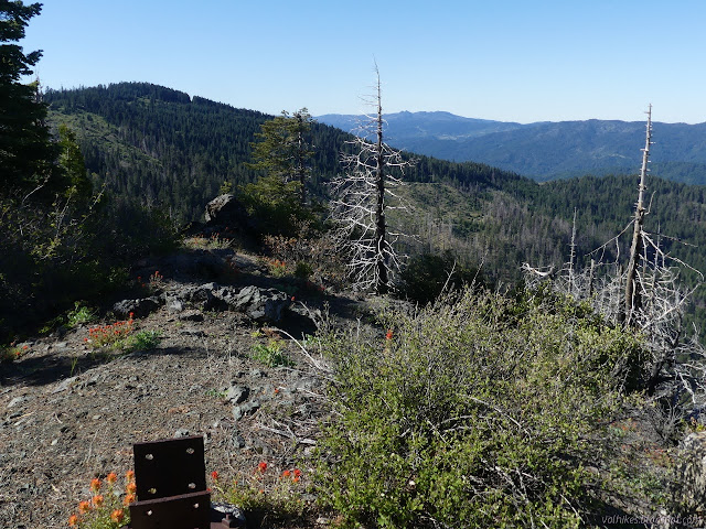
It's only a couple twists and a little bit of an overgrown spot to get to the old lookout location. Unlike the spot on Blake Mountain, it is obvious where the lookout once stood here.

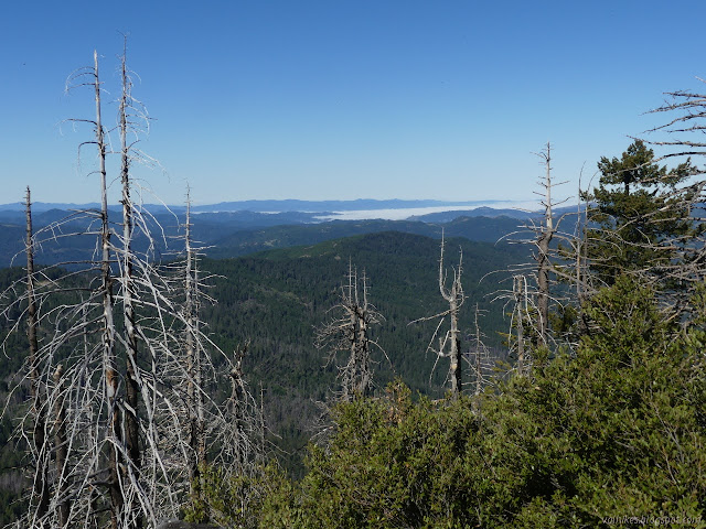
The view west is clear and amazing. The view south is there, but not far. North and east are both blocked by trees.


Looking around, I finally found reference 2 of the set of benchmarks, but couldn't find the station or first reference. It seemed to be pointing at the bottom step, a popular place for benchmarks at lookouts, but I'd already checked there.

I enjoyed the view a while and headed back down. I noticed a whiff of smoke as I went. Maybe it was just the power of suggestion. This year, it could be slash pile burns or uncontrolled wildfire. It seems like there shouldn't be overlap for those, but there is.

I found a view out to the east from near my parking spot. It did look a little smoky.

The view is a bit less extensive than it should be considering it used to be a lookout, but the payoff was certainly worth the effort to get there.
*photo album*
©2021 Valerie Norton
Written 16 Jun 2021
Liked this? Interesting? Click the three bars at the top left for the menu to read more or subscribe!


Comments