Bug Creek and Board Camp Mountain
Six Rivers National Forest
(Map link.)
I woke up early in the morning and looked up at a lovely Milky Way arching overhead, perhaps with a bit of green tint. I savored its beauty for a few moments, but it's not the sort of thing one expects to see during the full moon. I got up to look around to the west to find the moon. It was maybe two fingers above the horizon, among the trees from my perspective, and deep red, a bit brown toward the lower left. It was definitely in full eclipse. I knew it had to be early in the morning. There's a different solar eclipse for every location, but everyone gets the same lunar eclipse. I savored its beauty for a moment too, wondered what had woken me for it, then tucked myself away from the cold night air and back into a little more sleep.
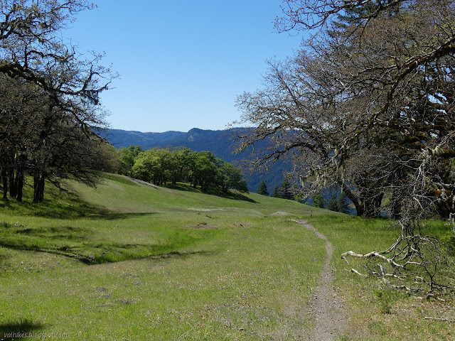
There wasn't long before I had to drive the rest of the way to the rather improved camp beside the start of the Board Camp Mountain Trail 4E27. It was still cold when I got there. I wouldn't have been able to see the eclipse had I gone there the night before, and probably wouldn't have seen the galaxy either. I walked back down the road to the camp site and found the brushy, unsigned trail off the south side of it next to FR-1. This is not a motorcycle trail and anyone on a motorcycle on any part of this route other than the small piece of road to Board Camp Mountain is flagrantly breaking the law. The Motor Vehicle Use Map is free and is the legal document that establishes what motor uses are allowed. None of these trails are included on it, and for good reason.

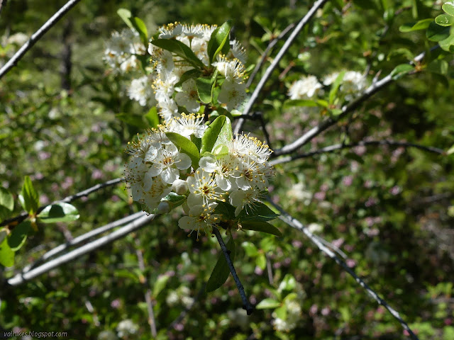
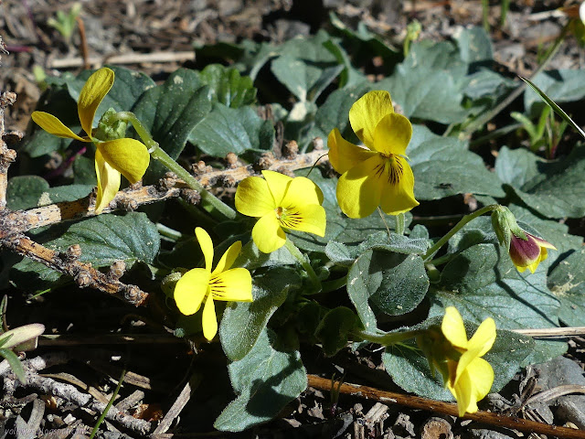
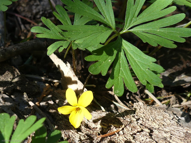
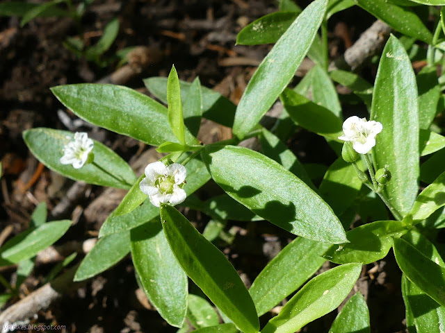
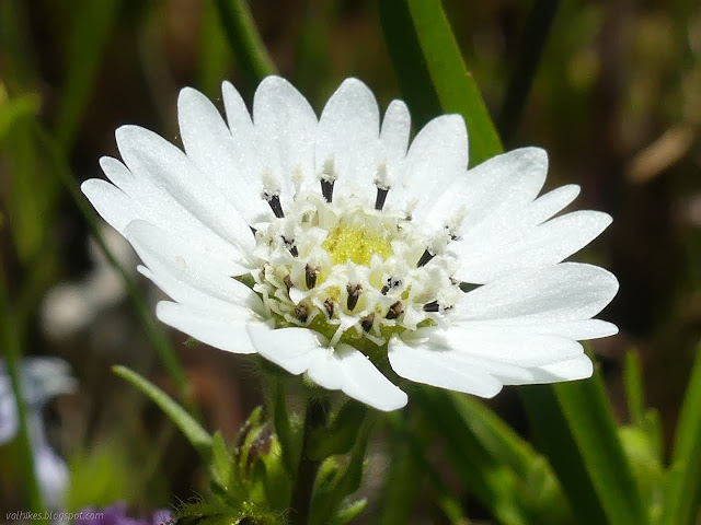
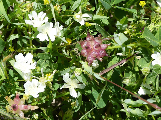
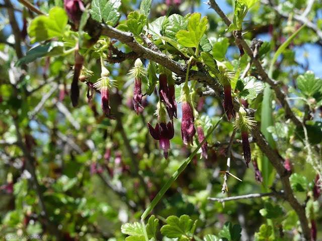
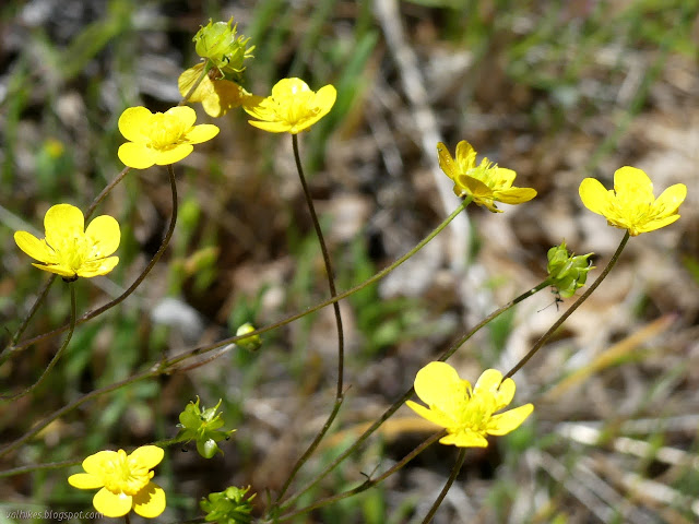
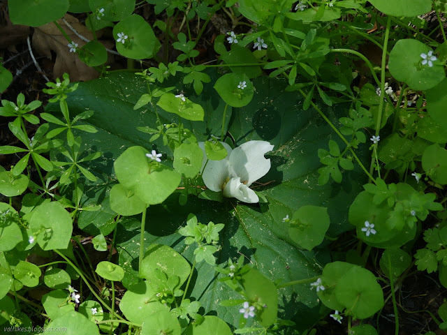
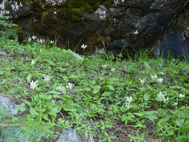
After the start, things opened up and stayed that way for the rest of the hike. Well, until the very end. Fawn lilies and violets, the first of at least three different sorts of yellow violets with deep purple veins, were prominent along the sides, but had many other flowers competing for attention.
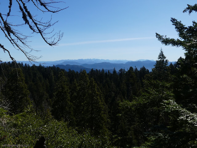
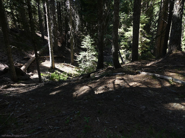
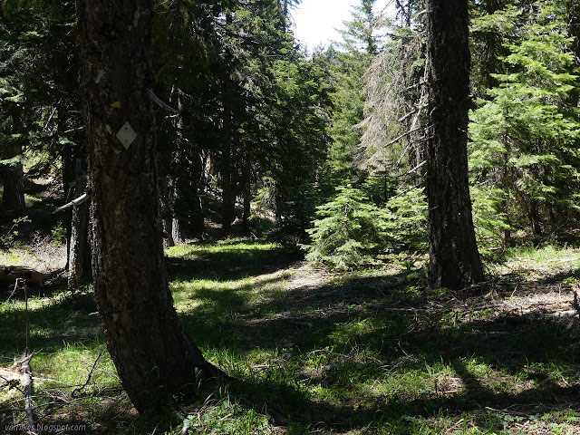
There are few spots to check out the view on much of the trail, so I stepped a little way off trail for the first. Mostly, the trail twists through the trees. It didn't used to twist so much, but when certain vehicles that have no business on the trail encounter a tree, they just rip up a new trail going around. This is just one of the reasons we can't have nice things. Sometimes I stepped over the tree and took the old path, sometimes I followed along.


At the junction, I turned south to follow the Wallace Camp-Forks Camp Trail 4E28. I was determined I wouldn't miss this part of the loop like last time. This is also not a motorcycle trail, but they've been tearing it up. Sometimes I would find a nice switchback to make the steep crossing of a small tributary to this bit of the East Fork easier. The ground ripping tracks would go more directly. The trail has been rendered steep in most places.

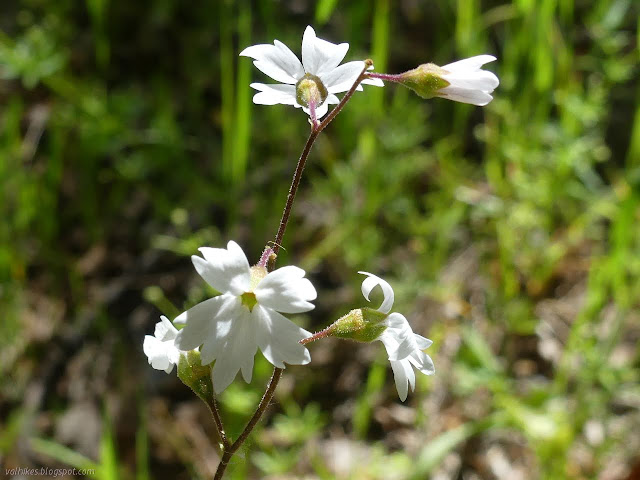
About 1.5 miles down, I found some blissfully intact trail tread with just a bit of forest litter and the occasional downed tree, proceeding downward at a steady and reasonable pace. I hoped that maybe the jerks with the outsized destruction trailing behind them might have turned back. No, they had just torn out a pair of trails on either side of the real trail. I crossed the growing creek and came to the top of the opening expecting horrors, but they've actually managed to leave the meadow largely alone. I haven't found a map with Wallace Camp marked, but one guess for the location is right at the top of this meadow. I took quite a while passing through because there were so many wildflowers.


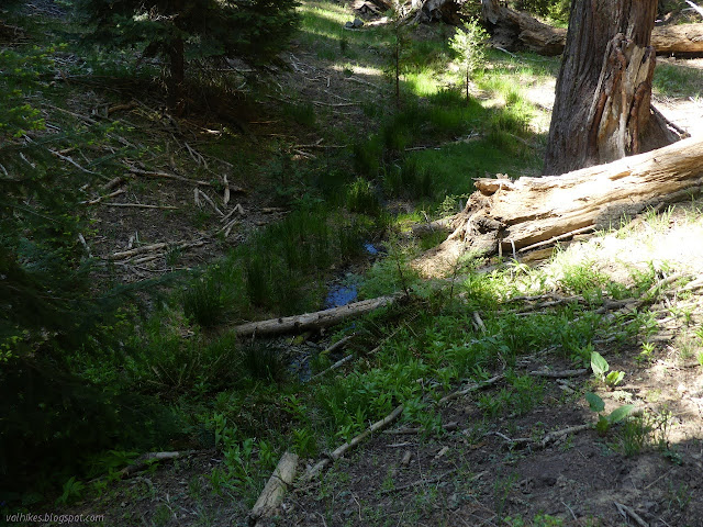
There's a little stream among the woods before the second opening and its massive meadow.
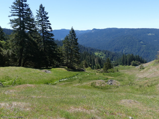


The trail curves around to finally finish the ~1400 foot drop to start a similar climb. It was getting warm, so I welcomed that the first half of the climb is supposed to be under tree cover, but was a little worried about the long opening at the end when it would be even warmer.


There's actually quite a lot of open spaces in the forest and a lot of sun getting to the ground. Still, it wasn't bad. I stopped to watch a waterfall over snacks just short of a creek crossing directly above the waterfall. There were more fawn lilies, but these were in seed. There was more moisture around and the creek is not considered seasonal, although I would quickly leave that part.


I got to the upper opening, but it was not so bad to be climbing in the sun. A cool afternoon breeze had started and was blowing at my back. This particular meadow is a little harder to navigate. All the posts have fallen over although they are there. I missed a turn near the top, but quickly regained the trail. I knew from before that it would tuck in under the bluff before climbing the last to the junction above.


Trail was clear again right up to the top, where I found the stubby marker for Bug Creek Trail 4E26 as it heads west. There is a tight slot through the shrub oaks at first, then it opens up. I followed grey diamonds nailed to the trees because the trail is so faint. Unfortunately, it can be quite hard to spot the next one from the last one. I seemed to keep coming upon another one as I dropped toward the main fork of Bug Creek.
The trail got easier to find as I got further down. Where game has used it, is it very easy. Other places, it is a matter of choosing the right shelf of land. Watching for steepness and length and probably some other things seemed to keep me on the correct path because I kept on passing markers. I am a little suspicious there might be two paths, one a bit to the south/higher marked with blue diamonds and the other marked with grey. I got mildly frazzled with the grey trail and trucked up the hill to find the blue, then got a bit suspicious of it and wandered down to find the grey again. Or perhaps trail actually did that. I didn't find some specific landmarks I had been expecting to hit along the way. Specifically, I didn't go through the barren area where I turned off the trail to climb Bug Creek Butte before and I didn't find the tributary that I had accidentally followed along some wrong trail.


I ran into illegal motorcycle trail as I dropped to cross the creek. Oddly it crosses at the same place although it only coincides with the trail for about 20 feet on either side. I followed it up a little into the meadow where it came down out of the private lands. I dropped back down and investigated the flat shelf to find more markers along it. As I went along, I became certain I was about the arrive at the meadow where the trail leaves Bug Creek to follow another tributary, then then ridge to Chaparral Mountain. This little camp area (and it clearly has been used as such) was my planned turn around.


I checked the tributary. It had been a nice flow when I was there before, but this time it would not require any careful planning to get across with dry feet. I was looking forward to it as a water source, but ended up taking from the main creek. Rather than retrace my path coming, I retraced where I hiked on my previous trip. There was a reason missing those landmarks was bugging me.
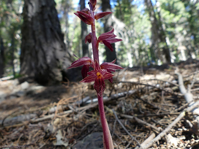
If I hadn't seen any glacier lilies, I'd have gone the wrong way up the tributary when the trail split to see them again. I didn't have to and correctly took the right instead. The tributary was absolutely dry when I crossed it and skirted along the bottom of the badlands. I crossed a little earlier than I did the year before and climbed to find and follow markers. I followed them up to the lower trail possibility below the rock outcrop with its garden of fawn lilies.


Sticking to trail rather than dropping down to the creek as I'd come, I found my way to the other landmark I had missed, the barrens on the south side of the creek. It was just the same, a trail marker at the start of the nearly bare hills and then a fading trail through it. I tried it a little way, but that trail really was just fading away. There were possible routes, but nothing promising before it just fizzled.

I turned back to cross the creek. There had seemed to be a trail that way, too, past where I noticed a mountain quail standing. That connected me with markers on the north side of the creek.

I didn't really have the time for exploring, but when I got to the illegal trail, I tried following it. It was rather direct in going up the hill and vanished significantly at the first log. It vanished more at the second log and was practically noting after a tangle of fallen tree. I decided to head back along happenstance game trails instead, following along the side of the hill. I noticed a sort of spring box down in the canyon although the water started somewhere lower down. (Or it was just hard to see under the sticks.) I probably connected with my route down off Bug Creek Butte, but waited a little longer to connect with the real trail. After a little scuffle through the shrub oaks, I was back to the junction, but staying on Bug Creek Trail 4E26 this time. In no time, I was up at the top of the little butte above the meadow. Virtually no one passes there without going to the top.


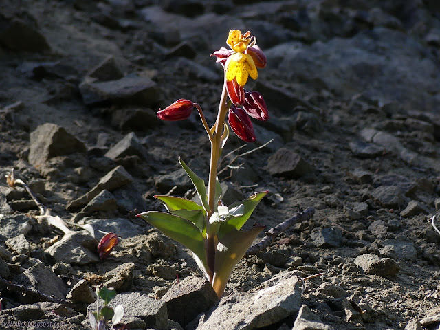
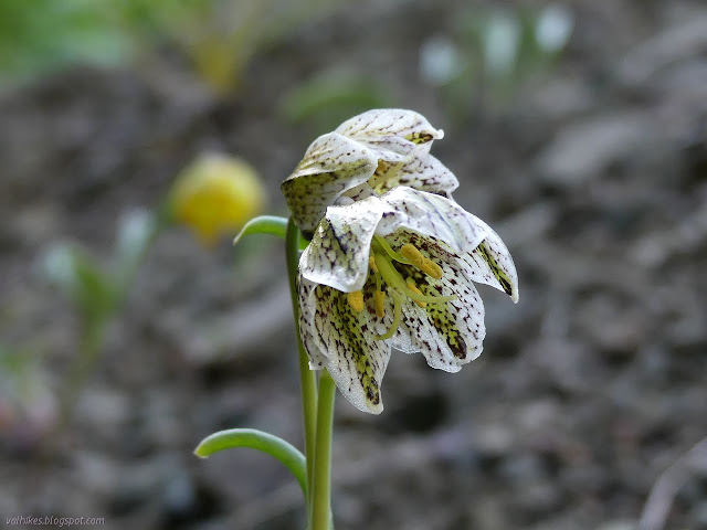
Then I turned back to find the proper trail along the ridge. I wasn't racing the sunset, so I didn't go quite as fast as before on the scrambly thing. I spotted another fritillary and some starts of more flowers in the lily family.

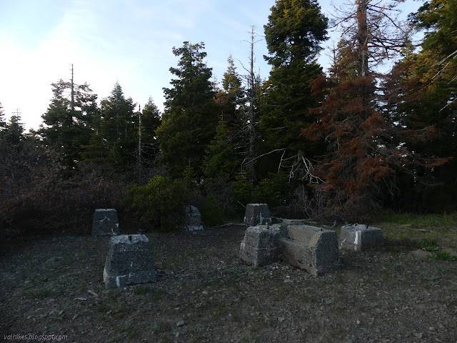
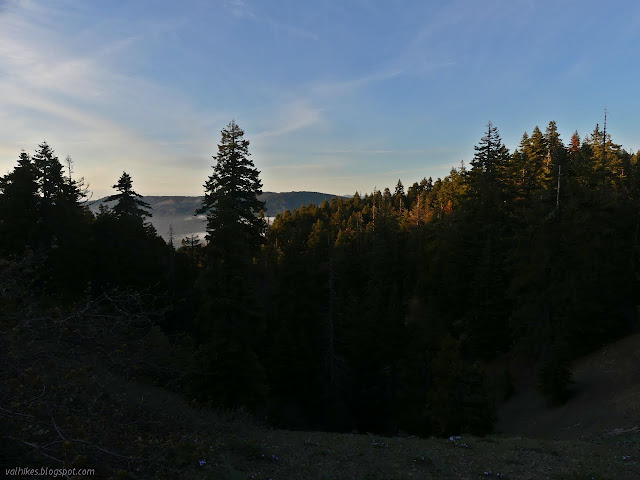
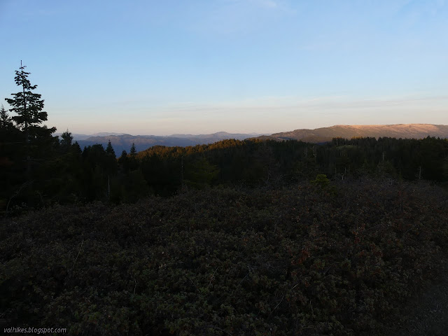
The trail ends at a single parking spot beside the road up Board Camp Mountain. This part all the way to the next junction is the only portion where a motorcycle is allowed and the last part is rather absurdly steep. I tagged the old lookout on the way past and took a moment to worry that the next day's plans were solidly within the standing dead trees on the next ridge over. I finished off the last of the trail as it darkened.
It was getting cold as I finished, but the really cold spot is along the road to the camp instead of at the camp. At least it was that night. I got myself fed, enjoyed the stars while scrubbing my teeth, and rolled out the bedding a bit under the trees forgoing the tent once more.
Liked this? Interesting? Click the three bars at the top left for the menu to read more or subscribe!


Comments
Where you started your hike, the start of the old road bed is really overgrown, as you note. Most people instead shortcut up the hill from the short spur road and campsite.
Fork Camp ordinarily has water--you have to descend steeply into the gully northwest of the camp.
I'm surprised you didn't have more to say about the area of the stream crossing at the low point on the Fork Camp-Wallace Camp Tr. It's a magical spot, with pools, towering rocks, and big timber. It very definitely looks like a seasonal Indian campsite--idyllic in my mind's eye. The trail branches a bit in that area, so it's possible you missed the nicest spot--though looking at your GPS track, I don't think so.
I did cut up from the camp the first time I did the trail when I didn't know where to start. There is now a deep cut gully cutting straight up from the camp and I resolved that I would definitely not be using that trail under any circumstances.
There was a lot more water when I went through last year, but there had been a good rain/snow in the previous week. I could see the water below where the spring is marked then. It wasn't much lower before I was finding water. Before the crossing, there was some branching, but after there was not. As I was crossing the meadow, I looked over a small ridge to my right (the area in the picture captioned "Down the other way...") and saw a post that I never actually went past. The campable spot I saw was right next to the trail, so not ideal in that sense, and I don't recall pools unless they were up the creek in the shade. A towering rock picture didn't make it for being too dark. There seemed to be more going up the other side. There are certainly some great places to just be in that area.