Hammond Coastal Trail and Mad River Bluffs
Mad River County Park
Hiller Park
Mad River Bluffs
Clam Beach County Park
Click for map.
Hammond Trail is a generally paved ACA compliant trail that runs from the Mad River Bridge up to Clam Beach where I started hiking a month ago. It is signed at many exits along the freeway and seems to be popular, so I intend to see what it is all about. The Mad River Bridge is the closer end, so that is where I start before the rain starts tomorrow. There are about four spaces for trail parking at this end, but the signs are set for hikers so that they know where they've stopped already. Fencing lines the walkway up onto the bridge and across although taggers have opened it up in a couple places for views of the river. (That wasn't their purpose, but it is an effect.) Not a particularly auspicious start.


One of the destinations on the sign is the Interpretive Trail section. The trail actually has many signs along it to educate the general public. Unfortunately the one along the bridge has become a target for those taggers and now shows nothing of its former topic. The bridge empties into the nonsensical end of a public road with a gravel turn around and a fellow putting away his camera equipment into his car. I have to walk around on a burm to keep out of a large puddle before hitting pavement again. A missing piece, but still possible with wheels although preferable when dry. Farmlands surround the road until it climbs just barely above the tsunami zone and then there are houses.


The road gets bigger as it goes on until finally finding an intersection across from a market. This is the closest destination on the sign at the start: School Road with a market and phone but no parking. I am uncertain at first which way to go. The School Road Trail, another paved pathway for equestrians and bikes and pedestrians, starts here to access the Mad River at various points. Along a bikeway that also starts up here, there is a Hammond Trail map sign, so that is the way.

The trail parallels a road for a bit crossing many driveways, then gets out by itself when the road turns away. It's a pleasant stroll among trees until emerging across a large road from Hiller Park, the next destination on the sign. Hiller Park gives me a chance to get out on some real trails if I deviate, so I do. Through the off leash dog area and into a path carved into blackberry bushes, I find my way to the Mad River Bluffs. None of it is paved and some of it is low, but the blackberries seem to get a regular slashing.

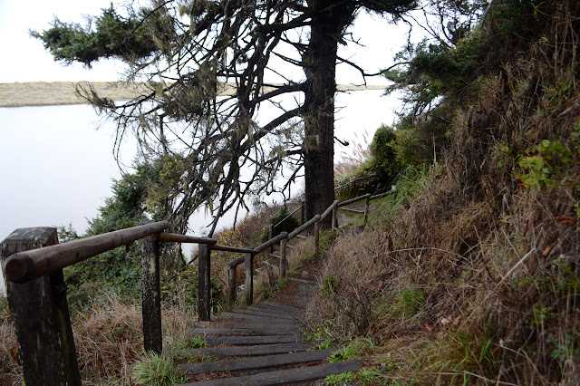
The vegetation changes drastically as I get to the bluffs. The trails are smaller, often with something hanging low. It certainly is not maintained for equestrians. Actually, it could use some maintenance for pedestrians, too, but that might be a usual state for once storms have started. Educational signs are here, too, including one that claims a solution to something that has been bothering me for a while.


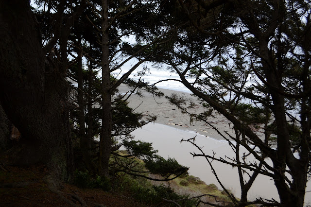
There are lookouts over the river and a few access points to it. I take them because it will give me the slightest bit of hill on the way up and they actually reward with a different point of view. All along, the river is illustrating the mystery that has been bugging me. When I crossed it at the bridge, it was heading toward the ocean in a direct way, but then it took a turn and didn't get there. The rivers here all seem to take a sudden northern turn before finally letting out, sometimes for miles. The Mad River will maddeningly take most of the 5.3 miles of this trail. It does this in spite of the fact that the current is moving all the sand south at a good clip.


The power that pushes it northward instead? The action of the prevailing waves as they break across the winter swollen river mouth is to eat away at the north edge of the bank. I am not certain I believe it. It seems like an incomplete story. Maybe something still needs to build up those dunes or a lagoon should form. Actually, there are many lagoons that form north of here.

The trail turns away to edge past a creek on one side, then sewage treatment ponds on the other. This is fenced off, so only the birds get to enjoy that the birds gather here. Today it is a flock of Canada Geese and mallards.

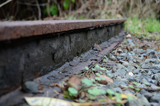
Just before the trail rejoins the Hammond Trail, there is a spot where the creek has overrun its banks and no way across except with wet feet. So my feet get wet. It passes under more trees until another access point which is likely the next destination on the sign. Here, the trail turns to gravel, but there is a paved alternate. I go on the gravel, which passes by more river access points and a preserved section of the Hammond Railroad. Again, I take the access trails. Hills do me good and maybe I'll finally see the mouth.


The trail turns and starts off what it calls a steep climb. It does not climb for very long and a bench is even provided for those who need a bit of rest. At the top, anther trail breaks off to travel Willow Creek. (The map identifies Norton Creek.) This might be the interpretive trail section. I take it, too, for that walk by the water and over a bridge feeling.

The trail empties onto more pavement beside a second sign and I continue on. The paving comes to a road again. It is signed "no parking" and I follow it the only way that is not a driveway past a freeway interchange and on to another road end that does have parking. Here the route turns to gravel with no alternate.

A spur leads off to a viewpoint up on the bluffs before the trail drops down past a well used vista point stop off the freeway and down to Clam Beach, or rather the trees that populate its higher sections. After an access road, it turns paved again.


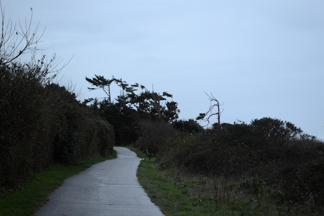
I take it all the way to the kiosk at the Clam Beach parking and then turn. It is ever so gently starting to rain. I am prepared, I brought my umbrella. A bit of rope helps sling it over a shoulder for an easy carry and only one person expressed a worry that I might be hefting a riffle along the way rather than a proper umbrella. The rain comes down harder as I start to climb, but not hard enough to bother any of the people who are not really prepared for it and have a nice warm car to get into soon. As I reach the alternates, I take the paved way and skip the wandering of Hiller Park.

The rain finishes again before I have as I zoom along back toward the car. Something more significant is still on the way.
©2018 Valerie Norton
Posted 23 December 2018
Liked this? Interesting? Click the three bars at the top left for the menu to read more or subscribe!


Comments