Hackberry Peak
Mojave National Preserve
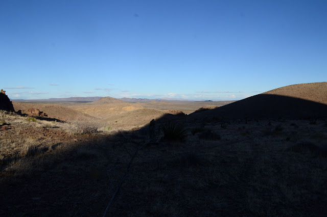
Click for map.
I was eyeballing the "Bobcat Hills" as a nice spot to hike, but then decided to go for the much higher spot on the other side of the road in the middle of a green wilderness area. Oddly, it seems to have a few roads reaching into it. I can drive in as far as I can and then, at worst, it will be 4-5 miles to the top. There is a handy camp site (or three) at the parking I used, which works out great. (The Mojave National Preserve allows roadside camping at well established sites with a metal or rock fire ring. You are required to pack out all trash including ashes and toilet paper and may not "improve" or increase the site in any way.) I probably could have driven in further, but there just doesn't seem to be much point.

The day dawns pretty, but inauspiciously. Just 10 minutes after the sun breaks the horizon, it hides determinedly behind an increasing black cloud blanket that nearly fills the sky. And then, yes, only two or three flakes visible at any one time, there is snow. I forgot to get a weather report. I have no idea how bad this could be or how long it is expected to last. I pack up anyway. I will at least get high enough to get a weather report and if I am overpacked for a little trip, so be it.
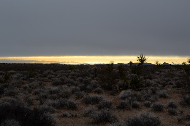

It doesn't take a lot of elevation gain to get a weather report and the outlook is good. It should only last a couple hours and drop maybe 0.3 inches of rain. Then, it should clear up but be very windy. "Rain", as I wipe off a melting snow flake. The nearest weather station is 20 miles off, but in the direction the storm is moving. I should see clearing even earlier, and much colder temperatures as I climb. My tyvek rain pants, suitable for very little else, have been a nice cold wind blocking layer in camp so far and I have them and a fair bit other warmer clothing, so I should be fine. The amusing shaped hill can wait for later if there is time.

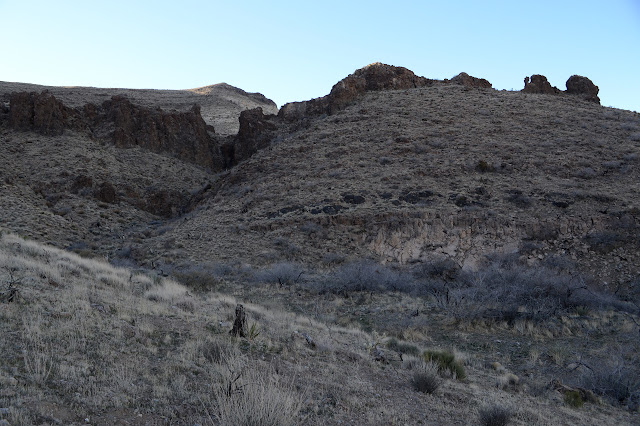
I turn onto a distinct road to the right and find a pair of posts marking the wilderness boundary. There really is a wilderness here. As is the fate of so many wildernesses next to a 4x4 travel area, it is a most disrespected wilderness, but it exists. You can't give some people something nice or even something adjacent to something nice because they are determined to ruin it. The road is easy to follow and brings me around to the first view of the peak, albeit with a thin snow shadow.

I am again the victim of impatience. The road I am following was not the one I intended, but an unmarked (on this particular map) one before it. It is an easy enough mistake to fix. I pick a low saddle to pop over which should take me to the end of the one I meant to follow, which happens to be where I was going to head up a short gully and over another low saddle to be near the end of a set or roads. The cross country quickly reminds me why I stuffed my tall gaiters into my pack as the thin but sharp vegetation grabs at the soft tyvek. The cats claw is particularly unruly as I did not recognize it without any leaves on. They help keep some working muscles warm in the wind and chill, too.

The vegetation changes significantly with the slightest adjustment of the terrain. The cactuses don't like the flats at the bottom, but start up a hill and they are suddenly everywhere, including on the flat at the top. The cats claw, on the other hand, loves to be down where the water flows and are the only thing that can be found in the middle of a wash. Many of them are suffering a mistletoe infection that is turning red. It is probably dying in the cold. The stout Mojave yucca has its own preferences and sometimes mixes with the rest and sometimes doesn't.

On the other side of the saddle, the road I meant to follow is not in evidence. What it ends at is quite noticeable once I take a good look around. A mound of tailings rolling off an unnatural shape in the hill could only mean there is a mine. Discarded metal lies below it: pipes and a single very thin rail. I go up to see what is there to find tunnels and another rail.

I go to look in from the top and there are more tunnels leading from it. On the other side is a rock cairn. Maybe a claim marker? I give it a good look to see if there might be a Prince Albert tobacco can with 100 year old claim papers in it although I don't even know what a Prince Albert tobacco can looks like. There is just a film canister with a decaying lid and claim papers from 1985 as well as a bit of metal to say this is the center marker for the claim. Well, the pipes below didn't have rivets up the sides, so that was probably my first clue. I put it all back as I found it, cracked lid and all, then take off up the drainage to pass over the next low saddle.

As I start over the saddle, there is a road I wasn't expecting, but it connects with the rest of the roads I was expecting. Of course, they were in the service of more mines. Now they aren't getting any use at all.


I can't see any claim markers for this mine immediately. It has old pipe sticking out of it, but the wood would have to be treated to be so old, surely. This is a desert, so maybe it could last. The pipe could have been stuck there by some random humans playing with what they found around the place too. This mine is just on a spur on the road, so I continue along to find one of the two main roads that go on to even more mines. These, unlike the one off to the side, have been fenced off and augmented with "dangerous historic mine" signs.

I can see the fence on the mine across the way and start up the road that should head up to a high mine and then I will have to find my own way across country. My first instinct looking at the map was to go up the drainage a little more and find a way up and my instinct now that I see the ridge line is to go around it just like I thought I would. The old road is very hard to follow, especially once it becomes washed out or crosses a creek. There are corner markers for mines everywhere along the way. A fire went through scorching some of them, but the others look like they came after. I follow a bit of trail instead of the road since I can't seem to follow it and eventually come to corners that might go with it. I still haven't seen the mine except from afar. Looking back, I have missed it. Something to check on the return, I guess. It is time to stop looking in mines and go onward and upward.


I pick up a trail for a little bit. It even has (much smaller) cairns to mark it a few places. A human trail. I must take a switchback that isn't there, because I lose it. The ridge was short cliff faces before, now it is a loose slide of rocks. Those can be a mixed bag. I go for some of a size I like, and they seem to hold. To my right are smaller ones and they slip if I get into them although it looks like someone else might have thought they looked good. There is a scrambly dirt path further to my right. I look up to see first more wooden posts and then some big rock cairns. I have not yet left the land of mining claims. Still, those big cairns at the top are as good a thing to aim at as any.


The view is still shortened quite a bit by weather. They should be gone by now, but a few snow flakes wander by just for show. The wind at the top is blistering. At the very top, past the two big cairns I'd seen below, there are four squat cairns. They are in the wrong direction, but a short way. I have to look.


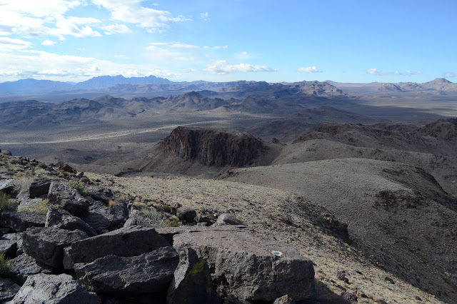
Within the first cairn is a rusty, but solid little can, thin and slightly curved like a flask. The hinges have gone, but the top comes off. The papers within are singed and weathered and saw a bug or two. They describe a quartz claim named "Colorado No. 3" found March 31, 1939. That certainly sounds like a common enough name. The preprinted portions note this is for a piece of land 1500 feet by 300 feet along a lead, load, or vein of mineral bearing quartz. Surprisingly, this gets you water and timber rights, too, not that there is any of either here. Even the long description of the boundary is still legible. It joins up on one side with the "Colorado No. 4" claim. More papers provide notice that assessment work has been done on the claim between Aug. 1 1939 and 1940, 1940 and 1941, 1941 and 1942, all by W. A. Abell, owner. The first one was on a bit of linen that has held up much better than the wood pulp. It all gets folded back up and tucked back in the tin and that back in the cairn the way I found it. I wonder briefly if the missing one is in some BLM storage room or some illegal collection. That was quite a fun find. Now on to the mountain. From here, it looks like a nice, long walk, rather reminiscent of the Flat Tops. A lot of the same geology goes into making both.


The sun is starting to come out just a little. The wind keeps it frosty. My stroll across the top is quite easy at first. The ups and downs can come with short cliffs, but they are easy enough to get around. Easier as ups, of course, since I can see them coming. Down, they just suddenly are there, so I have to backtrack slightly once. It is a low risk thing. One saddle contains another cairn, but this one seems navigational since it is right in the center of the thing. Maybe that trail I was following would have got me up to it. Then I would have missed the 79 year old claim papers. One stretch has a few geodes broken open. None look like they would be of any value.

There is a small natural cave in the side of one wall and I take advantage of it for a little shelter from the wind. Twice my tummy has tried to mention I'm a little hungry and I have ignored it, but this is a good spot to stop and listen. Then it is onward and upward, or rather downward. The last saddle drops a bit more than the others before the last climb. The last climb is another particularly steep one, but this time with cliffs to avoid. Baked ash form one set in yellow, then there are the ones of lava toward the top. I think the easiest way looks to be around to the left, but not too far around because the hillside gets into unstable looking slopes there.

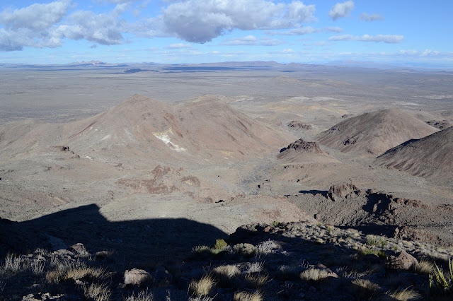
I come out at the top, more or less. I didn't get quite enough to the left. The high point is that extreme southwestern end of the upper plateau. It is easy to spot by the very orderly cairn built by the water district sometime before 1939. (The surveyors who set the benchmark note it.)

I scramble down to the north side to get over, then up a couple short blocks to arrive. Station mark and reference 2 also adorn the peak, but I can't find reference 1. A third reference is supposed to be along the top 200 yards northeast as an azimuth mark. There is even a register. Well, half a red coffee can register some Sierra Club member probably brought up years ago although this is on no list. The book inside looks like it has been washed by the weather and pages from it are collected in two different spots in the rocks with a note that it was found down the mountain a few years back and brought back up. Only two signatures are in it now. The wind is calm enough that I can drop down to a flat rock just below the peak and be out of it, so I take some time to fill my tummy just a little bit more before trying my way back.


The ridge will be easy enough to walk, so I take off to find the azimuth. My suspicion is it will be in the rocks I came up in, but that is not far enough and I don't see it. The rest the ridge looks grassy, but at about 200 yards from the station, there is a rocky section again. It also does not have any marker. I continue on to the next small rise where there is again rocks. A loose post has been left cradled in a rock cairn at the top of this one and off to the side of it some 40 feet is the third reference. It's just 100 yards extra. Walking along the ridge gives me a chance to look down into some of the other valleys. One should hold a road up to Hackberry Spring. A bit further around than I expect, there it is.

I know that people have climbed this peak from Hackberry Spring and the road comes out to the main road just a short way north of the road I am parked on. That seems like a great way down. I won't get to check out more mines, but I'm okay with that. I saw plenty. I haven't seen a spring yet. The map would imply I should circle back to start going down a bit further southwest and my instincts are there are a lot of cliffs directly under me. Of course, as I start to walk, this translates into going down tending to my right, which really isn't enough. There is one of those cliffs below me. Suddenly indecision reigns. Earlier, I'd thought the wash south of this one looked easy to get into and travel, so I decide to get down to the lower saddle the same way I came up and then try for that wash instead.
Backtracking is easy enough, but the lack of cliffs in certain spots to get down to the southerly valley starts to look somewhat less than accurate. Now I am below that first band of cliffs and coming at it from the right angle for the easier approach. There is still the spring to see. From where I am, there is a band of exposed ash that would be hard to travel, so I have to climb again a fair bit to get over that, but then wide areas to walk for a bit. Okay, so back to finding the spring. As I climb just a little bit higher than the ash, there is a distinct trail. Trails bring confidence, so I follow it. Someone who left no cairns made this trail. Someone, in fact, who seems more likely to mark the way with frequent road apples made this trail. Ponies! Well, probably burros. The folks who came up from the spring mentioned "game trails" to help find easy ways around the cliffs, but this really is a class of trail that is nearly as good as built.


The trail does get faint in some areas and I mostly have to be right on top of it to see where it is going next, but I still am able to regain it quickly when I lose it. The road apples tend to cluster, so they are not always good markers. Sometimes there is a wallow were one had a lie down. I tend to think that I will find them again as I get closer to cliffs if I lose it for longer than a few steps, but sometimes I end up taking narrower trails left by deer or similar instead. They are not quite so nice or easy.


I cannot see where the road ends to aim at. It just gets behind some stuff and then there is a whole lot of cats claw in the canyon. I want to see this spring, so head to above where I can see this road. That gets me to the lower waterfall I could see. One spot even looked like it might be wet, but there is nothing at all. There may be a short lived pool after it rains, but it is generally dry. I am above the road and the cats claw stands between me and it. I try some trails through it. One ends in bones. Bad trail. One passes over a vent hole for an old mine. Below, it is filled in. I climb back to where I was and head toward what I could see of road, which is the end of it anyway. The spring is piped and as I go to investigate, there is the rest of that mine.


Having got to the road, which clearly has been used (presumably in conjunction with the piped spring), so will go through, there is nothing further but to follow it. So I do, for a while.


Apparently that is just too easy, especially with the few hours left in the day. There is a low rise to my right and the map indicates I could pop over it and get into the top of the canyon I first turned up in the morning. It should be a more direct route to camp and the contours look nice enough. All this for just a few feet up. I hop on a pony trail and go for it. If the ponies are doing it, it can't be all that bad.
As I follow the pony trails down a wide and smooth ridge line, I start to realize I haven't quite got to where I meant to. I am just on route to shortcut the road a little bit. The "low rise" is a little higher and a little further off.

Well, now that I know, it is fine. I walk back up the easy ridge a way and turn to get across three rocky washes that tend to have cliffs on either side. My anticipation and land reading is doing well for these, though, and I can come to a slot in each as I need. The short climb is not all that much longer than it appeared at first, just further away. There aren't quite so many pony trails, though.


The canyon before me is a little rougher than the one I left with a few cliffs to bypass. The ponies weren't much in evidence on the other side when just about any route could work, but now they very definitely have a trail and it heads off sharply to the right without even losing much elevation. It is so well used that it forms a nice flat human sized trail bed on the steep slope for a very comfortable walk. As it gets to a wash, most seem to continue across and up a bit while my instinct is to follow along the top of the cliff as it droops toward an end. I follow the few, that turn again at the end and follow along the lower edge. It seems smooth enough, but the final section is a somewhat steep rocky slope that just must be attended to to get down to the wash below. At some point the character of the trail I am following changes from pony to deer, but it follows along the washes, generally out of the center of them, down the way I need to go. Navigation is basically done again since all I need to do is go down.

As I wander down the sides of the channels, there is yet another cairn for a mining claim. I can't see anything of the details of the claim, but the paper is tucked away in the same sort of tin as above and probably singed in the same fire. These things must be everywhere. Well, quite a lot exist anyway. I tuck it all back away in the rocks again.


There is a lot of fairly aimless movement in a generally downhill direction, especially as the slope gets so easy it is hard to be sure I am going downhill. Gradually, there is a road again, further along than where I left it. I follow it easily, except for one junction I didn't notice on the way up, but that is soon put to right. It comes out to the same posts marking the wilderness boundary, then I swing a left and return to camp.

©2018,2019 Valerie Norton
Posted 3 January 2019
Liked this? Interesting? Click the three bars at the top left for the menu to read more or subscribe!


Comments