Remington Ridge to Lightner Peak
Sequoia National Forest
Click for map.
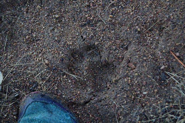
It is time for another peak, surely. The rain following the hike up Mill Creek was snow in the very high elevations and I can see the dusting on a few of the peaks nearby. If this has added to more already on the higher peaks, I don't know. Hopefully if it is there, it is still little enough to trudge through. Remington Ridge is another motorcycle trail that gets plenty of hikers. It gets plenty of the motorcycles too and I can see their tread in the trail along with one pair of boot prints on top of them all. It's some 5 or 6 miles up to the peak from here and I would again like to be back by dark. No rain expected today, it just gets cold without the sunlight.

There are all sorts of people parked across the road from the trail and further up the road in the larger turnouts. The trail looks almost untouched today, so they are here for something else. I expect one of the area hot springs is nearby but not enough to investigate, say, the road off the biggest of the turnouts. It looks like quite a crowd. Anyway, I am getting a later start than I wanted. The days are short and there are miles to climb.
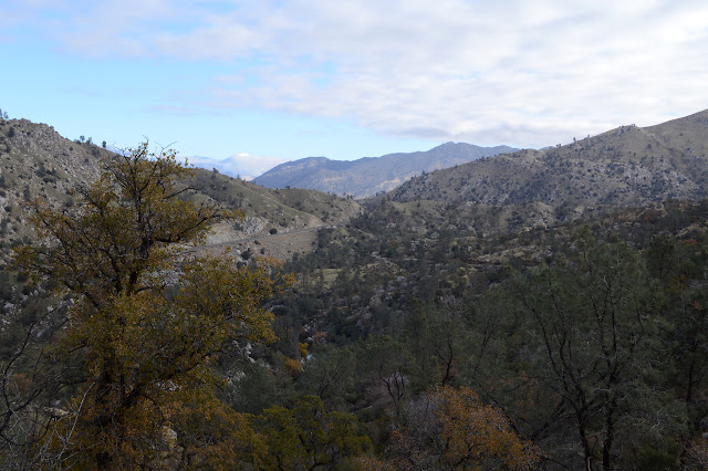

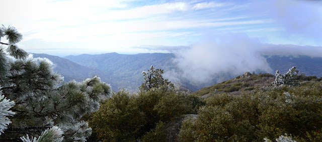
After a little bit of climbing, the trail wanders over the top of the ridge and down into a shallow valley to start climbing a different ridge. Although the day looks great, I can't help but notice that the clouds seem to be lingering and even increasing around the higher peaks that I can see. As usual, I can't really see what is happening on the mountain I am climbing, but there are some clouds around it too. I may just have to settle for the mystique of clouds instead of view.

Of course, climbing is the name of the game for this one, so the valley is quickly crossed and the climb quickly regained. Sometimes it is a bit too steep. The bikes have cut the corners for so long, the old corners have vanished. Now there are wide, steep turns with a bit of a bank and, today, a lot of mud. Climbing up them is a chore. Still, I can find a way.
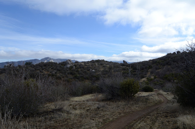

Narrow cattle guards mark the entry and exit of a bit of BLM land. I notice the jointed "needles" that make me think juniper, but these have woody pods. Cedar instead. I have moved into a new biome. There are juniper as well and for some reason yucca.


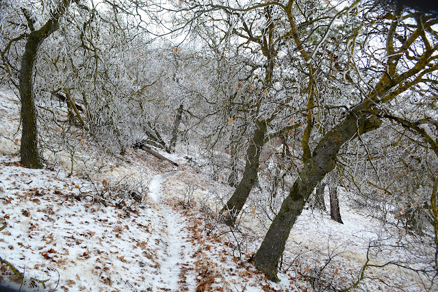
I start to hit evidence of snow. It only remains in the shelter deep under bushes, but it is there. The amount quickly increases and the branches and leaves are iced. It isn't actually freezing out, so there is a certain amount of water and a significant amount of small ice pieces falling from the bushes that are just high enough to hang overhead. It is not quite enough water to send little ribbons of it running over the mud. The ice is a curious thing all stacked up on one side, never wider than whatever it has frozen to, but reaching out for quite a distance.


The oaks up here had bigger leaves and are now hanging onto one or two if any. It is a completely different look. It is a different sound, too. Halfway through a stand of them, I hear thumps like distant shotgun shots. One on one side, one on the other just over the hill, and then two more on the first side. I probably do not want to stay long among these trees, but I do stop for a rest in a large opening just past a pine tree with a large green limb laying on the trail.
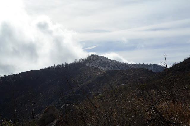
I can pick out a trail going up the nearest peak just past where I stopped. The snow is a depth that helps to pick it out, leaving one side of the long dent of it just visible and the other thick. I am certain this is not a trail I want and leave it be.

The snow is still quite patchy and certain aspects of the mountain are still clear of the stuff. I want to go up the mountain on that aspect. I look up the peak I am standing near and note that the brush and trees make a loose weave that would be a constant push to get through. Maybe I don't want to go up that aspect after all. The trail comes to another saddle between peaks and there is another trail up the next one just like up the last. I am not quite as certain I don't want this one, but continue on. On the map, it looks like the trail gets very close to the peak anyway with just a few short feet to climb to the top off trail.

I was thinking it was probably the next peak but I am overshooting it. It is not quite so close as I thought. The trail passes below a saddle with no obvious use trail upward. I go for it anyway. The snow is thicker and there are trees to climb over, so it is not so easy as if I had just gone up on the other side. From the saddle, there is a bit of thicker brush which I just have to push through toward the peak. I see no thin spot already broken by others except one blocked by a tree that has fallen such that the trunk is high for stepping over but low for crawling. Besides, the snow is thick enough to discourage that activity. Somehow past the tree, there does seem to be something like a trail up the mountain.

I follow the trail until it seems to be swinging too far. If it is an animal trail, it may not be going where I want to go, and I have noticed no cuts or cairns. Besides, there is less snow directly above me. That should keep my feet drier. The trail, or at least a trail, swings back from that side and I join it again. Now it does have cairns. I am feeling better about following it as it circles around one very minor bump to my left.

And so I come to the peak. It has a bunch of trees, a bunch of tall rocks, and a few spots for a little bit of a view. There are two blocks that look at first glance as candidates for a summit block, but neither are something I care to try to climb. I walk up a lower one with a bit of view instead. Right at the top of if is a chunk of mud off a shoe that looks very much like the tread of the one print I have been seeing on the way up. Someone did just like me recently. My shoes that usually feel very sticky to the rock are not feeling it right now, so it is the only block I go up.


I can see where the people trail continues down the other side of the mountain and follow it down. It vanishes into the snow here and there and seems to drop down onto the steep side of the mountain a bit more than I would expect, but ultimately I come out right where I expected at the second trail I'd passed up. Now I just have to get down the mountain. If I hurry, I can even do it before dark. If I don't hurry too much, maybe I can do it without slipping and landing in the mud on the way.

As I pass a saddle with absolutely no reason (there is a bit of yucca on the next near saddle that looks like it might be the decaying remains of some witness post) I stick to the ridge line instead of the trail. It is easy to do and not just because firefighters cut it back many years ago. Others have been following this too. The trail is very nice almost to the rocky outcrop of the next peak along, and then there is a spot I have to push through. It is not so hard. It does seem contrary to getting down in time, though.

The rock outcrop is actually a little short of the top. Trail continues to the top and then over and down the other side. I follow it, but soon have to admit although it is certainly cut purposefully, it is taking a rather decided turn for the west and I mean to exit north and just a little bit east. It might be fun to explore down it some time, but not today. I climb back the little way I have gone and grab a game trail that seems more my desired direction.
The game trail has some splits and I gradually just make my way along whatever is easiest toward the trail I can see below. There is always some way to get closer until I find myself back on it. I manage to stick to it a little better for the rest of the way back.


I am fairly certain the clouds over the mountains across the canyon are at least misting and maybe raining and am glad not to be in it. The wind across the ridge that I had expected but not felt in the morning is blowing now and it is quite cold enough without water falling too.

Getting away from the ridge is a little nicer because the wind is not so strong. Down in the shallow valley, it actually feels warm. Nine minutes to sunset, the sun is already a bright orange light lost to the canyon walls.

Once over the little up out of the valley, the trail is long and looping and generally downward and a very slow pace. I finish without needing a flashlight. The crowd parked across from the trail has changed a little, but certainly hasn't dwindled. I will head on to somewhere quieter.
©2018 Valerie Norton
Posted 28 December 2018
Liked this? Interesting? Click the three bars at the top left for the menu to read more or subscribe!


Comments