Dunioth Mountain
Calico Mountains (BLM)
Click for map.
You know what? It's cold out here! One might even think it was a bit into winter. I have this idea to wander over to places that have large prominence peaks, but they tend to be even colder and particularly cold at the top and, well, maybe now is not quite the right time. So, with a little bit of grumping, I am off to an opportunistic bit of peak bagging in the Calico Mountains. The mountain itself looks fun except for the swarm of truck trails wandering all over it. (Also, the sounds of ammunition from random target shooting isn't inviting.) A geocacher offered up an alternative (by way of putting a geocache at the top) that looks much quieter and can even be done in the few hours of light left in the day. The mountain is actually unnamed, but this person dubbed it "Dunioth Mountain" without explanation. I may as well call it that. One name is generally as good as another.
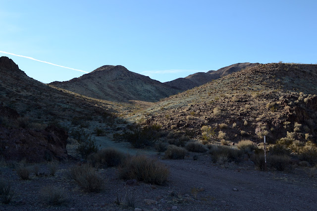
No route advise is given, that is part of the challenge to sign this particular geocache. My choice is a stubby little road that comes off the main paved road. The only marker at the road for it is a break in the fence and a cattle guard. I park just off the paved road because it is too short to go worrying about the little car on it instead of walking. The purpose for the little road is soon apparent: mining. The hillside has been chewed away in a couple of spots and, this being BLM land, they are now a couple of campsites.

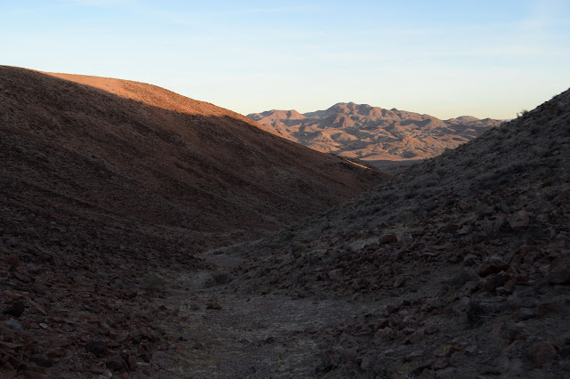
The road surprisingly ends soon after the second mine. I continue up the valley as the footing is easy, then up to a low saddle. From here, um, sort of up along the ridge to my left seems like something that will go generally up to the desired finish point. The views all around open up quickly.
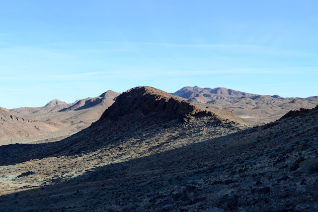
Ahead, it looks like the peak really is not all that far away. Really quite a bit closer than the geocache point. From the saddle, I scramble around on the side, climbing and getting closer. Some folks call this sidehilling with great disdain, but I see it as so very direct. There are usually something like flats to go along and the rocks here aren't all that loose. Still, it takes a bit more energy than wandering the flat bottom of a wash. As I scramble, the answer to the distance question makes itself known. There is a higher peak right behind the one I thought I might be going for.


So now I know a little more about the ridge I am aiming at. It looks like it could be difficult to follow directly, but easy enough to get around the rocky outcrops that make peaklets on the way to the higher peak. I finally make my way to the top of the ridge.

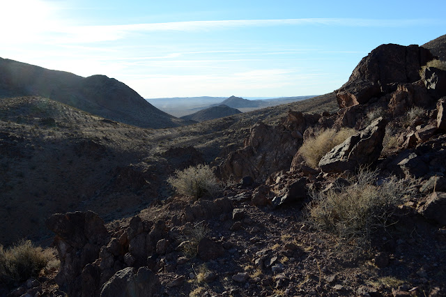
As I travel the ridge line, it abruptly drops in another sudden rockiness. There is a path easily down through it, but it becomes apparent that dropping to the wash to the right of the saddle instead of struggling along high on the left ridge would have been the easier choice for travel. The saddle before me drops practically down to the level of the wash anyway.

So now I could take the wash a little further before climbing, but no. I am set on the ridge. I will take the ridge. So I wander up it and around the steep rocks one way or the other. Somehow it always seems that the way that was easier for the previous one will be harder for the one before me. Whatever, each choice seems to work out well enough. I stay high and get to the slight saddle behind each ready to follow the ridge some more.


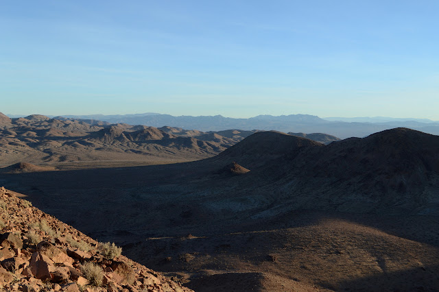
There are no more surprises until I find myself at the top and there is the can to sign. Sometimes I get to a peak before Bob Burd, but not this time. He signed it in January. Odd since it isn't officially named nor is it really on the way somewhere. He seems to go for the shortest way and Lane Mountain, which is somewhat of a continuation up from here, has much shorter approaches. The view still stretches out all around and I try not to get too cold enjoying it.


Since I figure there were easier ways to get to the top, I decide to take one of them back. I'll get down to the wash, then hop over a low saddle to the wash I started in and in between will be like trail highways. First I have to get down, which is a fair bit steeper than anything I came up. Still, the footing is not bad and the brush still thin, so it is just a matter of placing each foot.

The wash is even easier to travel than expected. Still, my plans fall awry to impatience. Up a low saddle to my right and... that isn't where I came from. That doesn't look right at all.

So I take to walking the ridge again. Here, it is a wide, easy hill. The walking really is a lot easier across the top than it was around the side. Down the far side is a little harder, but I swing right around some steep stuff, then maneuver carefully over to a saddle which should hold something familiar. And it does. I follow an old 'dozer track, evidenced by the large rocks having been pushed into lines along the sides, that ends suddenly near and above the second mine. Around that and down into the wash, it is again smooth sailing along wash and road to the car. I do take a moment to investigate one post of a pair visible below the mines. It is likely a claim marker, but now just becomes target practice.
©2018,2019 Valerie Norton
Posted 2 January 2019
Liked this? Interesting? Click the three bars at the top left for the menu to read more or subscribe!


Comments