Black Rock Mountain Lookout
Shasta-Trinity National Forest

Birthday hike! I thought I signed up for birthday work, but it's birthday hike instead. The crew had breakfast and headed up to the trailhead generally aiming to get to North Yolla Bolly Spring where the Yolla Bolly Guard Station once stood. The CCCs would be off somewhere else, it was just volunteers for the hike.


Once we passed the familiar, we were off to find Cedar Basin. There were lots of dips with incense cedars in them. Is this the one? How about this? There weren't many patches of whitethorn as encroaching as the one we'd been working on and none nearly as long.


There were more new flowers, but they were distressingly far from actually blooming. Only a delightful trillium was almost there.


The trees didn't really stand out for Cedar Basin, but the tiny valley was a little less tiny.

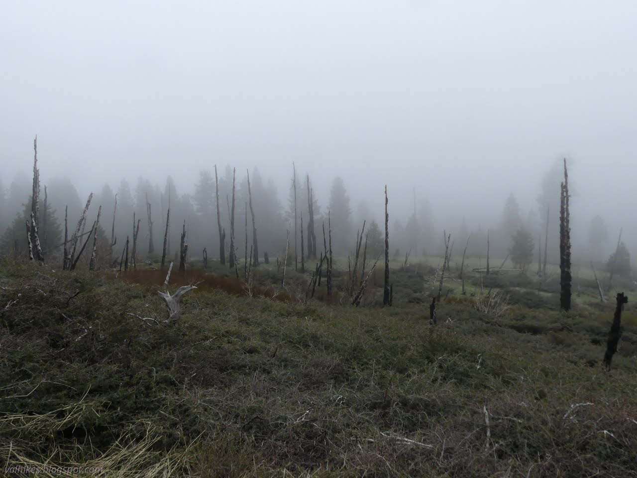
Hopefully that was Cedar Basin because we hit bad burn after that. If it wasn't, Cedar Basin is no more, at least as a home of cedars. We finally had our first downed log on the trail.


Some history is still visible on approaching the lost Guard Station.


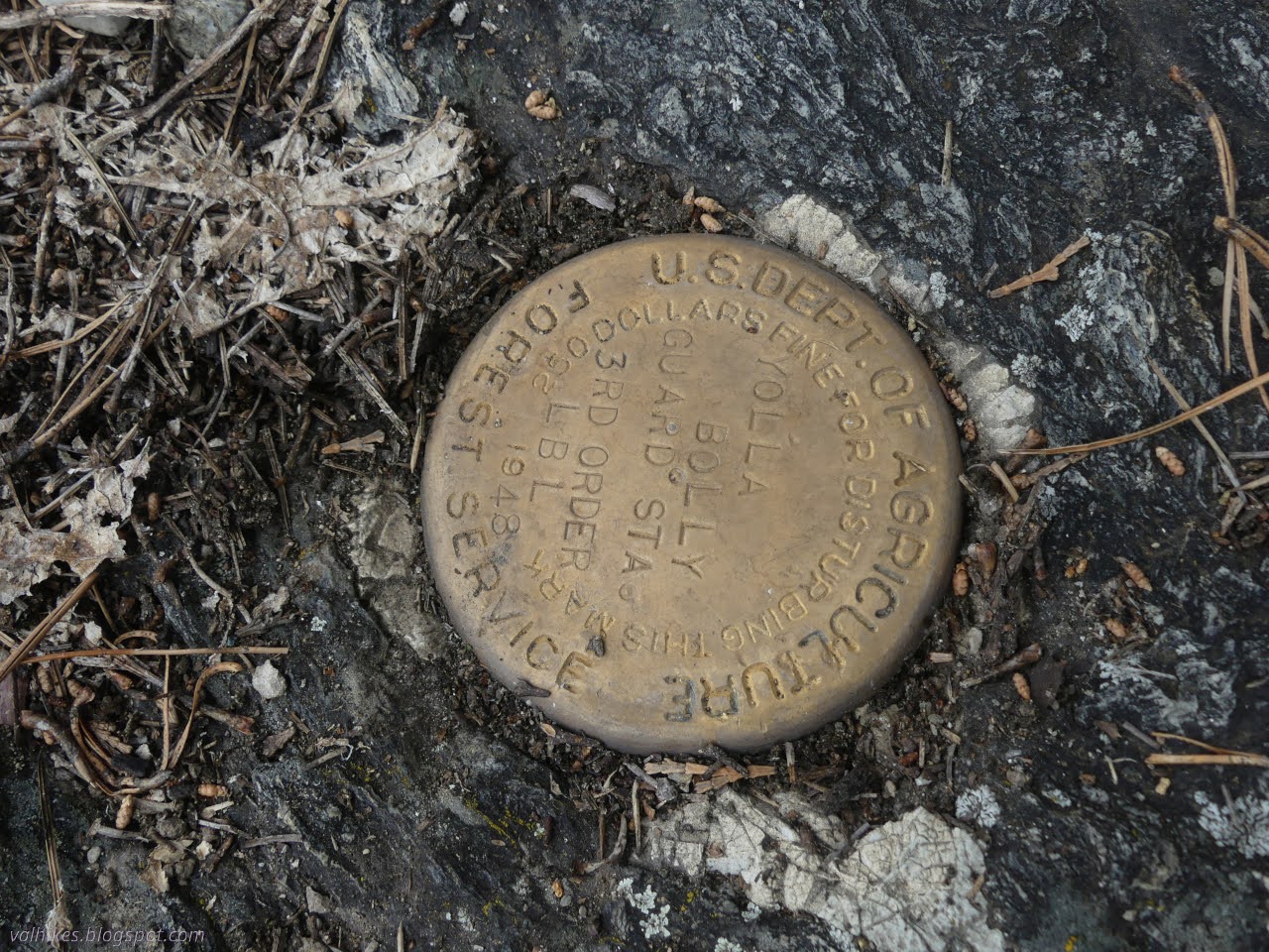
We stopped for lunch beside the ghost of a guard station. There's spots of concrete that might have once been part of the foundation. I noticed a benchmark on the map and went searching. Ultimately two were located, both from 1948, one USDA mark that is "third order LBL" and the other USCGS of a sort typically found by roads.


Eventually we headed out again. I still wanted to try for the lookout although I would have wanted an earlier start and maybe not the extra half mile out on the Humboldt Trail if going up was the solid plan. (Okay, I do appreciate getting out to the old guard station and would have regretted not stopping by.) Most were not going up, so we who were negotiated a return time. Well, Daniil negotiated a return time. Remember Daniil? He's been going to most of these trips. He negotiated back by 7PM and I silently suspected there was no way I could get up and back before 8PM and even that would take some cross country. But maybe I'm selling myself short.

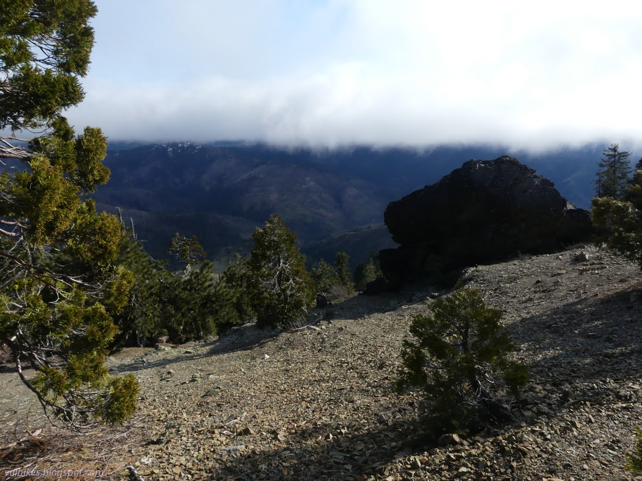
I fully expected to have to turn back at some point before the lookout as I started up the climb to the ridge. We started by climbing out of the 2020 August Complex destruction onto a mountainside that hasn't burned since the 1996 Rock Fire according to the fire maps on Caltopo.


There was plenty of water crossing the trail. The station spring had had the look of a stock fouled spring although it probably wasn't, so I ended up grabbing some water from one of the higher flows. Further delay in getting to the lookout.


We had snow patches on the way up, but the south side of the mountain was nearly clear of snow. When we hit the ridge, we hit a nearly solid sheet of 8 feet of snow. The trail plowed its way right underneath.


We retreated to a spot on the clear side where there seemed to be a thin trail, but this only lasted the first quarter mile or so. Some excursions to see any sign of trail didn't work out. However, there are some very distinct trail sign along the way and some still looks like the old mule trail that was needed to serve the lookout.


It was nearly 5PM when the lookout finally loomed out of the clouds. I had almost given up and headed down the hill twice by that time. It kept looking like the travel surface might turn rotten for people who had neglected to bring microspikes, but each time I decided to give it a chance before giving up on it and the route kept coming through for us.

I quickly gave up on actually climbing the lookout. The stairs were half buried in the snow and weren't reaching anywhere near the platform, much of which was sitting around the bottom of the struts instead of the top.

It was cold and windy and lacking in any sort of view at the top. I tagged a nearby bump hoping it is the high point. There wasn't enough view to know for sure. The map seemed keen on it being the high point and things seemed to go down all around, except maybe there was something to the west. A peak bagger suggests in a log that it might be a little west.

It was a few minutes past time to go and we were both getting cold. We headed down. The sun actually came out for a brief bit of beauty as we headed back along the trail to the closest saddle. Somehow the peak itself never quite cleared.


It was my assertion that we could make it down to the trail below from the closer saddle. The slope is steep, but not too steep except for some rock outcrops. There is ceanothus, our nemesis of the last two days, but there's always a way around it. Daniil had already experimented with a similar descent from where the trail hits ridge the day before, but it must be admitted that the slopes get ever worse as they go west. I also suspected it wouldn't be too hard to go down the peak on the west side and drop directly to the trailhead. Peak baggers have followed this route before. However, I couldn't get agreement for that route earlier and, once time was short, wasn't really happy to try the untried ridge walk. The ridge gets rougher that way too. I did get agreement for barreling down this hill. With great care.


Things did get steep right at the end requiring a slight route adjustment, but there was never a challenge to our route mounted by the dreaded whitethorn. Then there was trail. We arrived at it just past the shaded water oasis. It was just the known trail, generally downhill, to go. For a little over 2 miles.


I stepped off the trail a minute after 7PM. Almost made it! Unfortunately since that is not where we were camped, that wasn't the finish line. So we were late back.
*photo album*
©2025 Valerie Norton
Written 2 Jul 2025
Liked this? Interesting? Click the three bars at the top left for the menu to read more or subscribe!


Comments