Big Rabbit: Rabbit Peak
Anza-Borrego Desert State Park
Click for map.
DAY 1 | DAY 2
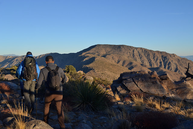
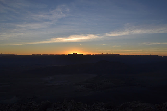
The night was already colder than expected when we went to bed, so we were slightly worried. Somehow it did not get much colder and was already getting warmer by our sunrise wake up time. Pudding again for this morning, in "special dark" chocolate. The shaking elicits an, "It's loud," from my neighbor with just a touch of animosity, so I yield to the thought of pulling on my shoes and going back to the top of the mountain where the sunrise will be better. Such is life. We are out just about on time for the four rolling miles out to Rabbit Peak.
I brought my Frogg Toggs pants for a little extra warmth and they were okay for the 40-44°F we were hanging out in. They soon show themselves to be way too soft to be hiking in where there is the occasional twig to slide past. We pause after 20 minutes to remove the extra layers, so although I do not yet feel warm in double trousers and short sleeves, they come off. It looks like they were a bit too soft for sitting in the dirt cooking, too. This reminds me that my heavy duty puffy pants have some holes that need sewn up. It is possible I am tough on trousers.

Ryan announces that we have hit rock bottom and get to climb the rest of the way as we finish off the largest of the bumps along the ridge between our two peaks. There is still one more short down, but then is is all up. He gives up free reign to climb until there is no more up and we take off all over the side of the mountain.
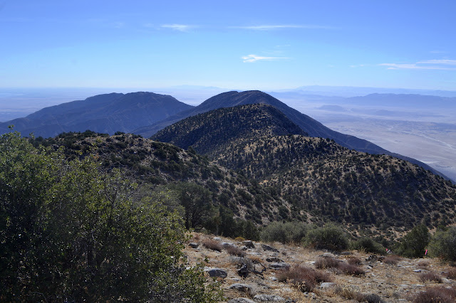

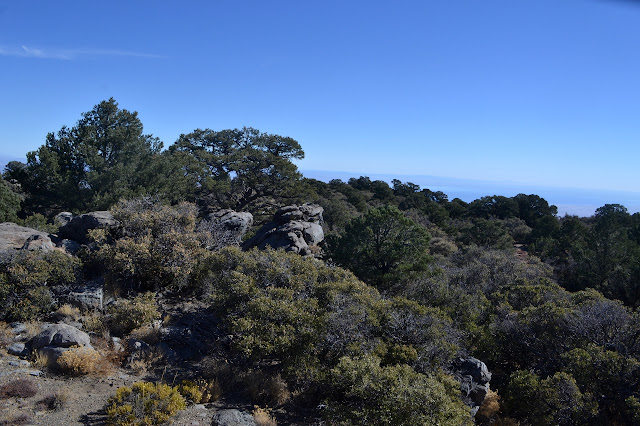
What exactly constitutes no more up is open to a bit of interpretation. The top a sloped flat with rock outcrops at various positions. Up the gentle main slope seems a good bet and eventually there is a rock with a cluster of people playing with a summit register. There is another outcrop that might be higher, but this will do.

There is no benchmark on the rock everyone is clustered upon. I know there should be one. It is on the map. There is a little time, so I scramble over to the rocks that look like they could be as tall, but nothing over there seems to indicate a benchmark either, but some more rocks over to the east look promising. Maybe they wanted it to be visible from the sea. I should check the map for a hint, so I head back over. Larry helps out with a map and, indeed, it is off to the east. We head out and after one extra rock climb, get ourselves into the right area. Tucked under one rock is a 2x2 with thick rusted wires wandering away from it. Surveyor trash. We have it. It is a big rock with a pile of little rocks on top. Larry does not think people would stick all those rocks on the marker, but a quick glance around shows reference mark 1 about 30 feet away and pointing right at it. The rocks surround a coffee can register half filled with cement stuck directly on top of the station.
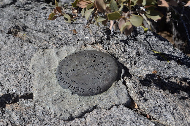
Larry restacks everything so it is not on top of the benchmark. He seemed to think that it was just not right to have things stacked on it. Then it is time to take off. We get going, not quite managing to diagonal across to the ridge to get back down. There is actually quite a lot of green stuff in the way. Soon enough, we are stepping carefully down the steep side over rocks of all sizes and trying to avoid the cholla. Most things we started with have vanished up here, how does the cholla remain?
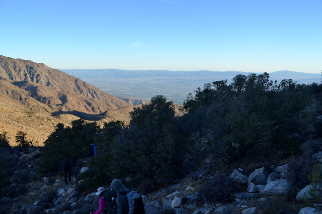
Up and over all the bumps again and one last climb back up to Villager Peak and our camp and we stop to gather up the extra weight we left there in the morning. The few tents that had been used are still up, so it takes a little bit of time. In some ways we wish to hurry and in some we are resigned to a late finish before the long drive home. There is a little up in the miles to go, but not a lot. Mostly, we just need to roll down the hill. After an hour, we get started doing just that.

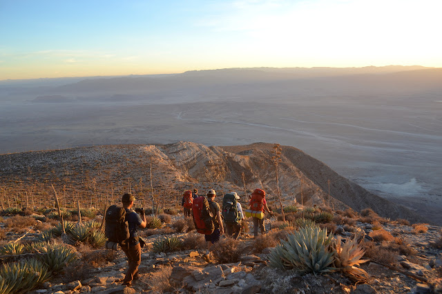
Ryan is even more enthusiastic about keeping us away from the edge on the way down. To be fair, there are some obvious large cracks going down beside the edge and it probably is just plotting when to go. We watch the sunset, still high enough up that it is almost exactly on the official time even though it is behind some mountains. There are still four miles to go.

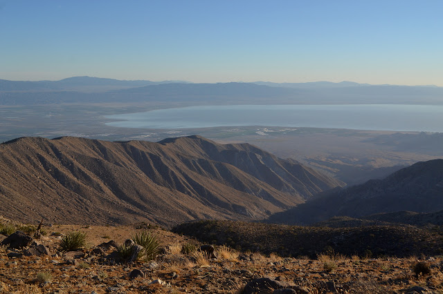
With the sun gone, it gets cold quickly. Once the jackets are on, we start down again. As we drop, the air gets warmer. We are playing a game with temperature and elevation again. If we go slow enough, it should cool off faster than we drop. But we need to start on our way home. Eventually, we overtake the heat of the valley and the jackets have to come off again. There is a mild cheer as we get off the mountain and land back on the flat desert floor since the most dangerous stepping is behind us. Following the trail across the flat only has a couple hiccups when the trail takes a sharp turn. Devious. We are back at the cars around 8 without too much off use-trail travel. It seems less sandy in this direction, but maybe that is just because we are not trying to climb, even though only slightly, through it.
*photo album*
©2017 Valerie Norton
Posted 24 November 2017
Liked this? Interesting? Click the three bars at the top left for the menu to read more or subscribe!


Comments