Conejo Canyons
Thousand Oaks
The cool is upon us for a day or two before temperatures shoot back up into the 90s. I have decided to join some geocachers to wander the hills of the open space in Thousand Oaks. It does lead to some odd spur trail choices, but also lets me go into new places and tick off that I have been there when I get home. (At least this collection does not fill up the house.) Rain is threatening as we start down the utility road.
 |
|---|
| Starting down into the canyons along the utility roads. |
We are not going far into the canyons. At the first junction, we turn for a steep climb as the rain starts down. It has already finished as we get to the model plane runway. There are a few fliers out today and they are sweeping the water off as we climb further toward the flag at the peak.
 |
|---|
| Newbury Park stretches out south of the freeway to Boney Mountain. |
 |
|---|
| Geocachers (well, one just often hikes with a geocacher) at the flag and taking in the view. (One is conditioning for a much bigger hike, the external frame pack is not typical day hiking equipment.) |
 |
|---|
| An art installation by some unknown party. |
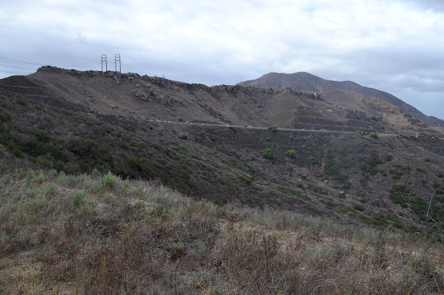
The trails up here are much narrower and less used, but they do make it around to the lower utility roads again. We do a lot of the silly spurs on our way because our silly devices suggest we might want to. We stall as two try to make one more spur, but without any trail down a cliff, to get another cache. The rest of us decide it is time for a preemptive mutiny and continue down the trail that connects to the utility roads below much more easily than any bushwhack. They follow after a couple minutes and we turn down one more spur to overlook the freeway as it climbs the grade.
 |
|---|
| Overlooking the Conejo Canyons. |
 |
|---|
| The Conejo Grade does not look so steep from here. |
 |
|---|
| Overlooking the Oxnard plane and Camarillo. |
It is about as far as we are wanting to go for the day, so we start back along the roads, with a few more extra excursions and inefficiencies on the route for good measure.
 |
|---|
| The transmission lines as they extend from the power station on the coast at Point Mugu. |
©2015 Valerie Norton
Posted 13 Oct 2015
Liked this? Interesting? Click the three bars at the top left for the menu to read more or subscribe!


Comments