San Andreas Fault Trail in Los Trancos Open Space Preserve
Midpeninsula Regional Open Space
Click for map.
I had been hoping the clouds would burn off before I crossed over to Los Trancos to hike a bit of it. I wanted to do the San Andreas Fault Trail, which is an interpretive trail about that largest of faults in California. It is one with traditional numbers and the handouts to go with them are tucked in beside the maps. They are well stocked and I expect they can be found online if there's been a run on the physical ones.

The brochure says to actually start off to the left of the main trail. It climbs up onto a hill with a bench and the first couple numbers so that you can look out over the fault including the emergency water storage that has been built directly on it. It is no coincidence that this happened. The fault creates narrow, deep holes that looked attractive for water storage by engineers who didn't know how they formed. I have seen them before and can picture them, but there is nothing but cloud to see now. It really should have burned off by now. Who has the fog machine turned up so high?


Annoyed at the weather that no one can control, I head down around the loop where the rest of the education concerns much closer features. The San Andreas Fault is marked with posts topped with a yellow line while a second is marked with white lines. At one spot, we can compare the reality today with what it looked like shortly after a rupture, which is to say an earthquake. Further on, old ruptures have filled in to give a flat area like a road bed. The markers stalk their way down the middle of it. It notes these were often used as ready made road beds. A fence built where a fence once stood to illustrate the distance the land moved feels a little gimmicky, especially as they've collected wood from the area to build it so that it carbon dates correctly. (Disclaimer: carbon dating does not discriminate well on the order of 100 years, which is the age of this wood.)

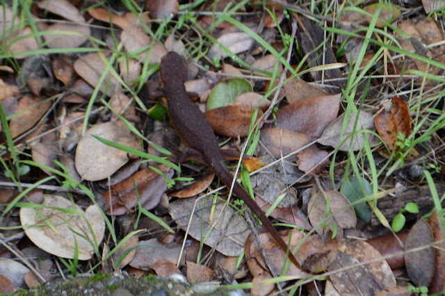

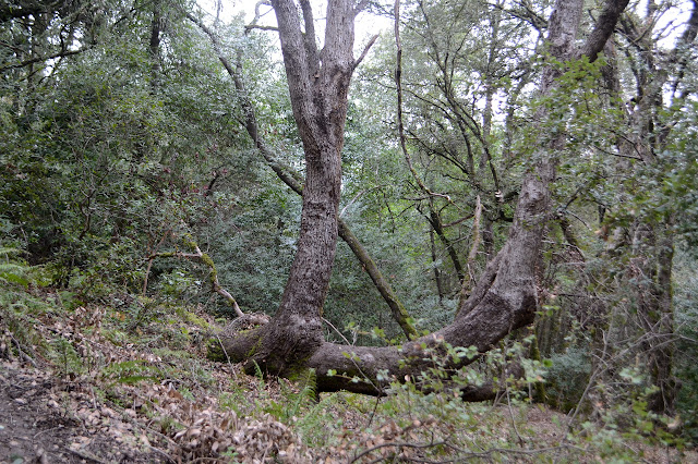
The trail is a lollipop, so I'm done with it at an odd spot. I figure I'll just take the Franciscan Loop Trail around the outside of it all to get back. This passes through some impressive laurel trees, some large and hollowed and partly regrowing. I sometimes forget how much likes to just regrow from its roots if a fire comes through. Well, I just expect it less of big woody things, but they do it too.
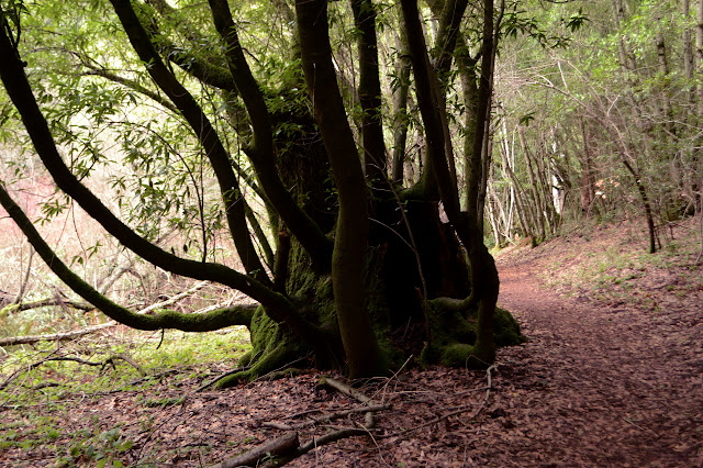

There's not so much water flowing on this side. I thought there was none, but sometimes I hear it so it must be on the surface sometimes. This time I spend most my time among trees rather than getting grassy segments, but there are such wild shapes to some of them. They've got a few rock outcrops that the brochure had interesting things to say about too.

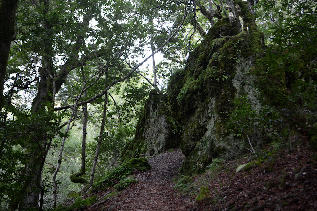


The trail encounters power lines and seems to take a slightly wiggled route up the old utility road, which is a little bit steep. Somehow it feels like less climb than was included in the interpretive loop even though it is coming from lower to higher. It would have a bit more view to it, too, but the clouds just won't let that happen today. I just have to enjoy the wildness of the trees and rocks.
I am a little put off on my return by the note that there is sudden oak death in the area and I should be sure to clean off any dirt clods on my shoes. Similar shoe cleaners have been in other areas, but I did not see similar notices next to them. I wonder if they all are for this purpose as I give my shoes a sweep through the brushes. Not that there's any clods on them anyway. I really don't want anything like that on my shoes. They're going too many places.
©2020 Valerie Norton
Written 19 Feb 2020
Liked this? Interesting? Click the three bars at the top left for the menu to read more or subscribe!


Comments