Silver Peak
Barstow BLM
San Bernardino National Forest
Click for map.
When I realized I'd have extra morning chores before the hike up Granite Peaks, I probably should have turned my attention to the shorter Silver Peak hike, but it does seem a little less romantic a thing. This is another Hundred Peaks Section listed peak and it seems more straightforward. There's a couple of ridges that present themselves as likely start points to connect to a road over the top. Yep, that's right, it can be done as a drive up. I ain't counting no drive ups. Most people have hiked up it from the south side when they engage a similar ethos. The road is open to there, but I'm here, so I'll try it from the east, give or take some degrees north. I did stop a bit short of my previous parking spot because I felt I was almost there anyway only to find I still had a mile to go. Whatever. It's a much shorter hike. I can do another mile on the road up.

I think I'll pop up Round Mountain on the way up, switching my original plan front to back. This will set me up to follow a short mine road up, then take the more obvious ridge the rest of the way. I can come down a slightly different ridge that looks like it might be easier. Round Mountain has some mines and a short road on it, too. That road starts beside a flattened parking area, but then moves on to cut into the sides of the mountain with no good launch points. I start up the hill cross country from the parking area. It's a quick hike over some odd rocks to the top.

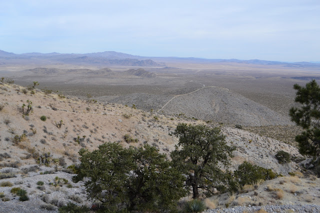
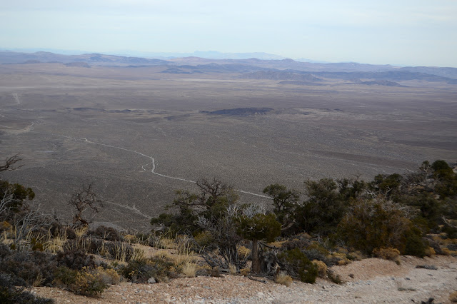
The top has a very simple station stuck in the end of a pipe and only imprinted with a triangle with a dot in the middle and a campsite. It is an excellent view of the mass of tailings around Terrace Springs. I guess it's a little bit better view of the rest of the valley, too. The overcast day is just subduing everything a bit.

There is also a road down the south side which drops down to where the road up to the mines on Silver Peak start. That's my route down and my route up the other side. I follow it all the way to a bright red scar in the mountain side just past where small signs mark the edge of the national forest.

There's not really a good launch point from this road, either, but there is a thin animal trail going up some loose rocks to the left. As usual with animal trails, it does seem to be the most promising route so I follow it. The hill side is initially steep and covered with loose grey rocks. The trail follows along the edge of the drop off on these loose rocks. It gives me a little pause, but there's more loose rocks everywhere else. I make sure every step is firm and plow my way carefully upward until it tops out on a shoulder. Everything else is a nice, easy slope. I look back down. Trying to get down this way would have been like trying to thread a needle without quite knowing where the needle is. It is a narrow spot to hit and I can't see where I came from. I get to walking the much surer slope upward.


There seems to almost be a faint trail as I get to the ridge I plan to follow back down. There are more and more claim markers as I climb. Even the cairns along the way look more likely to be claim markers than navigational. The most recent users of these trails are deer anyway.


There is definitely a little bit of trail coming down off the road where I finally join it. This part of it just goes off to a mine and stops and hasn't seen a lot of use in recent years. I turn away from the mine and follow it around a shoulder to a slightly more used road. This one goes all the way down to the system of roads I started on. I think. I take the left to regain the ridge. People have definitely been on this bit of road in the past few years, but they seem to be missing the turn and going out onto the shoulder where they quit. I go up.

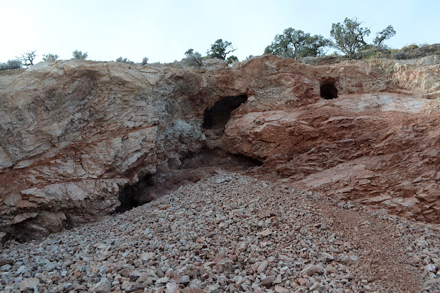
There are more roads heading off to the north. Those aren't on my map. One looks like it might be a reroute of the one down to the bottom and another looks like it might not go anywhere but an area of prospects nearby. The road has some steep spots and the mountain is getting torn up underneath by people trying it out with their trucks and Jeeps and such. I get to the top where the bright red HPS register can looks like the only bit of color next to yet another prospect. It is actually a rather deep shaft barricaded so that only bats can use it.

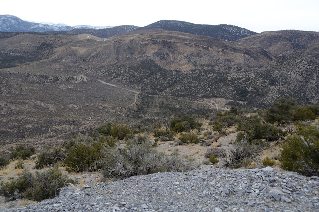
I can see cars moving along the highway below. If I had driven around that way, I might have been able to grab Gold on the other side of it, too. That would definitely have been a good idea if the point was to get the most the quickest way possible. Unlike the last one, I have lots of time to just enjoy myself. Also unlike it, this peak isn't very warm. Those rocks that were West Granite Peak's top had been basking in the sun all day and were very comfortable to sit among. Today, there is no sun, just a wind to try to hide from. Looking around is quickened by it.


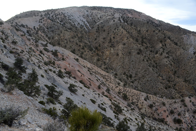
I get some food into me before scrambling back down generally the way I came up. The turning point will be easy to see as I go because it is one of the few places with a minor false peak. Another easy way to tell is that it follows along the edge of a canyon that is another large mining area. A lot of the mining claim markers seem to go with this mine which is made up of stacks and stacks of little claim tracks.

I'm briefly distracted by a bearing sign on a post laying down in the rocks at my turn. So there's a marked corner nearby. It's not very far, but it's west. That's a steep slope of loose rock. I'll not be checking to see if it has fared better than the sign. Up and over the peak and down the other side, there is still faint trail following more claim markers. They go nearly all the way down. There are spots where the ridge gets narrow, but it is easy travel the whole way.

There's not even anything weird along the ridge except a pile of large lithium batteries broken apart and a little burned on some. It gets a little rougher where the claim markers end, but is still easy enough for walking right on down to the road below. This is definitely the better choice for going up the mountain.

So I have roads to follow all the way back to the car. Oddly, I seem to have chosen the ones the cars don't like for my route back. It's the most direct way for me, but there's one cholla that comes all the way to my waist right in the middle of one stretch.
©2019,2020 Valerie Norton
Written 23 Jan 2020
Liked this? Interesting? Click the three bars at the top left for the menu to read more or subscribe!


Comments