Copper Mountain
Barstow BLM
Click for map.
Copper Mountain is north of the college named for it and its peaks wrap around the east side of Coyote Lake or Sunfair Lake depending on what map one is looking at. This generally dry lake bed is a better known spot to get some free dispersed BLM camping while visiting Joshua Tree National Park. It and Copper Mountain are also quite popular with the off roading crowd, so I expect this hike won't be quite as nice as the last one. The climbing might be easier. I've spotted a rough road up this side of the high point to aim at. It is a little hard to see when looking directly into the sun in the morning, but I'm sure it's still there.
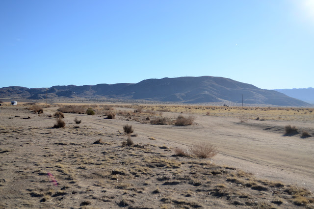

Setting off across the flats, there are distinct vegetative zones. I expect I am walking around the edge of what can be lake, or at least muddy. To my left is a very thick and tall growth of things like grasses while the right has a scattering of bushes with shorter things that actually are grasses. It's not muddy now in spite of recent rain. Perhaps I need a different hypothesis for the growth patterns. I cross a neck illustrated as lake, something which does not exactly follow the depressed contours, and the mountain stands before me.

I start up an edge with very little of a road. It turns out that comes up from the valley to the left. It is rough and rocky and probably made by people believing that being allowed to take their OHV there means being able to take their OHV off road there. It is a common erroneous belief. I haven't checked which way BLM falls on this particular bit of land. Believing the local lore is a good way to get in trouble when they decide to crack down. The only prints on it appear to be mine coming down, but I'm sure I wasn't here already. They're actually a little bigger than mine.


The road gets a little better near the top where it flattens out. This is probably more to do with the easier terrain than that it was meant to be by anyone in authority. The high point is even flatter, having been bulldozed that way, and has some workers at one of the electronics sites. They came up the good road on the other side. I poke around looking for an azimuth for the High benchmark (seems to be gone as are the things it references for its placement) and tag a bit of rock left sticking up a little higher than the rest of the area.


Next I'm off to the other peak where the benchmark that goes with the azimuth should be. I'm rather surprised to find it just outside a fence for more electronics. There is also a single reference mark left.

And now I am off to ponder the other peaks. First a little way down the good road until there is a motorcycle track along a ridge heading north. This is mostly an easy walk interspersed with crazy, nasty downhill moments. They start picking the most up and down route and I decide I can do better on my own as I drop back to the flats.


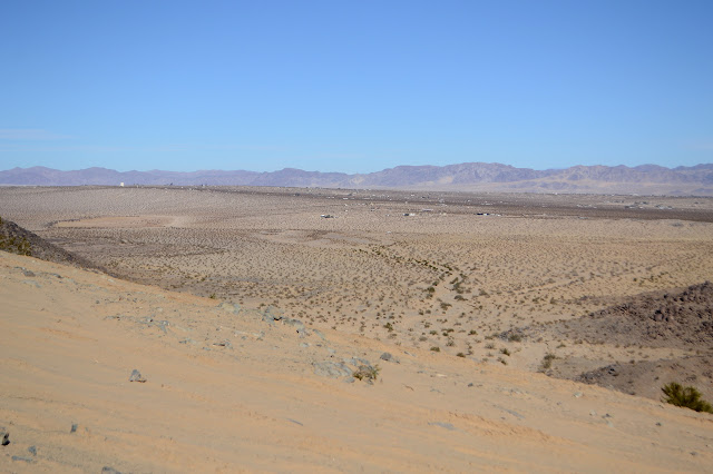
The flats are not what I am expecting. They are actually a little sand dune area. Roads go everywhere, so I have my pick of easier or more direct routes.

There's a very steep road up one side of the mountain and a tamer one up the other. It looks like a few have tried the first and ended up dropping off it again. It is less ripped up above the fail point where only the capable or foolish downhillers may go.


I head down the road, but could have saved some downhill going along the ridge. No idea if it would have been easier. Travel isn't too bad along these ridges, but they're getting rockier. I've decided to go up one listed on Peakbagger, so I follow lines in the landscape up and double back to easier spots then follow the lines again. Eventually what looks like a tough little motorcycle track comes up to join me. It hasn't been used much and isn't hard to walk to where it misses the peak by 10 feet. I go to claim it and find it is actually only on Lists of John. Never mind. Still a nice spot.


I head down again with thoughts more of wandering the area. The north end of Copper Mountain is pock marked with mines, presumably copper, on the map. I make my way on road and cross country. If I knew better where the roads went, I would probably be able to just go along them. There are geocaches to string together and take entirely too long to look for up here, too.


As I wander off the far northeast side of the mountain, there's huge talus to wander and climb through. I can't find the geocache that hides among it, but it certainly has more levels than I expect to look through. My attempts to get to the top are all thwarted. Finally I have to give up and head back down toward the lake and across it.

I take the road across the mountain as the light dims, then drop down to the dry lake. The lake offers roads and simple flat areas to aim and go. In the deepest areas, it is devoid of vegetation altogether, so walking toward the lights of a farm near my parking is easy. There are spots where the light reflects from standing water, so I avoid those, but most the area has firm footing. As the tall dry reeds start up, I start to follow the roads through them. It is easier than the battle with the stems. When I am too low down to see the lights, I go toward the dark shadow, this way and that, until back to the car.
©2019,2020 Valerie Norton
Written 19 Jan 2020
Liked this? Interesting? Click the three bars at the top left for the menu to read more or subscribe!


Comments