Sheephole Mountains high point
Needles BLM
Click for map.
A week has already passed and there's a hike with some Hundred Peaks Section folks, but they're actually doing a couple things off the Desert Peaks Section list. The one on Saturday made me pause. I think I could do it on my own, but with a group I'd be slowing the rest down. The Sunday hike looks much easier, although the stats are a little worrisome. Only 4.5 miles and 2100 feet gain, but it'll take "5-7 hours, possibly longer." (I can find this out because the DPS peak guides are now available to all online, not just members. I don't even have enough DPS peaks to become a member yet.) Yikes! But it is nearly 1000 feet a mile with class 2 climbing and no trail. Well, there could be the tiniest bit of old prospector trail at the start, but then nothing. With a 7AM start, we have plenty of time to get up and back in the day. Unfortunately, after an in car navigational problem, we're actually starting at 8AM. Still more than enough hours in the day and the delay lets me go find the Pass benchmark before going down near the azimuth to park.
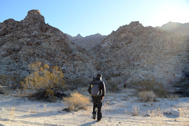
It is nice and easy at first traveling along a wash bottom. Oh, yeah, with the occasional mild waterfall (dry) to navigate around. We're following a standard DPS route and I'm surprised by how well established it is. Not that it is anything like a trail yet, DPS routes don't get nearly as much foot traffic as HPS routes.


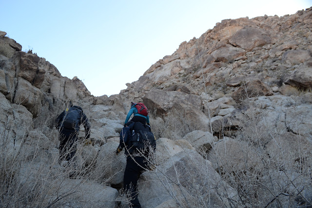
We start to stay up on one wall as things get rougher. It seems nonsensical at first, but it is what the previous passers have marked with cairns. The path and the possible paths seem somewhat disjointed through one section. It's not something I've experienced before. Further up, we are climbing up through a chute that reminds me a lot of the Cargo Muchacho Mountains high point. The second time when I followed the surveyor reach to the benchmark and actually made it, not the maddening first time. Except this time I'm pretty sure I wouldn't want to go down the chute again and when I get to the top, no one has left a mining claim marker. That I wouldn't want to go down is at first disconcerting, but I'm pretty sure there are other routes nearby.


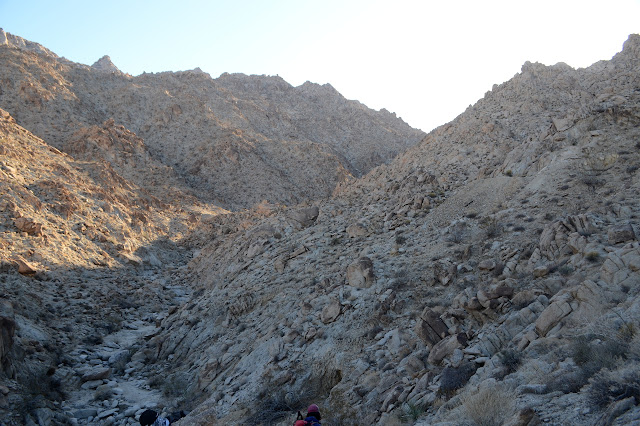
We break out to a ridge line below a huge rock where we can suddenly see bits of the desert not covered with similar rocky mountains. In between, it is a long alluvial fan, or fans, as apparently flat desert land slopes easily toward the local (dry) lake.

We drop a little into a long valley running with the mountain instead of down it. I point to some cairn marching around in another direction, but we don't want to go there. That's the way to the class 4 route. I fully support skipping that.

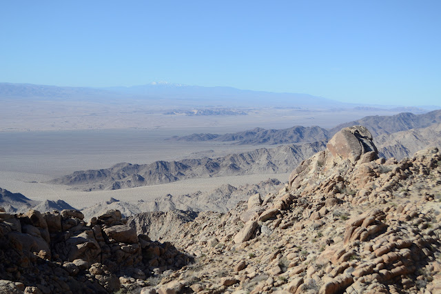

We make the final big climb to reach a ridge with even more encompassing view. It's just a quick stroll to the summit block. With our options narrowing, we actually get a tester for the route to the top. It is just a friction climb, so we all trot up it just fine. Then there we are, surrounded by everything with nothing hidden.


Then I see the craziest optical illusion ever presented by a landscape. It is to the south and we could see it earlier, but somehow from here, it pops. And I do mean pops. All the peaks, big and small, that stick up from the flat level of debris seem to have an outline around their edges. That is except this one which is obviously the shadow of a small floating peak. There is no other correct interpretation for what my eyes are seeing. I know it is impossible, but there it is. Rocks. Floating.

So that crazy vision consumes me for the rest of the time before we decide to run for some place less windy for lunch. It's actually not quite noon yet anyway. We've gotten up faster than we expected, so I promise that I can make the down take longer than the up.

So we eat below the peak with quite a bit less view, but with spaces that have less wind too. It is cold still. And then down the edges, over the ridge, and down some more. It is mostly the same way as before, but it does miss the chute I didn't want to climb down. I was almost feeling like I might be able to after all. It probably got easier with memory.


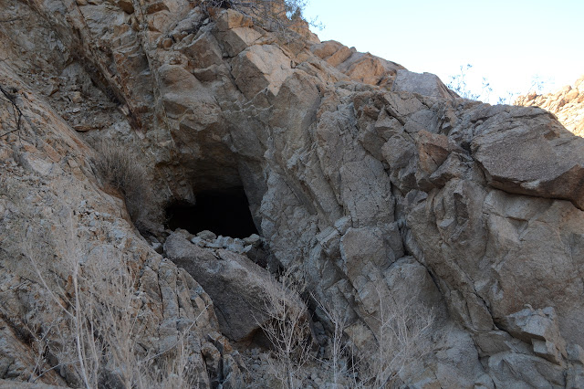
On the way up, we did find a piece of prospector trail as we came down into the correct canyon. Now we get to see what else we missed. The trail itself doesn't really go anywhere anymore, so would have been no easier walking at first. There are, however, artifacts all over the place from mining. Holes, metal, wood, tailings all lie about the place. We are going a little quickly, but I can still catch a little of it.


Even holding back a little to look at the mining history, I broke my promise. We are back to the cars faster than we went up. Our time is on the short end of what the peak guide expects for this excellent little desert peak. Now I have enough DPS peaks that I might join! That gives the others plenty of time to drive home and me time to poke over and find the azimuth (it's there) and then get water from the visitor center (it wasn't in a place to get locked in anyway although I was told it was).
©2019,2020 Valerie Norton
Written 19 Jan 2020
Liked this? Interesting? Click the three bars at the top left for the menu to read more or subscribe!


Comments