Ryan Mountain
Joshua Tree National Park
Click for map.
The second hike I signed up for was originally going to be Mineral and Tip Top, two on the far northeast side of San Bernardino National Forest, but there was a report that the road was more impassible than usual after the recent rain. Instead the group decided to do a loop over Ryan Mountain and Lost Horse Mountain as a shuttle. I'd been trying to get some interest in doing this as a loop on Sunday, so that worked out for me. Well, discounting that I'd have liked to do both. Again, the $30 entrance fee is taken care of by flashing a senior pass belonging to someone else in the car. Then we're off to the Ryan Mountain Trailhead and setting up the shuttle. Then we're off! Almost. We have to jog over from the "Indian Cave" trail we actually end up starting down. We're a little eager.

There's a more elaborate sign at the start of Ryan Mountain Trail to say that it is quite strenuous hiking at 1.5 miles each way and over 1000 feet climb. The climb is immediate once we're on the right trail. It quickly grants us views of the surrounding rocks as reward for the work.


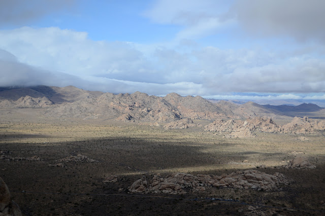
We pass through a small inner valley before gaining the ridge with its own rewards of the new view including Queen Mountain. Well, Queen is to the north, so it was a little bit there before too. The stuff out to the east has a little different character than the western stuff we have been mostly looking at.
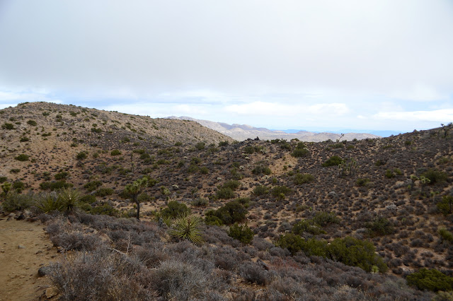


The top is marked by a giant rock pile. It is a little too disordered to call a cairn. It looks like someone has been grabbing rocks at the bottom to drop off up here because the trail isn't quite strenuous enough. Somewhere underneath it, there should be a benchmark. Maybe there's a register, too. Cairns mark a track down the other side going toward the complex expanse of Lost Horse Mountain.


We're not so suggestible. We follow the cairns over the top because that's what we planned all along. They don't last long nor does the track. We pick out own way down the hills and tagging the bumps along the way. Well, the leader does most of the picking and some of it seems to be along the steeper slopes. Individually, we just have to pick the spots without so much cactus, but there are still a couple accidents. Most are in boots, and accidents don't hurt so much.


We're down to the California Hiking and Riding Trail. Unfortunately, that's less than halfway along the route. Once again, we are going too slow to do the second peak. We've somehow only done 1 mile an hour for the first one. This time, we have to be back in time to be setting up for the party. Denied again! My clean sweep of Joshua Tree peaks is in shambles as we follow the trail back to Ryan Campground, then over to the parking area for Ryan Mountain.


The way back is nearly flat, so we're a bit faster as we go. We don't get to look over the old ranch ruins or the cemetery, though. That was definitely on my list of places to stop by when doing a loop. The problem might be that someone got in trouble for calling off a hike as planned and then doing something else nearby instead of proceeding back to start as quickly as possible. So now we don't get to have small consolation prizes even though they are on the way even if the group is unanimous.

Then the hike is over and we have a shuttle we didn't get to use to undo. Very embarrassing. Some head off and a few are left behind as our ride vanishes for a while. At a loose end, we decide to go and see that cave after all.

So, we poke around the opening below the rocks wondering if it is the cave. There are artifacts, but the fact that it is not a cave at all makes us try to follow the trail further. Plenty of climbers have followed this trail too. It goes to many alcoves, but nothing big enough to call a cave. Nothing big enough to shelter from the elements. There's certainly no other obvious artifacts. There's just wildly formed rocks to behold.


The rain is bearing down on us coming from Lost Horse Mountain. I guess we missed getting wet. There was one cave looking spot just off the Ryan Mountain Trail and definitely not what the Indian Cave Trail means, but with the rain coming along, it seems attractive to check out.

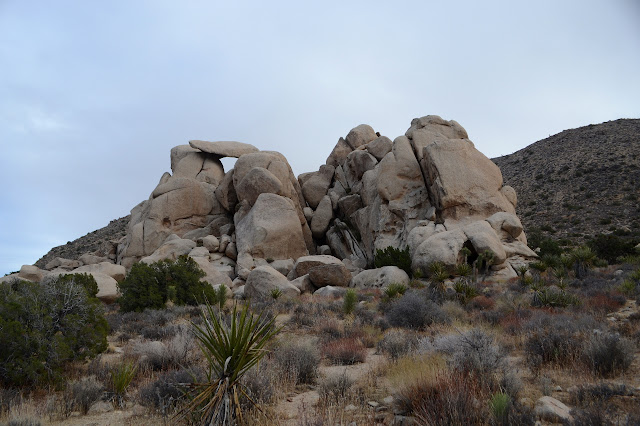
The cave isn't quite as much as it looks like from afar. It climbs steeply and reduces quickly to a small hole that must have a fair bit of water directed to it. There are grooves where the water has flowed. It is interesting as a natural phenomenon, but unless they were grinding in the ceiling, there is no sign of former occupation. Our rides return as the rain becomes unignorable, so we are off to the party while still dry.
©2019,2020 Valerie Norton
Written 12 Jan 2020
Liked this? Interesting? Click the three bars at the top left for the menu to read more or subscribe!


Comments