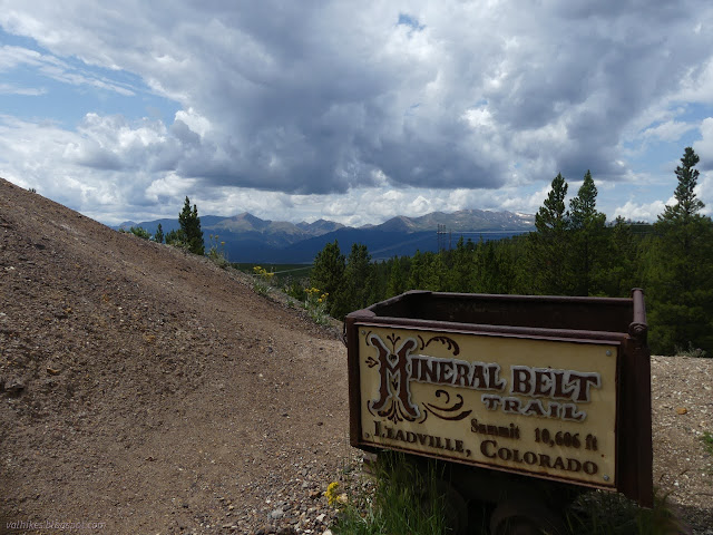
Mineral Belt Trail
Leadville City Trail
(map link)
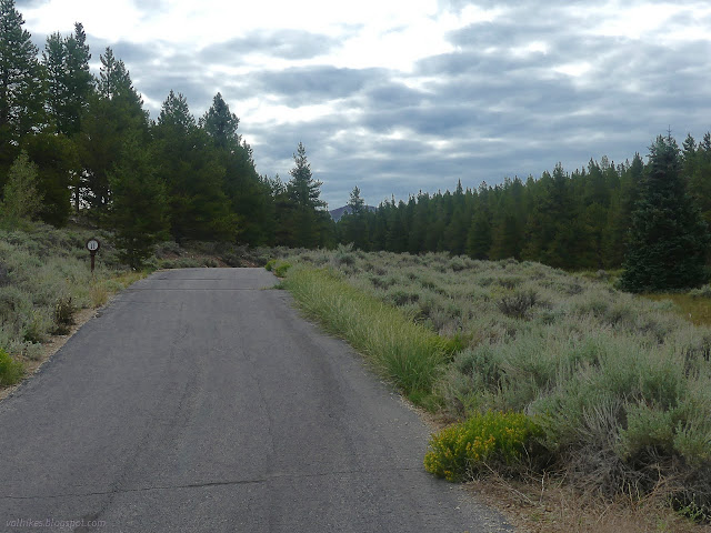
The Mineral Belt Trail is a paved biking and walking path that circles Leadville. Usually, 11.6 miles of pavement wouldn't sound very attractive, not even if it is a National Recreation Trail, but with all the rain the reliable surface has its appeal. Additionally, it comes with numerous interpretive signs that are all unique and very few generic. If you stop, you're going to learn something and it's actually about Leadville. I decided to do it with an extra excursion on dirt up Iron Hill. I parked in a big lot off US-24 south of Leadville, which does seem to be the nominal start point. I then took off in a counterclockwise direction, which brought me first to the 11 mile marker, so must be considered the wrong way. It seemed like an excellent direction anyway.

I encountered a number of buildings and other mining relics very quickly. Though I'm sure there's ample to say about these, there were no signs yet. The largest building did have an old, faded sign saying, "Biscuit Department/Biscuit for all occasions fresh from the oven." Since there's very little variety in biscuits, I wonder if they mean cookies. When did the biscuit/cookie divide happen, anyway? Past it is a toilet. A two seater! Then there's an ore cart. One might start to think it's been gathered together, but the ore cart has track and waste rock and a hole in the ground to sit in front of. Perhaps it is all part of Stringtown and Jacktown, the communities of the smelter workers that are the subject of the first sign I came upon.


Boy Scouts put together a nice picnic area next to the trail with sighting tubes, but it didn't look like too many had taken to it. I guess it is just too far from any parking.

The trail largely follows old railroad grades, so we get history about the particular grade, which happens to be the first standard gauge railroad to the area. Charcoal is needed for the smelters, so there is a sign about making it where large circles full of charcoal can still be seen if one looks carefully around the forest floor. Here, they would set a pile of wood on fire and shovel dirt over it. Kilns in other areas later supplied the charcoal. There does seem to be chunks of burned wood, but it would take very careful examination of the area to see all of what the sign points out.

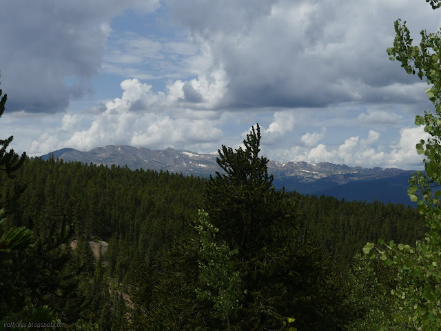
Gradually, it gains some height and a bit more view than of Mount Elbert through a corridor of trees. (But stop and find out about its naming. Oh, dear.)

As the sun came out, so did the people bicycling. Oh, and one way to get rich is to provide the tunnel to drain other mines that would otherwise be flooded and unworkable. I couldn't definitively spot the tunnel across the gulch.


There's old mining works and buildings and even the retaining walls holding the waste rock back are historic. What really caught my attention, though, were the bright red pools of water. California Gulch is one of the first Superfund sites. It gets a mention on a sign. Further on, large red pools are securely fenced and signed "danger", but it's hard to make such a place completely safe.

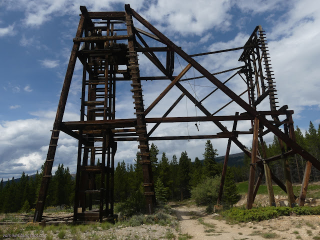
A little past the high point, there is a sign about the hulking relic of the Pyrenees Mine, which drove a shaft over 1200 feet deep. This marked the start of my excursion up Iron Hill which would finish with getting a much better view of those remains. First, I started up the gravel road that crosses the paved path. This road looked quite nice at first, but it quickly deteriorates, then I turned onto something that could really only be termed an ATV road getting to the view at the top of Iron Hill.


I had let the geocachers lead me to the top of Iron Hill, but it was not quite the peak. That was off to the south with a USGS benchmark according to Peakbagger. So I turned down a faint old road heading my way and followed it ever so slightly upward, eventually, to more piles of waste rock. I was surprised to find the benchmark in the top of waste rock. There is no view from it.


The reach for the benchmark offered that there was a triangle blazed tree east of it so many feet. I tried, but could not find such a tree. I again let the geocachers be my guide and headed down the hill westward, arriving at a bold structure I'd seen from the Mineral Belt.


There's more to the Silver Cord Mine than the arch, but none of it is in as good shape. Even the roads in need some care just to walk. I selected one and made my way back to the ATV road and then to the Pyrenees Mine.


Then I got back to that good road and back on the paved path to continue the loop. The path comes to crossing railroad grades where the old track owners forced the new tracks to go overhead instead.


At a sign about the Tip Top Mine, a lead producer of silver of Fryer Hill and very high in sulfide ores, particularly iron pyrite, there is the clue about the water. The pyrite breaks down to sulfer dioxide (stink) and sulfuric acid (often the strongest acid in the lab). Do not touch the funny colored water, it bites hard.

Then I came upon a bit of confusion as there seemed to be a small spur full of signs similar to the ones around the loop, but an unfriendly "no trespassing" sign stood on the path to get there. Since there seemed to be people in charge who could tell me off if I was doing wrong, I wandered over. It is the area of the Matchless Mine which made Horace Tabor's fortune, one of the largest in the world while he was making it. The exhibit is actually part of the Mining Hall of Fame and there is a free self guided tour and a more involved guided tour included with museum admission. (Get there before 5PM because the signs get locked up at night.) Tabor and his second wife, who died in poverty a few decades after him, seem to still be the subject of quite a bit of Leadville gossip. The first wife ultimately did quite well on her own. Besides the gossip, they have some basic mining information that's been missed on the other signs. (It says I am misusing the word tailings, which are wastes from the milled ore, not the unprocessed rocky wastes which are just "waste". Dutifully edited, but I think it reads better with "tailings".) It's a good read and I'm sure the paid tour is even better. I was feeling a little full just from the signs. Since the guide had no people to show around, she did offer up some choice information, like that the average pH of that yellow/orange/red water is 2-3. (Seriously, do not touch that stuff.) Some very interesting information about water rights came up too. I'm on team Pacific. Just out of tribal membership, not from actually considering the situation.

I got on as it started to rain lightly. I'd brought my golf umbrella and it did a dandy job keeping me and the camera dry. I passed a flume, which was the first answer to keeping the drinking water uncontaminated by burning acid and does not seem to have gotten photographed. Along with it were fields and murky views as the rain intensified. I considered having a sit in one of their shelters I'd just passed as the thunder started to roll, but decided against. I got to see quite a show over Poverty Flats.


As the trail enters Leadville, there's a couple places where one must follow signs along the road rather than having a devoted surface. I was half a block from the library, so stopped to do a few things hoping the rain would reduce. I got the things done, but it didn't. There's different signs along the trail by it. They've got many posts in which to mount stories. The current one is a bilingual children's story. The cemetery is nearby and might also be an interesting place to visit when drier. There's recreation complexes. Then I came to where, quite obviously, the volcano had hit and lava had flowed.


The sign says it's the slag from the smelters and not a natural disaster. After they ran out of trees, they shipped everything off to be turned to value and slag elsewhere, meaning there could be someplace that looks even more like the earth erupted. At that point, I was almost done. There's another short section signed along the streets and then a careful crossing of the highway before I had to leave the paved path for the soggy gravel lot.


*photo album*
©2022 Valerie Norton
Written 10 Oct 2022
Liked this? Interesting? Click the three bars at the top left for the menu to read more or subscribe!


Comments