Zirkel: Davis Peak, Seven Lakes, and Gem Lake
Medicine Bow-Routt National Forest
(blue line, map link)
DAY 1 | DAY 2 | DAY 3
I woke in the middle of the night and celebrated the fact that there was only a little roof over my head by scrunching around to watch the stars for a while. Then I got cold and scrunched back under and tucked in properly again. Good stars, though. Maybe the reason I can't feel any inclination toward any of the tents I've been pondering is that I'm just not a tent person. They're good at blocking winds, but they do it by trapping you inside with no way to just look out whichever way you want. Anyway, I managed to get back to sleep and woke up in a brightening world with frost over my toasty feet. Even cheap down socks are brilliant things.

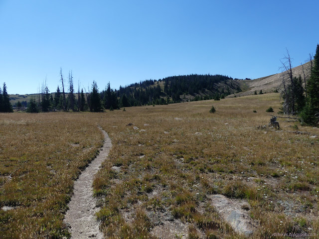
There wasn't quite as early sunshine as I'd hoped to get, but it came and the place warmed nicely. I headed off for the last little bit of trail to the junction with Buffalo Ridge Trail. The state of the junction had me worrying. There's just a thin stick in a cairn to mark it and almost all the trail visible is Beaver Creek Stump Park going right past it. Further from the junction, it does thicken into an obvious tread.
There was again that trail work that seemed minimal to make it work for a horse. There also wasn't all that much need. Then I got to a tree across trail where the horses had just decided to walk around by going through the meadow. I followed along until I hit the mud, then turned around and clambered over the tree to try to follow the real trail with one soggy foot. I do not like soggy feet.

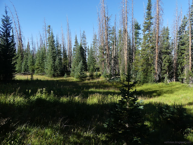
The proper trail worked better for me than the walk around. The horses rejoined just before a muddy section, but most of it was good walking. The map says there's a good stream off the north side of Davis Peak, and it proved to be true. From there, the trail pops up onto wide and flat ridge top where I found numerous old camps. They are generally by the small tree clumps for shelter from wind, but it does look a nicer spot than Stump Park.

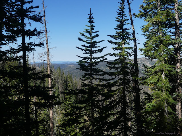
At the top, there was a mystery cairn to the north marking maybe another spot someone really likes to camp. I headed south with the trail, which was really strong and obvious right before vanishing completely. It comes and goes like this and I took more clues from distant tread I could spot than from the few cairns as I continued south.


As the trail reached its high point on the side of Davis Peak, I turned to walk the rest of the way up to the top. It's a pretty easy slope to climb.


I poked around for the benchmark once I got to the top. The Forest Service placed one in 1937 and US Coast and Geodetic Survey got around to placing one in 1949. I looked around for a while for reference 2, but they just used the older marker as a reference. The azimuth location is only described as "200 feet north of a trail" which seems inadequate. The reach was back the way I'd come, so I didn't look for it at all.


I could see Hog Park Reservoir with Bridger Peak behind it off to the northwest, Medicine Bow Peak to the northeast, and Williams Fork Reservoir to the southeast. All places I'd been recently. (But I didn't stop at Williams Fork Reservoir, only the river further upstream.) I played around on the peak for a while and weather was moving in, so I moved on to rejoin the trail. Well, give or take. I thought I was doing a passable job following cairns roughly approximating the track on the map until I ran into some good trail coming from way off to the west. It was easy to follow that to the end of Buffalo Ridge Trail at Big Creek Trail and that to Seven Lakes. I got a quick hail and some sprinkles on the way.


I made it to Seven Lakes without noticing where the trail continues down to Encampment River. There were a pair of hunters at the lake who were stashing gear to use later in the week who informed me there "isn't much trail past here". Well, I've still got places to go, loops to complete. I paused long enough to take in the lakes visible from the end of the spur, which really isn't enough to give justice to these beautiful lakes. They're a popular destination.


I headed back to find the rest of the trail. When heading back, the trail actually splits and the left one that then continues down to Encampment River is the more obvious one. It just comes in at such a sharp angle that it is easy to miss when coming the other direction. See, there is trail! And so I started down another 2 miles of some of the most difficult trail I have ever taken with obvious tread.


There's lots of trees down and lots of walk arounds. I got suspicious when I got to one that was a bit too long and decided to clamber over the two big trees instead. As I continued down the trail with drizzling rain starting again, I heard a voice above and looked up to see an actual ranger going the other way on that long walk around. There is hope that someone cares and these trees will get cleared! He had counted 183 trees across the trail so far. Ack! I don't want to know the magnitude of the problem! I was already estimating about 200 back the way I'd come. I might just give up and cry if I know that really is about it. Well, I didn't know he came the way I was going, so I couldn't be sure I would really face that. This particular trail got worse as I got lower.
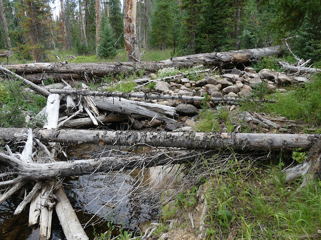

Getting to the Main Fork Encampment River Trail actually did mean things were easier again. Getting across the creek on the main trail was a wade, so I went back across on Big Creek Trail and squeezed through the brush instead. Then it was along trail where the great annoyance is that water is squeezing from the land right where trail claims it goes and it's hard to keep out of the deeper mud so the feet don't get soggy.

No sign marks the trail to Gem Lake, but a couple cairns beside the trail, another in the river, and more on the far side made it clear this might be a place to turn. I crossed the river and started up it. At first, it looked like there had been some user maintenance, but they gave up. I lost the trail at one point and after wandering far from the outlet stream of the lake, finally just started back that way to find trail again. It got better as it got higher.


I walked the edge of the lake looking for camps. They're all too close to the water, but getting away from the water means getting into the beetle killed trees. I finally settled on being about the middle, then decided to check out across the outlet. I settled on that, then decided to follow a trail up. It's in the trees, but there are minimal standing dead in reach of a couple flat spots. I finally really settled on that. It was at least approaching 200 feet from the water.

continue to the next day ⇒
*photo album*
©2022 Valerie Norton
Written 7 Nov 2022
Liked this? Interesting? Click the three bars at the top left for the menu to read more or subscribe!


Comments