Huston Park: Red Mountain
Medicine Bow-Routt National Forest
(red line, map link)
DAY 1 | DAY 2 | DAY 3 | DAY 4
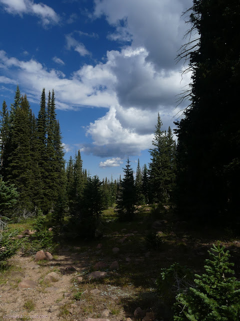
All I had to do was get back to Battle Pass and I was already much closer than my first night's camp. I wanted to add on Red Mountain, but that could only add a mile extra. I expected a lovely day of it, so had a relaxed morning. I even did something I almost never do. I photographed the setup!

Then I packed it all up and got moving. There's a peak to bag! First up, the wilderness high point. I chose a point, pondered it from a different angle, and became very sure it was the exact same point I'd chosen before. If you've hiked this trail and claim the Huston Park Wilderness high point done, I fully support that. I took in the views from other places because they were better.


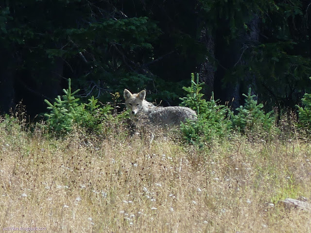
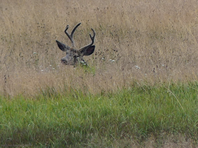
As I came into view of the river while descending into Huston Park itself, I spotted a coyote and watched it a while. It noted my presence instantly and started up the hill, then paused and looked a while before continuing. It took four or five pauses before it reached the trees and could pause before vanishing.


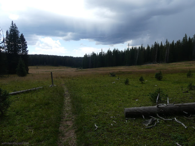
And along I went through bands of trees and parks and avoiding the muck, which seemed to be less now. Overhead, weather seemed to be moving in on my sunny day. There's not a lot of places to find signal on any of this hike and what little I could sniff off the east side was 3rd party and only good for emergency calls, so I couldn't get a new weather report. One of the dangers of paying $6 a month instead of a whole lot more.


I was walking under the trees when it began to rain. And thunder. And hail. I selected one and pulled on my coat, then settled down with my rain skirt settled over my legs. Did I want to just hike through it or wait it out? Well, I really wanted to go up Red Mountain and there was plenty of time, so waiting seemed fine. I pulled out some Friday night comedy from the BBC to listen to as ice chunks fell around me and it did pass.

It didn't stay passed. Another wave of weather came through with thunder and hail and plenty of rain. This wasn't the light (but way too long) spatter I put up with most of the second day. I settled down under a tree again and made it through a comedy of the week and a drama of the week before ready to get moving again.

My plan for Red Mountain was simply to take the Baby Lake Trail to the ridge and follow the ridge up to the top of Red Mountain. There's actually quite a few trees on the mountain to take shelter under or among. I wasn't too worried about exits should another wave of weather be coming.


The trail looks like it might get almost as much traffic as the CDT and had had some recent maintenance. When I got to the ridge, I found that there had even been some maintenance of the path along an old road heading south. This might have been accidental and a small tree had been tossed down across the start of this trail. There was no sign of old road heading north, but it was pretty open. I put a little hurry into it as I started up the hill.


As the rumbles from the last wave of storm faded to the south, I could hear a new set of rumbles coming in from the north. It kept being lovely in between.


There may be a lot of trees encroaching on the peak, but the view from the top was grand, especially to the south. I read a bit of the register, which has lots of entries. Most people just clamber up the steep south slope. I added my entry and sat in the sun ahead of the rain for a little longer enjoying those red rocks and parks and the whole.


It was still sunny when I started down, but the incoming weather was noticeably closer with plenty of rumbling. I followed something like trail along the edge of the wilderness toward the trailhead. Signs are posted frequently in the trees to inform of that boundary.

I managed to hit a different road that must be a driveway to a bit of land not shown as inholding on my map. I was approaching a building. I corrected course and found the main road on the second try. It started to rain again as I got to the last stretch through private property. I didn't want to stop to pull on a coat, but my big brimmed hat was failing as rain gear by the time I got to the hiker box. I made a quick run to the car, bringing more water than I'd like in with me.

I waited out this third wave, then headed to the west to get a new weather report. The old one clearly wasn't valid and I still wanted to play in the area. Then I headed down the mountain to set up for the next thing.
*photo album*
©2022 Valerie Norton
Written 4 Nov 2022
Liked this? Interesting? Click the three bars at the top left for the menu to read more or subscribe!


Comments