Green Mountain Falls
Medicine Bow-Routt National Forest
(map link)
A geocache alerted me to the presence of a nearby waterfall and I put it on my list of things to visit. My hike started at FS-550, a good gravel road running from Encampment to Steamboat Springs. There's actually road running more than halfway from there to the waterfall. The sign benignly states "4WD recommended". The description on the geocache said bring your ATV. I chatted with a local and asked, "So, you gonna drive it?" He laughed and said he had once and it wasn't fun at all. It also says "North Fork Encampment River Trailhead" because, once upon a time, this trail went a lot further. It continued along the north fork to join the Huston Park Trail, now the route of the Continental Divide Trail, below Red Mountain. Now it gets to the edge of the wilderness and what would have been a spur crosses the fork and stops. Good thing that's as far as I wanted to take it.


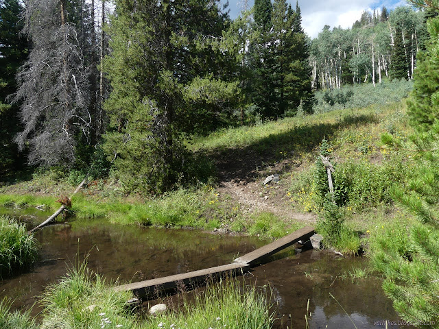
The road is easy enough on foot, although there are some huge puddles. Each of these has a well established trail off road around the side. I could see in the dirt the signs that lots of people hike it. They also ride their horses on it and there's certainly a few who do drive it. A true multiuser road.


There are a couple camp sites at the end of the road where the trailhead is. It's been rebranded to Green Mountain Falls instead of North Fork Encampment River. There have been attempts to keep going by vehicles, but the land puts a stop to that nonsense pretty quickly.


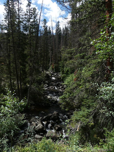
The trail crosses an inholding and there's actually a sign to mark it. The owner appears to be trying to make a bridge across the river. I hadn't seen much of the river from the road, but got a bit more view from this area of the trail.


There's a spot where very distinct trail climbs but a sign points off to the side. It's just before a stream and there are multiple crossings and returns to the lower trail before things settle out. It seems rather early for the waterfall spur, but this may be the point at which the waterfall trail diverges from the old North Fork Encampment River Trail. Only the thinnest trail continued at the top of the little climb and that included a tag marking a prospect.


It began to rain. I was expecting some in the afternoon, but it was early. It was also very light and came and went and in the forest could be easily ignored. There were finally some good views of the river.
There's a hitch to tie up your horses before a narrow bridge signed foot travel only. There's some old cuts, but the bridge is the end of any recent trail work. The water it crosses is the Huston Park Wilderness boundary and there's even a nice wilderness sign for this trail that only gets a few feet into the wilderness. After jumping over a few trees, I came to a "Green Mtn Falls" sign which must be considered the end of the trail. People have pushed on from there along the side of the water above, but this is not the old trail. The falls are on a tributary and the old trail went up the fork itself.


The waterfall is, well, not actually a waterfall. It's a very pretty cascade, especially if you can catch it in the sun. I tried to catch it so as thick clouds moved past overhead. The rocks it comes over probably surge with the snowmelt and are slippery if wet. Fortunately the little rain wasn't enough to wet them as I walked around. When I did dip one shoe bottom in the water, I had to dry it off before I could move without slipping again.


I got tired of waiting for the sun for the lower section after much snacking. I was expecting rain all afternoon anyway. I scrambled through the trees back toward the bridge only to find that that, too, was trail.

Of course the sun came out when I was 5 or 10 minutes down the trail and it stayed that way. It was just particularly cloudy and a little dribbly while I was near the waterfall. Excellent timing.


There's a road that splits off upward that's not on my map. I explored it a little way expecting to find a camp, but it just kept on going. Maybe it accesses the inholding.
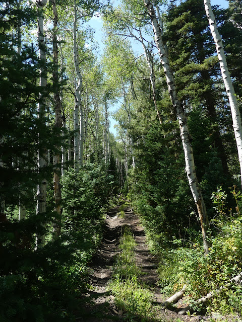

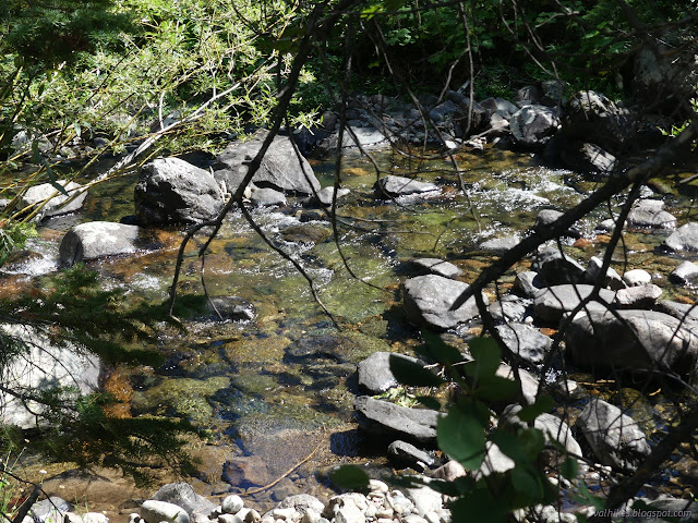


*photo album*
©2022 Valerie Norton
Written 5 Nov 2022
Liked this? Interesting? Click the three bars at the top left for the menu to read more or subscribe!


Comments