Busk Creek and Highline looped with the CDT/CT
San Isabel National Forest
Leadville National Fish Hatchery
(map link)
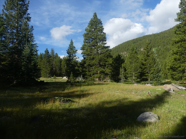
While pondering the mile or so interpretive trail at the Leadville National Fish Hatchery, I noted that there is a "Highline Trail" that starts near there. Does it deserve to be called Highline Trail? The map suggests that yes, it does, at least for a few miles near the other end. It can be done as a loop with a section of the Continental Divide Trail (and the Colorado Trail) with a road walk along Hagerman Pass to connect. There's also a trail shown on OpenStreetMap along Busk Creek which allows, for only a couple more miles, a loop entirely on trail. That's the option I went for. Disturbingly, even though the trail includes a numeric designation (1509) on OpenStreetMap suggesting its officialness, it does not show on my Forest Service topographic maps. I put it at the start of the day so it and any consequences from it could be dealt with most easily. The first difficulty was just finding it. I used Busk Creek itself as a sign post and parked in the larger turnout just west of it above Turquoise Lake. Then I walked back east to find the trail. Surprisingly, I wasn't the only one. A pair of hikers came up the road looking for it too. They promptly vanished as I went back for my forgotten poles. I found a well used trail slightly west of indicated on the map and tried it. It went a little way up the creek and stopped, so I cut east across the forest to find the old road cut the trail follows. It has no sign, but it is marked with orange diamonds for the skiers in winter. It provides a short and easy access to the CDT and I only had to walk around one tent right at the end of a hiker who decided to camp on it.


The obvious trail stopped at the CDT. Map suggested I needed to jaunt off to my right, so I did, finding there just a muddy track and the old road prism less obvious, but there was a big orange diamond. The old road track was surprisingly hard to follow at times considering it is through trees. It shouldn't be that hard to follow a wide track of missing trees. Sometimes the orange diamonds did wander off the track. Opinion, as expressed by trail on the ground, tended to be divided about which way to go when it did this. Trail was generally obvious, but somehow vanished entirely for a moment here and there. I just looked further and further through the trees and found it again. Then there was meadow.


I couldn't follow the track once I hit the meadow, but travel was easy. I just tried to find trail again at the end of the opening. It wasn't the easiest.

I'm not sure I actually found trail after the first meadow. I thought I had after the next couple and was feeling good about it until it ended in rocks. The map said I'd passed where the trail crosses the creek. Oops. I backtracked and tried to follow where the line goes, but that was not a trail. I gave up on trail and just looked for a place where the willows weren't so bad. It exists! There was a very easy approach and egress from the vicinity of the water loving plants and absolutely nothing to help in the crossing. I just had to splash across. I was expecting soggy feet by the end of the day anyway.


I went looking for old road again. I went high to stay out of soggy bits of meadow where streams came down which meant crossing streams of boulders instead. This had some minor challenges. Finally, after not seeing any for a while, I spotted a single orange diamond on a tree below. The ground near it was pretty flat, but when looked at very critically, there was an old wide cut there. It climbs up and was easier to follow on this side of the creek. It must be getting some foot traffic. It doesn't completely avoid soggy spots, but there were obvious trails climbing higher to get around these spots. I even thought I saw a few very recent prints that could have been from the couple that started up a few minutes before me. They made better time through it than I did if those were their prints. I never saw them after the pavement.


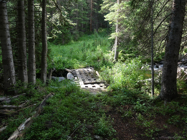
After again not seeing any trail markers for a while, they suddenly started coming fast and furious. Trail turned and probably left the road bed again, although not all the walkers did. (The line on the map didn't cross, but there are hints it is only approximate.) I followed the markers to a latticework bridge with 8x8 supports just slightly shorter than the creek is wide. Water flowed through it, but when I stepped out on the dry edge, it held without even swaying. Then trail got maddening again. There is some old road which maybe it follows and maybe it doesn't. So many markers and yet I still wasn't sure where I was supposed to go. I gave up and climbed to the road above. There is a clear top to it.

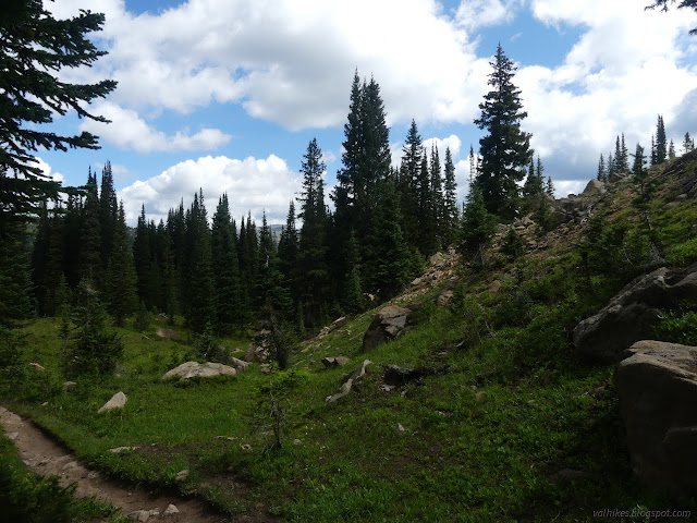
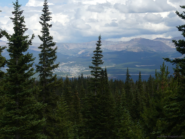
I was ultimately very saddened to see what a state Busk Creek Trail is in because the route was actually very nice. It far exceeded my expectations for a creek side trail with its numerous meadows and views. But good grief, it was a hard three miles to travel it! I continued up the road to the parking lot for the Native Lake Trailhead, the northern terminus of the Highline Trail. This was a lot more promising as it was half full and had extensive signage.


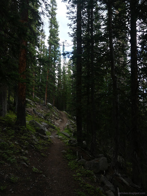
Not only is the trail extremely clear and maintained, but one can even see rather clearly the old, steeper route. This trail has had plenty of work put into it. There aren't a lot of views at first as it climbs up toward tree line.


Some days it was already storming by the time I broke out of the trees. The clouds continued to oscillate between heavy and light, but they didn't really look ready to pour. So out I strode on the grand flats below Mount Massive.


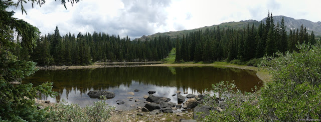
Over the top, I caught the first look at Native Lake below. The trail wasn't rerouted this far in and it has some steep spots.


I took the spur trail down to the lake. It's clearly a common camping area.

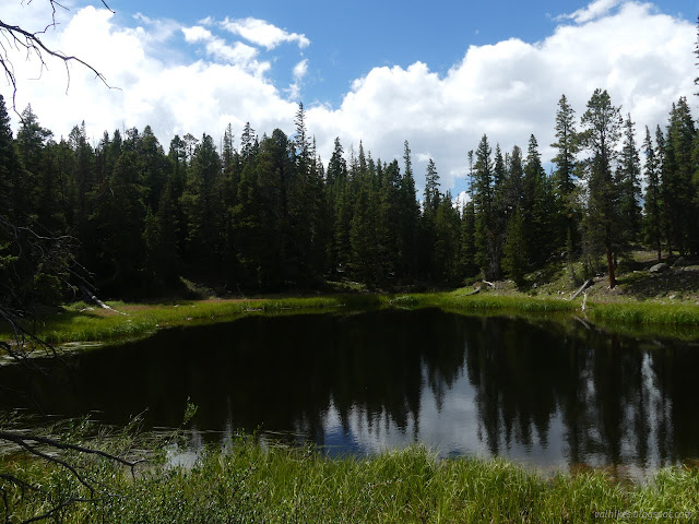
Heading out, the trail crosses a few creeks as it drops a little before climbing up once more to some more small lakes.


The climb is near a steep creek that almost looks like a waterfall from the distance, although it's too hidden in the trees for a good picture. There was actually a camper at the lake at the top. Other well used camp sites could be found on the way down to the CDT, generally near the other little lakes.
From that second high point, it's a descent into the trees.


The sign at the junction has had an addition under "Highline Trail" that "this is not Mount Massive Trail". No kidding. I'm sure there's a route, but the trail is a few miles south. I feel like it's far enough away you shouldn't be mixing them up. Have there been problems? It's even well labeled and matches the labels on the map. I headed north on the CDT, which is marked by blue diamonds for the skiers. There's a few more trails it crosses that come up from the fish hatchery and none of them need distinguished from the Mount Massive Trail.


There was no nice wilderness sign to mark my exit from Mount Massive Wilderness, either. There was an explicit reminder to the mountain bikes that it's not okay to continue on the trail. There was also a tire mark that came right up to that sign. It looks like the bikes like to come up and descend on a utility road associated with the power lines one crosses under. A little further, there's even a public road. Then there's a lot of downhill to get back to the edge of Turquoise Lake.

On the way past the road, I detoured a short way to find a benchmark. I found a rock spray painted "B.M." but still couldn't locate the mark. I continued down the last of the long hill and the short bit of old road on the better used part of Busk Creek Trail to the car. It really was obvious you were in the right place at the bottom even if it wasn't signed by more than high orange markers. I'm still disappointed at the state of the rest of it. It's an important part of this complete trail loop.
*photo album*
©2022 Valerie Norton
Written 18 Oct 2022
Liked this? Interesting? Click the three bars at the top left for the menu to read more or subscribe!


Comments