Darling Creek
Arapaho National Forest
(map link)
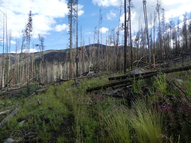
I wanted to do a hike from the end of the road and my seed of an idea of a backpacking trip would be on the South Fork Trail, if it happened, which left Darling Creek. What I'd seen of Darling Creek from Ute Peak hadn't excited me much. It was burned. It was so very burned. It looked like it might be burned all the way up. But weighted against the prospect of hiking even more of the same trail twice, I went for it.

The trail starts at the power substation that presumably exists to power the 15 mile conveyor belt. That was thankfully silent for the weekend. Just past the substation is where it enters the mountain to get to the molybdenum on the other side. On the other side is industry of a different sort. The Williams Fork has been dammed up here and there by beavers. Nature takes over very quickly on this hike.

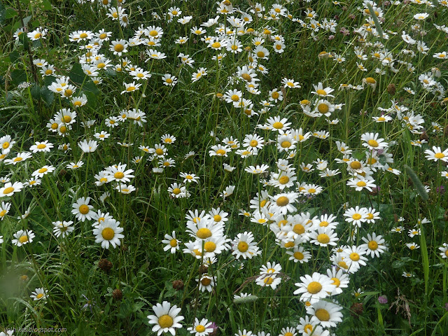
I got to South Fork Trail N21 where there are more destinations I wanted to note for the potential backpacking trip. Jones Pass Forest Road 144.1 in just 7.7 miles, Ptarmigan Pass Trail N35 in 15.7 miles, Southfork Trailhead (maybe at the end of road 142) in 19.5 miles, and Southfork Campground (the other end of this looping trail less than a mile in the other direction) in 23.5 miles. Comparing to what the GPS was later reading, those must be nautical miles. Long nautical miles. I doubled back, finally approaching Darling Creek on a rocky trail that became meadow, all tall grasses heavy with dew. I was passed by another hiker. If his dog had just stayed on the trail, he would have knocked off all the wet from the grasses before we got there. He didn't so we got soaked.


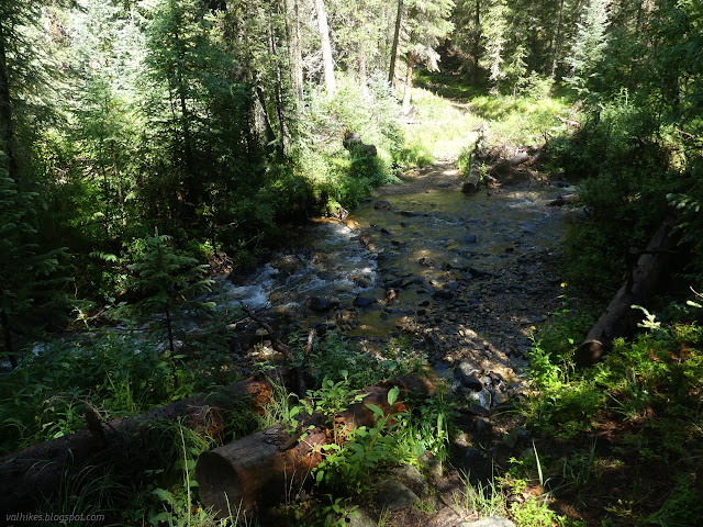
I got to the creek to find that there is a band of unburned trees there beside the water. There's also no bridge, though I did finally find the thin trees tied together by a rope just upstream after I crossed it on the way back. I might have been able to crawl them, but I definitely wouldn't be happy to walk them. Downstream is a larger log over churning water. It looked slick and the consequences of falling were rather drastic, so I wasn't happy to walk it either. I plunged through the ford taking my shoes from soggy to soaked.

I found myself joining much larger trail a couple times. There seems to have been some rerouting since the fire.


As I crossed the creek again, I was well off the route marked on the map. I wasn't sure if that was because the routes on the map are really wrong or because of rerouting. One section of actual blazes seen along the trail suggest it's the first. Knowing that the trails up top are faint and the map has a tendency to incorrectness had me worried about my potential backpacking trip.
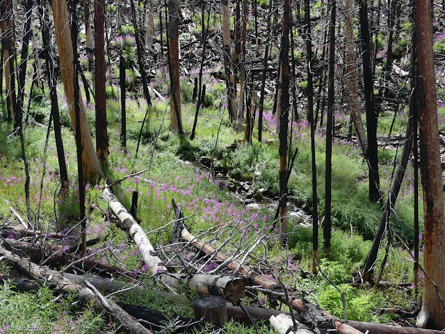

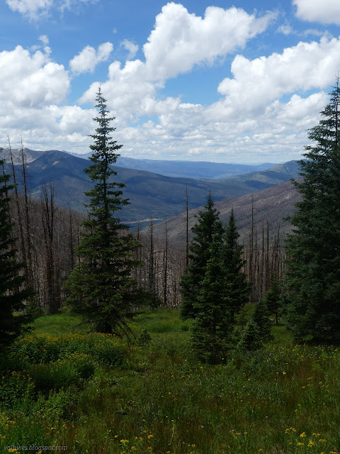
After a couple miles of severe burn area, I began to see areas high up near the tree line where the trees lived. I passed a couple hikers coming down who were sitting among the standing dead for some lunch. I wasn't stopping among those black sticks even if there was no wind to help push them over. The trail was heading toward a particularly large patch of green, but turned off to the side to stay in the burn before climbing to a much smaller band of green. At the top was another sign for the other direction to warn of entering a burned area and your safety is your responsibility. I took it as an indication there wasn't more burn to be found although there'd been similar signs when the trail crossed a road that was also very much in the burn.
Again, hitting tree line meant route finding became much harder. I think I mostly got it between the faint tracks and the cairns, but there were often extra tracks and sometimes extra cairns. Here the map seemed more likely to be correct, but I wasn't sure if that was simply because people following it were building cairns and putting down trail or they did a better job for the high sections. When I finally got to the junction, that wasn't correctly placed on the map.


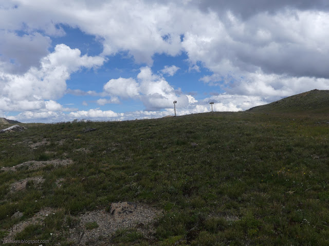
I found the junction much higher on the ridge than expected, but it had signs, so it was certainly there. The trails were less obvious.

The named peaks all seemed a little far away to go for. St. Louis Peak is the closest, about 1.5 miles off, and only 50 feet higher than the unnamed one in front of me. The peaks get taller as one goes north, eventually hitting Bills Peak at 12703 feet, then Byers Peak at 12804 which might be just as far off as I'd already walked. I went for the 12199 foot peak in front of me to get the view.
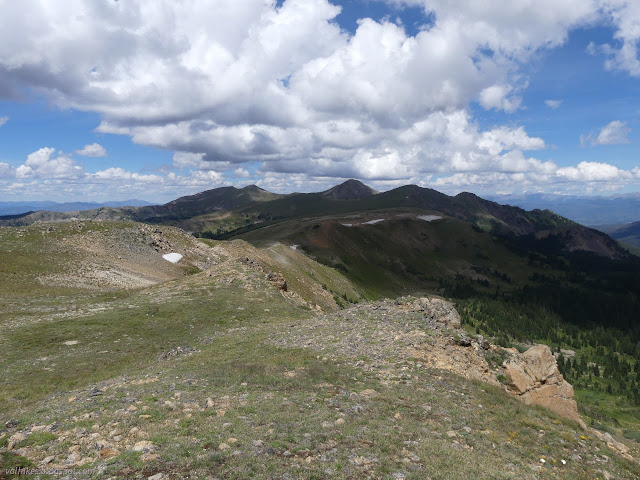


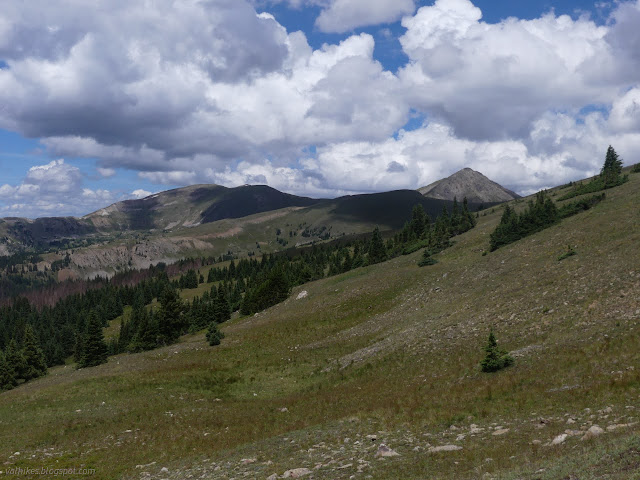
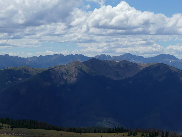
I spent a long time at the top pondering the view and the clouds that were so much less threatening than the ones the day before. I also pondered the 10 miles of exposed ridge line between Ptarmigan Peak (the one to the south, not the one to the north just past Byers Peak) and Ute Peak concluding that there was one place where it was not so exposed after all. Otherwise, it better not be storming a bit.


Then I headed back down.


I found a log I was willing to use as a crossing on the upper creek crossing, so got to keep my now dry feet dry for a little longer.


I had plunged through the water by the time I found the bridge for the lower crossing, not that it was a very good bridge. A few thin trees cut and bound with rope made it. That only left me with a mile of hiking in wet and soggy shoes and socks.

There were some good spots on this trail, but there was a lot of burn. I did get to wondering if maybe I shouldn't be planning a backpacking trip up along the Saint Louis Divide and the other spaces around it, maybe get into the little wildernesses up there some more. (Besides Byers Peak Wilderness, there's a Vasquez Peak Wilderness to the east. My plan would get me to Ptarmigan Peak Wilderness to the southwest instead.)
*photo album*
©2022 Valerie Norton
Written 22 Oct 2022
Liked this? Interesting? Click the three bars at the top left for the menu to read more or subscribe!


Comments