Huston Park: More Monuments
Medicine Bow-Routt National Forest
(orange line, map link)
DAY 1 | DAY 2 | DAY 3 | DAY 4
The day looked every bit like it would be dry and warming like my now two day old weather report predicted. Actually, it might be a little warmer than desired for all the elevation gain that needed to happen a the end of the day. When I crossed the signs on the road yesterday, I noticed that they, like the signs on the trail, were about 100 feet south of where I expected them based on the map. I had spotted that first monument without any reference to where I thought I was in relation to the state line, so wasn't sure how it sat. (My track indicates north of the line drawn.) I had reflected that being that far south could easily have hidden a monument from me when searching for 148 M, but I should still have been able to find 149 M. The first one for today was less than a quarter mile off, so I would look, then get a bit south and look again.

It wasn't where the map said, but when I headed south, I promptly spotted the back side of a bright yellow sign on a post above the monument. That's 2 of 4! This one is even younger than the one yesterday. It was set in 2021! Of course, when I started, I was hoping that there'd be something funky and old. These are just standard PLSS style markers and freshly set.

I got moving west, first moving back under the trees away from the muddy meadow. The first half mile was challenging between fallen trees blocking the way and muddy meadows. When the trees got too hard, I headed for the meadow and ate raspberries. When the meadows were too much from mud or raspberry vines, I headed for the trees. It got easier. I was climbing and eventually had a hillside of good animal trails to follow, then over to a fairly dry meadow, and finally a forest of aspen to search for the monument.


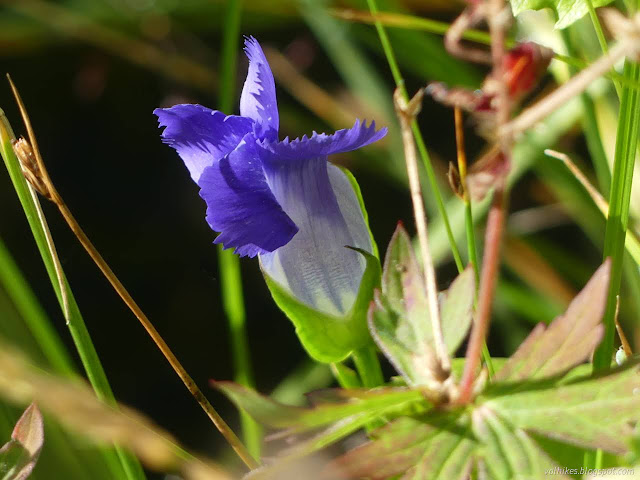
The meadow had some stunning flowers, especially by the streams that were flowing down it. It was possible to find muddy puddles, usually under the trees, but pretty easy to keep to dry places to step.

As I approached the monument under the aspen, I spotted a few trees circled in red paint. That was it. An easy find, and no wonder. It was also set just a year ago. That's 3 of 5!


From there, I could go about half a mile more cross country downhill to find a trail to get to the last monument. It should be just a couple hundred feet of the trail. Then I could find my faint road and head north again. Travel was not without challenges, but not too hard.


Wondering if it would really exist, I came upon the well maintained motorcycle trail that is Whiskey Creek Trail. That was easy walking up the hill to a point where the witness objects for the last state line marker can be seen to the south. I stumbled over a closing corner first, which is fully 300 feet west of where I would expect based on the map. Then I found the last state line. That's 4 of 6!


Then I turned north on the old road. It's no longer something on a Motor Vehicle Use Map, so it's not maintained, but it generally travels through open country. There's a march of little yellow signs at the side to show where the inholding is. I noticed a double sign and found a quarter section corner from 2020 below it.


I rejoined the CDT and got to see all the things I'd missed in the low clouds and a little rain the day before. There were footprints on the trail now and I even bumped into a few southbounders. I knew some could be passing because I bumped into them in Saratoaga soaking in the hot springs, although I didn't know which way or where exactly they'd hitchhiked from.


Across one last road and with a bit of climbing, I could be back in the Huston Park Wilderness.


I paused in the saddle just before the trail goes to find the creek and looked down and considered trying to follow that old trail. Surely there's something to be found of it once you get moving along where it should be. I ultimately decided that I didn't have time or inclination for the extra 300 feet I would have to climb to do it. I stopped by the creek for some water and then continued on, heading for the bonus water I had found high up.


The little creek seemed further off than I expected, but it was still flowing in its small and clear way. I'd remembered a camp somewhere near it, but didn't find it. There's lots of potential camp area a short way past it. I found a sandy spot by a rock that looked like a brilliant site. There weren't even trees looking ready to fall on it.

continue to the next day ⇒
*photo album*
©2022 Valerie Norton
Written 3 Nov 2022
Liked this? Interesting? Click the three bars at the top left for the menu to read more or subscribe!


Comments