Tour of Glacial Lakes in the Snowy Range
Medicine Bow-Routt National Forest
(map link)
I looked for a way to turn a tour of the glacial lakes below Medicine Bow into a nice overnight loop, but the loop I found came to an estimated 12 miles. A little short for an overnight in my book. With the trails that were missing on both the Forest Service topo and OpenStreetMap, I could have done it. It turns out the publication I really needed was a fishing guide which is among the many free brochures you can pick up at ranger stations. The one I visited was actually on Routt (in Walden, about 3 blocks from the library) since anything else wouldn't be open when I passed. It turns out that although they are administratively joined, that doesn't mean you can get all that much on things across the state line. There's some Motor Vehicle Use Maps until they run out. That larger loop goes over the mountain again, and I'd already done that. I also decided to try out the Circle Trail to get a little height and terrain variation and to avoid lake overload. It seemed about the same length, but I likely needn't have worried. The lakes are also varied. I parked at the Sheep Lake Trailhead, then hiked across the campground to Glacier Lakes Trailhead and found maps at both with Circle Trail not included except for a vestigial spur labeled Shelf Lakes. It isn't on the fishing guide either. I had already noticed an oddity about its representation on the FS topo that left me wondering.


I headed up through the trees (sadly with a bit of beetle kill) to the first of the hiking lakes: East and West Glacier Lakes. Perhaps it's the snow field above that gets these lakes the designation Glacier Lakes out of all the other glacier lakes. Signs at the trailhead mentioned there's an ongoing science project measuring water quality of the outflow and you can see it next to the small mining dam on East Glacier Lake as you pass.


I had taken a few feet spur to see East Glacier Lake but got another view of it from the trail on the way to West Glacier Lake. It's harder to get a good look at West Glacier Lake from the trail or even from an easy spur.

There's a few little lakes through the trees, some of them really just mud holes this time of year, as the trail rolls along to Telephone Lakes and Lost Lake. I followed trail around the edge of a rocky hill for a good view of Telephone Lakes far below, but then couldn't find any more trail for certain.


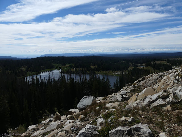

I had missed the trail as it turned into the trees. Once found again (while searching quite fruitlessly for a geocache), I was on my way to Lost Lake and the suspicious Circle Trail. It kind of looked like there was trail up there when looking from Glacier Lakes, but it wasn't really in the right place.

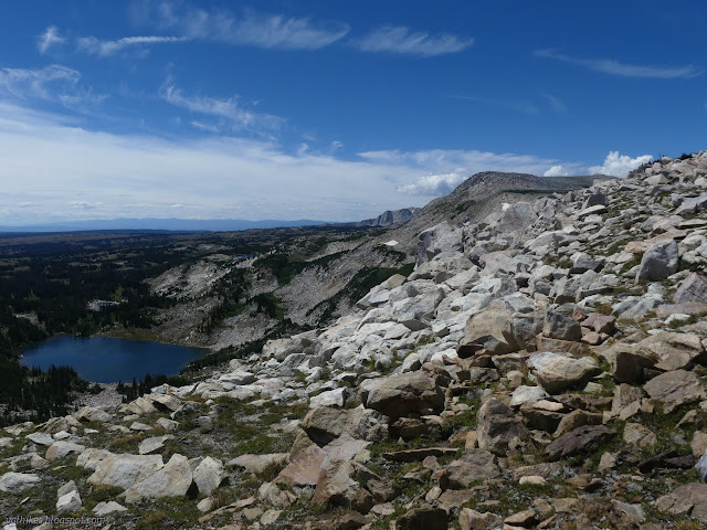
So what's so suspicious about Circle Trail? Well, according to the map, you need a boat to actually follow it. It goes right through the middle of Lost Lake. Maybe it's lost lake because they forgot to put it on the map, but they put this trail on in something like its route. Then they threw the lake on and nobody noticed or cared enough to change the trail to a more reasonable route. I didn't bring a boat even though I had noticed this oddity and could have prepared for it. I assumed there would be a real trail around the side of the lake and found one well used one along the south side to follow to the outlet. Cairns indicated more trail on the other side. The marked trail is still much further. Those cairns were the last sign of trail for a while. I just followed along where it would be reasonable to have a trail.


As I got far enough around the lake to explore where the trail is marked, I didn't actually go over there. I was in a much more reasonable path and there was clearly no trail down there.

My ridge sort of runs out, but I still had a nice space for walking along the hill. I only had to give it up because there was a geocache 300 feet vertical above me. Not only was it a little "lonely" and needing some signing, but the description indicates it is next to a trail. The map indicates it is next to the Circle Trail. I was willing to divert from my "where a trail should be" path to get where a trail is. It's faint, but it's true. There is a trail there. I followed it along the top to a lightning rod.

There are a couple other geocaches up there and one of them describes the trail. It says you can follow it by starting at the Glacier Lakes Trailhead like I did, but just 200 feet along take an unsigned trail on the right to follow the ridge up. I followed this old service trail a little way down. It has tread and cairns to mark it, but it also braids a little. There are multiple versions.


I returned to the lightning rod and went looking for the rest of the Circle Trail. The area is very much a higher flat after the little climb up. I could at least pretend a little that there might be something there. Maybe. I found a cairn about the time I decided to wander off in a new direction for a geocache. Really, with the time I put into the geocaches, perhaps I should have gone after the top of Browns Peak.


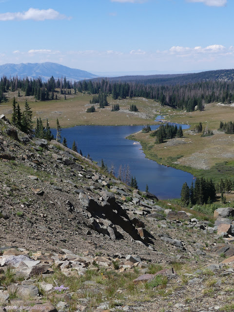
I scared a group of elk and found a hunter's gear stash near the largely imaginary line of trail. I did start to find more and more of something to follow as I wandered down the hill toward the Shelf Lakes and hopefully some real trail with faster, easier travel.


My faint path was getting less imaginary as it arrived at the eastern pair of Shelf Lakes. I crossed the outflow to a much clearer use trail heading off to Arrowhead Lake, I suspect.


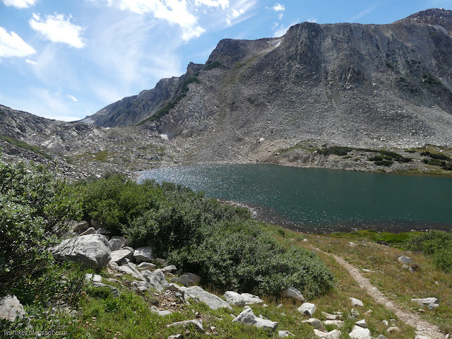
It was still tough going along Shelf Lakes #4 and #3, but trail got more distinct and easy to walk on the climb over the little ridge toward Shelf Lakes #2 and #1. The two pairs of lakes aren't actually connected. The two closer to the Gap Lakes definitely get a lot more visits.


I continued down to North Gap Lake and rejoined the more typical loop trail I might have taken with its well used tread, signs, and a few people to actually share it with.

Oh, and its extra trails. Something broke off to the right without a sign, maybe to hang out with Crescent Lake. Official trail doesn't get very close to that one even though it is sizable.


I got to the junction with trail to Reservoir Lake, which goes all the way to a 4x4 road for access. It looked a well used trail too. I wasn't feeling too tempted to get along that way and see it rather than Cutthroat and Black Spotted Lakes up ahead.


Then there was the trail for Deep Lake. I was tempted by that one, but there had been too much geocaching and wasn't enough time for the extra hiking.


Finally I made it to the Sheep Lake Trail, my route back. It came with warning signs about cyanobacteria in the lakes. It was especially disturbing since I really could have used a bit more water.


I started meeting fishermen out for the evening. The first seemed to be evaluating, then passing up what would be the best lake for a few miles from the trailhead.

The blowing wind was a bit cold as I got over the high point to start down to the trailhead.
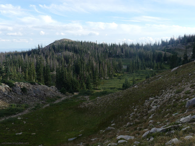
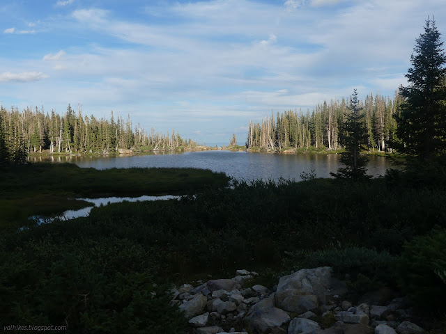

*photo album*
©2022 Valerie Norton
Written 1 Nov 2022
Liked this? Interesting? Click the three bars at the top left for the menu to read more or subscribe!


Comments