Medicine Bow Peak
Medicine Bow-Routt National Forest
(map link)
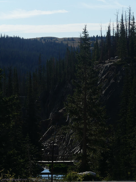
I had in the back of my mind the goal of actually getting to Wyoming, Idaho, maybe even Montana this year. Well, I got to Wyoming! It's not my first visit, but it is the first in the time of this blog. Scanning around the places of the nearest National Forest, I found its namesake and resolved to visit. It's hard to find a good dispersed camp in the area without a 4x4, but I managed, then came up the Snowy Range. "Oh, real creative naming," I thought sarcastically until I came around a corner and saw the peaks glistening white on a day that certainly had no remaining snow up there. I chose to start at Lake Marie, which was closest to my camp. The regular start point to climb Medicine Bow Peak is Sugarloaf Campground where it's difficult to find a place in the larger lot and there's a $5 day use fee to try. The small, free lot at Lake Marie was filling somewhat quickly as I arrived around 8AM. The hike is longer, but still not all that long, and there's a loop available.

The trail starts in on climbing immediately and gets about half of the elevation change out of the way quickly. The trail is nice and clear and well graded, so nice and easy as it can be.


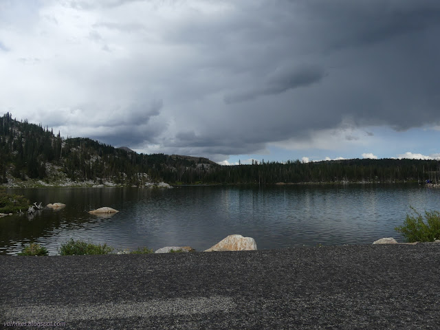
After the first climb, it has a rest before climbing more gently. It doesn't necessarily take less energy, though, since it's often quite rocky.


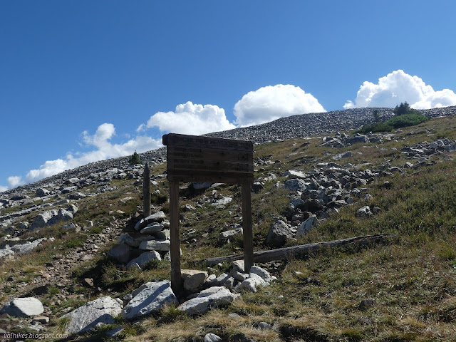
There was once a lookout on Medicine Bow Peak, but not on the top. It was in the saddle below. A sign marked where to head out to see it, but implied that what I would find there was just a cairn. That didn't sound so interesting. A little further, I looked over to see that it is much more than a cairn and headed over to have a look at the old lookout.


After that diversion, I continued on. The trail got rockier. Mostly it chose to climb in spaces that weren't so rocky which made the climbs easier.

I encountered a nice big sign informing me of a trail I wasn't expecting. It's not on USGS, the Forest Service topo quads, or OpenStreetMap, but it sure looked real. (It seems to have been added to OpenStreetMap since I downloaded mine, which wasn't very old.) There's trail down to those lakes on the northwest side of the mountain.


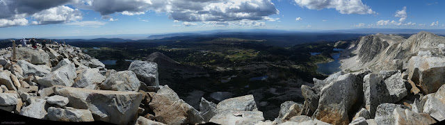
I guess the trail wasn't rocky after all. It devolved into a boulder hop although steps had been built into these rocks to some extent. I arrived at the top well before noon, which was nice because I fully expected it to start raining about then.

I headed east off the peak as my plan had been to take the loop that was available. There were a lot more people on this side. Most the people I had come up with were going down the other way and even more had come up that side to go back down the same way. The trail was even harder on the east side. It is only marked by cairns and sticks until it gets a little way down, then becomes steep and rocky for a while longer.


The trail has calmed down to something reasonable by the time it reaches the junction with the Lakes Trail. This side of the loop is actually slightly shorter, but with the way the trail climbs and finishes, I expect it's harder.


It was well after noon, but it did start to rain a little. I had expected pouring, but it was only a few drops. Really not worth mentioning, especially after all the rain in Colorado.


The trails multiply before arriving at the picnic area at Mirror Lake. I chose the wrong one and ended up at a table that was getting used before trying again and finding the sign marking the trailhead. From there, you've just got to walk through the picnic area and down a little of the access road to get to the path that leads back to Lake Marie. It's paved, but still better than being on the highway.


Before finishing, I got to learn a little about Mary Bellamy for whom the lake was named. She was elected to the Wyoming Legislature in 1910 which, if anyone is keeping track, was before national suffrage for women. "Wyoming was the first place in the world to give all women the ability to vote" in 1869, says Wikipedia. (Did that include black women?) Wikipedia adds: "The territory retained its woman suffrage law even when that law could have jeopardized the Wyoming Territory's application for statehood." It's an interesting contrast to the Wyoming of today. With the primary in 4 days, I was listening to radio ads proclaiming Liz Cheney "too liberal for Wyoming" even though she has exactly zero liberal views. Well, sometimes it seems like votes for women is still a liberal rather than universal view. A fun hike with an interesting little history lesson at the end.

*photo album*
©2022 Valerie Norton
Written 29 Oct 2022
Liked this? Interesting? Click the three bars at the top left for the menu to read more or subscribe!


Comments