South Fork: Ptarmigan Peak and Ute Peak
White River National Forest
Arapaho National Forest
(orange line, map link)
DAY 1 | DAY 2 | DAY 3
My perch up on an exposed hill let me watch the morning animals. The deer were up particularly early and high on a nearby hill, chomping away in the dawn light. Moose wandered by later to stare at me while I stared at them. It was good to enjoy the animals because I was seriously not enjoying my breakfast. I found these quinoa flakes in Dillon and decided to try them. It has a sour flavor and a poor texture. You might expect it to have more protein than couscous, but no, it has no nutritional advantage whatsoever. The couscous I could find was $8 for not even 2 pounds and I'm used to scooping it out for $1.60 a pound, so I was open to new ideas. Flaked quinoa is an all around fail. (Also in there: lots of cinnamon, pinch of nutmeg, cranberries (other fruit infused ones are most excellent), raisins, big pour of parmesan and Romano cheese (Romano is funky at first, then missed if left out), "superfood creamer" (coconut milk powder, coconut sugar, coconut oil, and I didn't know coconut was a "superfood" now), and whole milk powder, brown sugar. All good stuff spoiled by quinoa flakes.)


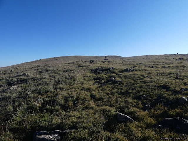
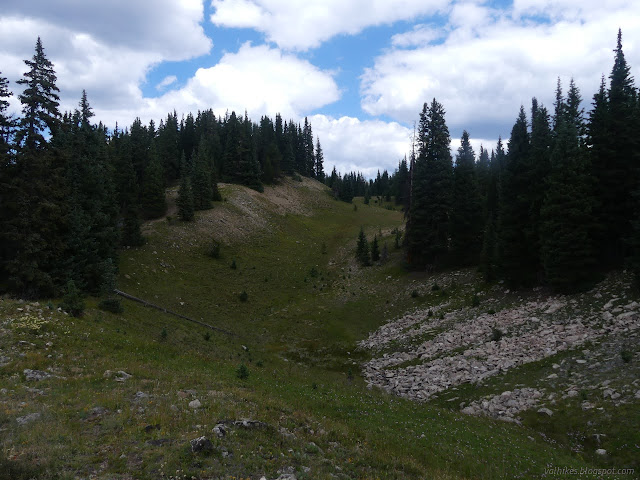
I packed up and headed out for the junction of Ptarmigan Pass with Ptarmigan Peak. I was expecting a day of challenge finding trail that would have little tread and mostly be marked by too distant cairns. Trail was good at first as it passed a small spring surrounded by monkey flowers. I hadn't quite camped at the last water for a while! It was good for another half mile or so, then obliged me ever so well. I followed some cairns and just ran out of any sign. I spotted a fence post and wandered upward to see if there was any meaning to it. As near as I can tell, it's not even an old fence. I looked around a bit more, perhaps with the peak too much on my mind rather than the junction. I noted that I was halfway to the upper trail to the peak anyway and never saw that junction.

I followed giant cairns up the ridge line but gradually was able to see a very distinct trail coming up on my left. It finishes at a sign just short of the peak where it intersects the Ute Peak Trail. The Ute Peak Trail is claimed to continue along the ridge all the way to Ptarmigan Pass, but I deeply suspect that this is more theoretical than real. It's easy enough to walk on the ridge so one may as well call it a trail. The trail doesn't diverge enough from the ridge boundary lines (county, forest, and wilderness) to be visible as anything more than a name. It's like that for the first many miles I was going to follow it, too.

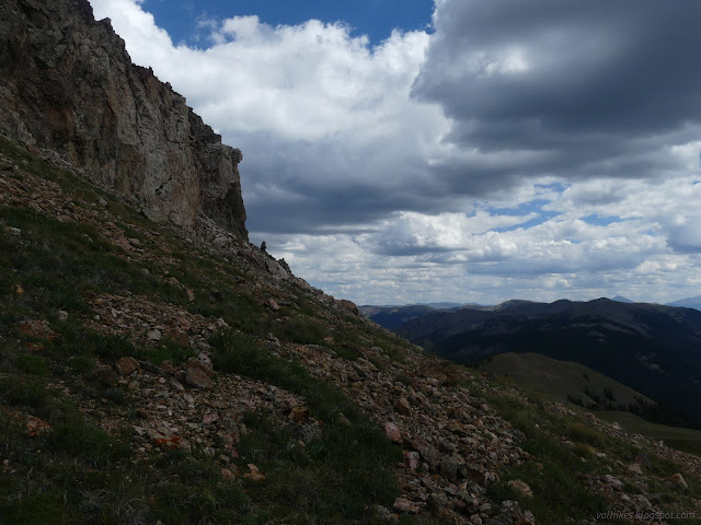
The Ute Peak Trail does exist between Ptarmigan Peak and the junction sign. From there, I tried to follow the arrow and found there was no trail where I might expect it going off the north side. I stepped out to the hill that the map seems to indicate it should be and instantly concluded that there certainly was never any trail there. It's really steep. More investigation didn't turn up anything like trail, so I just launched myself over the side and down, picking what didn't look to terrible.

Down by the saddle, though, I did notice trail. It's hard to say if it was constructed, but it goes around the peak instead of over. Typical use trails seem to lack that level of imagination. It was a start of finding a bit more trail than I expected although a bit less than I hoped.


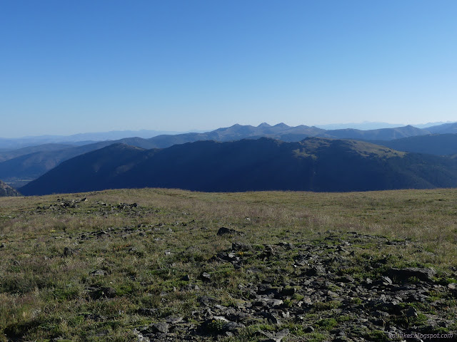
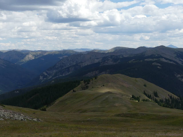
I made a point of looking into each of the canyons to my right along the way. Each had a bit of different character. None of them has a trail. There's all kinds of exploration to be had in this area.


It was looking like I'd have to climb the highest of the unnamed peaks between Ptarmigan and Ute. Enough people have that there's an obvious trail. I followed a faint track and found good, built trail behind some obscuring boulders.


I found a couple trails through a rocky area. But of course, I guess. When I got to trees, I found actual ancient trailwork. It got logged out at least once. I think I got into some animal trails along here, but they worked.
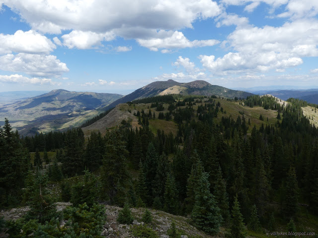
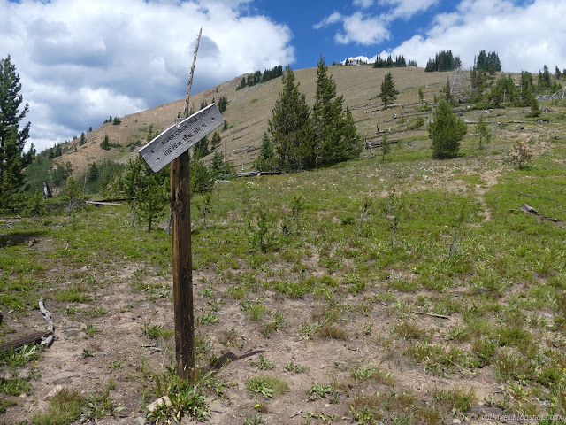
I found a sign for Acorn Creek Trail FDT 71. My map only shows it as far as a junction with Upper Acorn Creek. There's no sign for that second, but I didn't see much trail for the first. The alpine tundra seems a little more resilient than advertised sometimes.

Climbing Ute Peak had some steep switchbacks at first, then it just dissolved. I tried to follow the hints of the map for where to find more, but only halfway managed. Just climb it, just like Ptarmigan Peak was just drop down off it.


I remembered there being a rough and obvious trail up the front side of Ute Peak, but it looked rather steep and I decided to swing around to the back to climb it. There was trail there, too, although faint. These spaces really get a bit of traffic if all the AllTrails entries are to be believed.


Unfortunately, the peak was swarmed by some sort of fly. I couldn't stick around long, so I dropped down the peak along the more usual route on the west side of the peak. I found a nice spot lower down, but lost the 360° view.

The Bureau of Reclamation mark describes an azimuth mark that is "in an outcrop of bedrock which is about flush with the ground." Additionally, it is "about 8 inches east-southeast of a small cairn." Like those are hard to find. Sometimes there's clues in the "reach" which are the instructions to get there. This one says that after getting to the azimuth, one should "continue southeast for about 0.35 mile to the south one of the two cones. Pack easterly for about 150 yards to the top of the cone and the station." It's not much of a clue. I picked out a spot before coming down off the peak and resolved to look there on the way. And would you believe, I found it. It's a bit more than 8 inches from the cairn and less than a quarter mile from the peak.

Just a little further and I was along the portion of Ute Trail I'd already done a few days before. I just had to find the spot it drops into the trees and roll the rest of the way down the hill.


*photo album*
©2022 Valerie Norton
Written 28 Oct 2022
Liked this? Interesting? Click the three bars at the top left for the menu to read more or subscribe!


Comments