South Fork: Williams Fork
Arapaho National Forest
(red line, map link)
DAY 1 | DAY 2 | DAY 3
The South Fork Trail is a loop trail of a little over 20 miles (according to the sign) that travels from the main Williams Fork to its South Fork with a ridge crossing in between. My backpacking plan was to start on the Williams Fork portion of this trail and follow it up and over to South Fork. Soon after reaching South Fork, I'd climb again on Ptarmigan Pass Trail to Ute Peak Trail and hike it all the way back. This route has a nice mix of environments and, it turns out, challenges. The final day is a long ridge walk, but the weather machine was promising some perfect weather for it. There was 0% chance of rain! The day before, which had some high stuff late in the day, was only about 10% chance and the first day was more like 40% chance. You can't have everything. I decided to put the short road walk at the start and parked at Ute Peak Trailhead to get started. The first thing to go wrong was when I ripped my GPS halfway off the wrist strap while getting my pack set up. It's good to get an early start.

There are two places to start the Williams Fork side of the South Fork Trail. One is Darling Creek, where I'd already hiked two days before, and the other is the Boardwalk at the far end of Sugarloaf Campground. Although it represents more road walking (from Ute Peak to Darling Creek is about 2 miles on the road) to do the Boardwalk, I was more interested in that. Unfortunately, what I could find out about it indicated that after all the expense to build it, trees started falling on it and it was too expensive to maintain so was closed. I parked at Ute Peak and chugged my way quickly along the road to Darling Creek instead.

When I got to the boardwalk, I found no indication that it is closed. It did have a tree across it and had buckled badly with the shock of the fall. A section 20 feet away had apparently pulled out of the ground, lifting it high and leaving it there. Trees falling obviously could be exceedingly expensive. There was no indication that it was closed, though. No boards removed from the end to make access difficult, no painting "closed" on the boards, no signs or even sign posts at the edge. There was a sign indicating that horses weren't allowed.
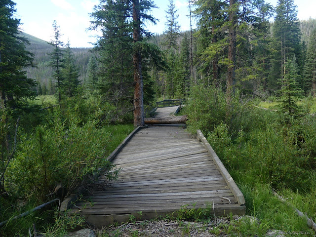
I decided to carefully explore, testing each step before committing, this extravagance and found it to be far more extensive than expected. The river crossing comes quickly with thicker boards than the rest. There were other trees that fell and just got cut away. There are cutouts at the edges and in the middle to allow trees to grow through. Further on, it splits and has spurs with nice picnic tables. It's not just a raised path, but a system of them.


I suspected that I might as well have come via the boardwalk after all, but didn't explore it all before returning to the South Fork Trail. I still had a lot of miles to gradually climb to a planned camp on Bobtail Creek, one of three creeks that join to form Williams Fork.


I was hoping for bridges over the Williams Fork when it came to the two crossings. I didn't get any.


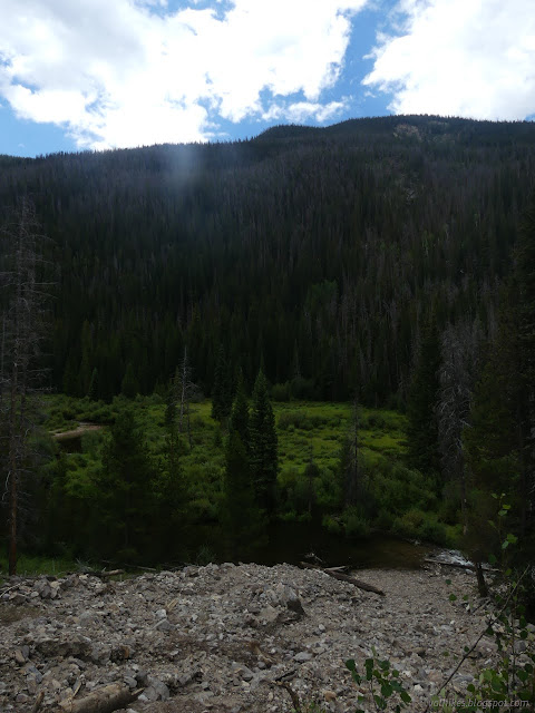
The burn I'd walked through going up Darling Creek mostly did not get down into Williams Fork. While the river wasn't so hard to cross, one spot below the burn was challenging. A debris flow had cut the trail and left big logs on both sides to boost the difficulty of crossing that little bit more.

But mostly it's just a trail that tends to stay up on the hill, sometimes a steep hill. It runs into soggy places when it doesn't, although what I had read about it suggested it was pretty dry compared to what it can be. I had wet shoes a long time after the crossings because of the frequent encounters with muck, once stepping in it right over the tops of the shoes.


I got to wondering about a small square of private property randomly along the trail. Turns out, it is an chimney for the conveyor belt. The signs on it say to stay back because of the 1600 foot falling hazard. That's a long way down.

I'd encountered some tough trail to follow along the way. In one section, cairns lead me one way, then I followed one of increasingly many thin tracks in the grass that became just squished down grass. When I finally got to obvious trail again, I looked back to find cairns leading the other direction along a different route. From the chimney, there was evidence of a road that probably only gets ATV use. It looked there wouldn't be route finding problems for a while, but that ended quickly in a pond. Map said the trail was below me. I eventually found a road in the trees above me. It had recently been cleared of fallen trees and there had been a lot of fallen trees to clear. Then I didn't have route finding problems.


I stopped for water at a stream and found a big fish in a little pool. It acted stuck, but it managed to vanish before I got back with the camera. I found some extremely pretty little flowers instead.


And then I was coming up upon Bobtail Mine and Jones Pass Road. It's a short section with a bit of road and inholding. Up the road at the pass is the Continental Divide Trail, but I decided not to quite get that far. I had a moment of wondering where the trail might be and just had to keep following road even as it looked like a driveway. The map says it passes between a building and a dam and that's exactly what it does.


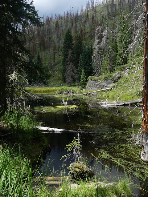
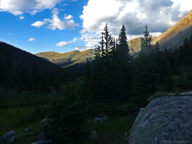
So up I went, now along Bobtail Creek, in a canyon that just kept getting prettier. The trail was doing a good job of being clear and followable, even if not always totally obvious. It did split at one point and I wasn't totally sure which to take. The lower route looked like it would be soggy soon and the higher route worked out well. I think there might have been a reroute.

A lot of the flowers below were going to seed. Here, the flowers are still blooming. The fields were full of buckwheat and common harebells and yarrow.

I'd just seen a moose when I saw a couple of very tempting campsites. They had only two marks against them: 1) I'd just seen a moose and 2) it wasn't quite as far as I was hoping to get this first day. On the other hand, I was really feeling tired. I kept on going.

Then I came to a meadow and lost my way again. I spotted a camp on the far side of the creek, but the reasonable route for trail seemed to be across. I thought I saw a cairn that way and another directly down the hill. I should have gone to the camp. I ended meandering over difficult territory, almost having to step in muck again after not dealing with much on the trail, down toward the creek, finding the trail over a rise, and following it back to that camp. The trail had gone steeply down the side of the meadow after all.
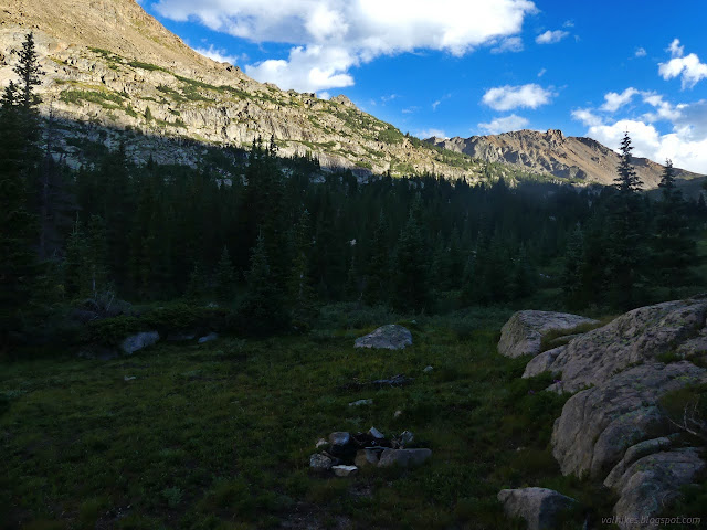
I probably should have gone back up the hill to a lesser used site I'd found on the way. I could feel the air getting colder as I descended toward the creek and trail. The higher site was a more reasonable distance from both trail and creek, but much less impacted. I got lazy and went with impacted. The night didn't get much colder, so it all worked out.

This last crossing of Bobtail Creek had been my goal for the day. The GPS was claiming I'd come 17 miles. The plan had claimed it would be 12. The measurements from the track always seem to turn out shorter than what the GPS says at the end of the day. Whatever it really was, I was tired and glad the next day was expected to be short at only 10 miles. (The actual is always more than these initial estimates, though.)
Thus ended the day of canyon walking where the challenges were route finding and muck.
Continue on to the next day ⇒
*photo album*
©2022 Valerie Norton
Written 23 Oct 2022
Liked this? Interesting? Click the three bars at the top left for the menu to read more or subscribe!


Comments