South Fork: Ptarmigan Pass
Arapaho National Forest
White River National Forest
(purple line, map link)
DAY 1 | DAY 2 | DAY 3
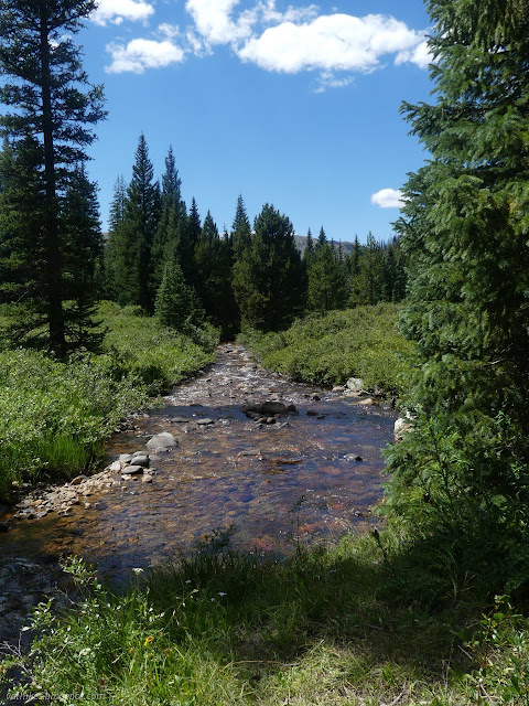
It wasn't too cold in the campsite by the creek and I had a rather good sleep. I didn't think I needed to get up early since this day should be a shorter and therefore easier day. I was half right. It was shorter.

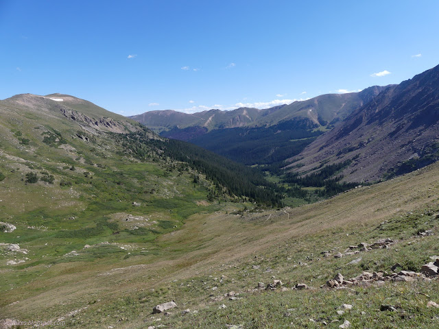
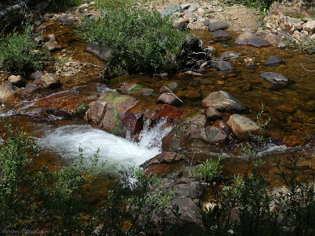
It wasn't all that late when I got climbing for the pass, leaving the canyon part of the hike behind. No more muck! Also not a lot of water for quite a while, so I was sure to start filled up. There actually was some water in the first mile, but after that it wasn't just one pass but many as the trail traveled around the rim of the next canyon.


When nearing the high bowl the trail pauses in before climbing more, I encountered the first of the day's challenge: too many trails. This isn't to say that the trail doesn't outright vanish here and there, but it wasn't as bad as the day before. The trail passes a small chute which wasn't all that hard to cross, but new trail had developed, perhaps even been built, that bypassed this spot. It wasn't much of a challenge here. I chose the old one (maybe?) and crossed the chute since that was less steep and it all comes back to the same place.


From the bowl, a rough track heads directly up a ridge line, but a much nicer trail switchbacks up. It is hard to see in a few spots, but cairns mark it well enough. Again, too many trails, but the choice is easy. I was admiring the numerous little blue flowers in the grass when, like a line drawn across the mountain, they all turned white instead.

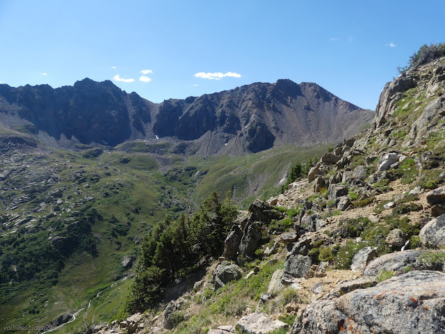
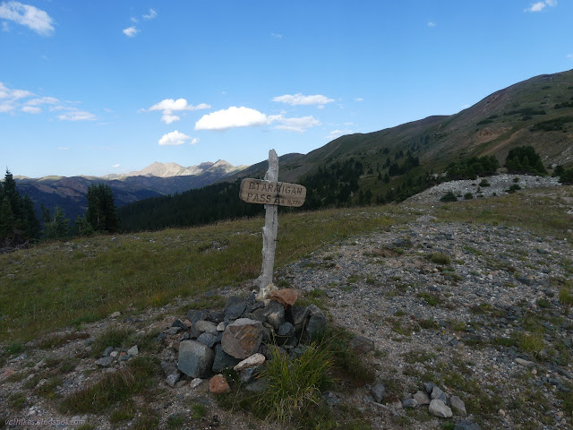
At the pass, I had a few extra trails going along the ridge and about three choices of trail heading down. I wanted a different choice for the first few feet, which were steep and heavily eroded. I tried to choose the least steep trail from there. Extra trail off a lower switchback probably climbs Hagar Mountain to the south. Trail is slumping off the mountain and the mountain is slumping onto the trail and it all felt a bit like a balancing act. The second challenge of the day was that these trails are physically hard to walk. I took them with care, slowly, testing my steps and being sure not to slip.


This trail is so devoted to having extras that there are two trails paralleling each other just 6 feet apart in places. I actually did pass a little water, the most minor trickle that could never be counted on, high on the side of the mountain. Below in the flats are little pools. There's also more trail visible, but it obviously hits muck a few times. It's probably been made by two toed ungulates whose prints were well represented on the trail over the pass.


It's a few feet off trail to get the view of Steelman Creek from the saddle, but I made a point to take it in. The tread I followed was heading off somewhere and obvious enough that one might think it trail instead of the track that roughly follows the line on the map.

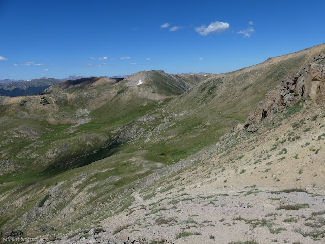
Then I continued on along the peaks and saddles with the plethora of trails. There's always a high one and a low one and when I got to the far side of one, I found an even lower one that looked correct for anyone coming the other direction.


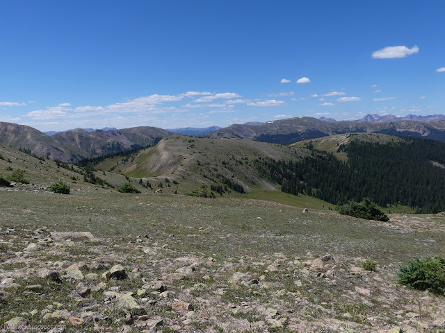
Getting to some less barren areas along the ridge, I was back to following not quite enough cairns through the alpine meadow. I met a Continental Divide Trail section hiker going the other way. He said he wasn't feeling sufficiently conditioned for the actual trail, so was taking this alternate to Jones Pass. It seems like anything near the trail is considered alternate trail by someone, but I wouldn't be surprised if this was the actual trail 10 or 25 years ago. (Google says it still is.) Half an hour later, a met a hunter checking out the area after setting up a camp near the junction below that he would occupy off and on for the next three weeks. Hunting seasons are coming on fast. They were the totality of fellow trail users I met on this trip even though it is well within the easy reaches of Denver and almost gets enough traffic to keep the trails obvious.

At one more saddle between Short Creek and South Fork, the trail turns downward and it was time for me to cross South Fork. I thought I was doing well, following vanishing trail between the few cairns roughly along the route on the map, when I came to trail already in progress, very distinctly heading off around all the stuff I had just done. Too many trails. At least from there it was easy for a while.


The South Fork crossing was only confusing in that the trail continued off in an unexpected direction. It was easy enough to find once I looked the right way. Trail follows along above the river for a short way before coming to the signed junction.

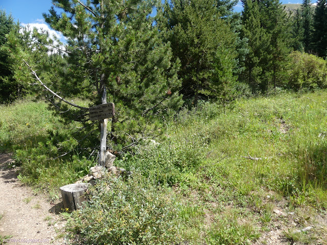
The trail looked worrisomely underutilized, but it didn't get challenging until over halfway up, and then it was a problem of too many trails once again. It split and I decided the well used one to the right must be... a campsite? I went left, which was fine until it started to get scrambly and wasn't getting the last traverse west to get to Ptarmigan Pass. I ended up dropping through a steep meadow with a couple slides until I met trail coming up from below, presumably from the right hand trail.


I didn't find the expected Laskey Gulch Trail coming from Straight Creek Trailhead by I-70, but my trail was fine. Sometimes sound drifted up from the 8 lanes of interstate below, but mostly it was quiet.


The south side of the mountain was distinctly dryer than what I had been traveling through and I was worried if those high creeks I was heading for would actually be running. I reassured myself that I could just go back a mile or two to find some if it didn't turn up where it was supposed to.


No need to worry, water was flowing just fine where the map said it would be. The trail was lower than the map said, but I spotted a couple big cairns and some trail with some slide problems higher up, so suspect it might have gotten rerouted. There was a small camp just before it crossed the stream and I probably should have stopped there. The map shows a bit of vegetation a little further along and I decided to camp there since that usually meant trees in this area. It turned out to be willows. The nearby water was a bit harder to gather and my camp was ultimately on an exposed hill with no trees nearby at all. It was, however, flat and there was no wind to worry about.


I was getting a bit worried about my second attempt at Ute Peak due to the clouds. I got a new weather report and my perfect Wednesday was no longer perfect. It was still a pretty good bet. I may have had a few negative thoughts about my chances since things did seem to be centering on my hike on the morrow.

It was already after 7PM as I finished and I sure was glad this was a "short" day as I fell into bed. Thus ended the challenging day of walking rugged ridgelines with too many trails.
Continue on to the next day ⇒
*photo album*
©2022 Valerie Norton
Written 26 Oct 2022
Liked this? Interesting? Click the three bars at the top left for the menu to read more or subscribe!


Comments