Cave Basin
San Juan National Forest
Click for map.
In among many questions, I asked a ranger why Cave Basin was named such. He said there's some limestone up here and it has some caves, but he didn't know where and they are rumored to be hard to find. So probably no caves today. The trail itself is only a little over 5 miles long, but the fellow hefting a big pack makes me question if there might not be a little more to it. The long out of date USGS maps show a trail down Hell Canyon to connect with the Lake Fork Trail. But no, five miles to an overlook is all he knows about. He's just getting set up for archery season for deer and elk which starts tomorrow. I knew I'd seen something was starting Saturday. He seems to think this trail is not well known about. I think it's right there on the map. (The Forest Service topo. USGS shows it on the other side of the peak to the east. OpenStreetMap hasn't got it.)

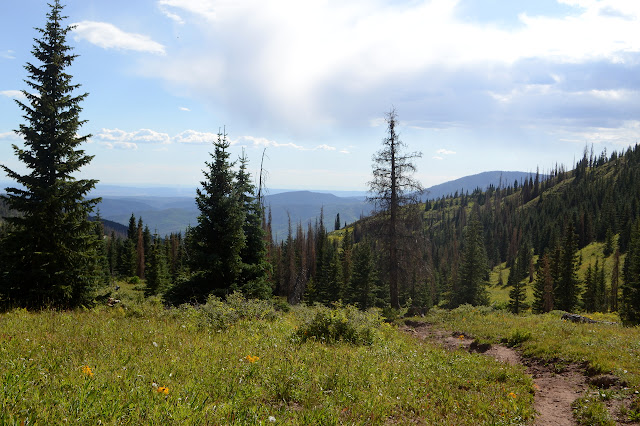
I record my plans in the register and start up the hill trying to be leisurely, but seeming to chug along a bit faster than usual. No need, this is a short day compared to most. The trail follows old roads with a junction here and there. They must have been logging. Little signs point the way at the junctions but the trail is well enough used to make it obvious, at least in this part of the season.

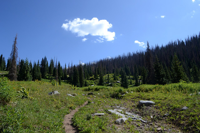

There must have been a nice sign for the wilderness once, but there is only a post now. Higher up is a basic wilderness sign and a bright yellow sign to make it very clear that snow mobiles are definitely not allowed either. I sort of want to skip ahead to the bit above tree line. Down the back, there is more forest. Beetles have had their way with it and most of it is dead long enough the bark is flaking away. There are a few trees fallen across the trail, some quite large. It just makes me more eager to skip ahead.

Big meadows open up before the trees are quite done. Lush, green, full of flowers, and occupied by a few cows. Conversation behind me seems to belong to some horseback riders. The cows seem to be going down the mountain a few at a time in trailers. Maybe these are about to get removed! A conversation piece from one woman about how she and her horse are learning to take harder and harder trails makes me suspect these are more pets than workers and the cows will be continuing their wilderness wanderings.


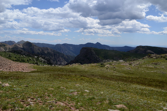
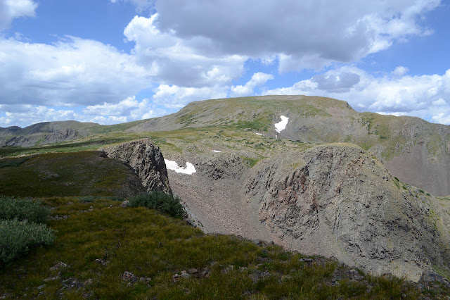
It's a long, gentle climb up from the first meadow with hills to drop down. It doesn't feel like I'm gaining enough elevation to note, but the trees subside and the low vegetation gets shorter. One last hill of distinctly white, chalky rock yields an alpine table land with a few lakes, the first occupied by the horses. I guess I found some of the limestone although the area is not looking promising for caves.


Trail passes a few more shallow ponds on the way up. I am frankly surprised they have any water at all after a whole week without rain. Bushes sweep over the trail, but it is still easy to see until a little less than a mile from the destination. From there, there are multiple paths of cairns to choose from, mostly heading off for a high point on the side of Dollar Lake south of the ultimate end according to the map.

I start trying to stick to the line on the map, but the lack of line on the ground makes it hard. I figure I will want to pop up to the high cairn anyway, so might as well aim for that even though it is definitely not trail. It's just a good view point. One of these things is more important than the other.

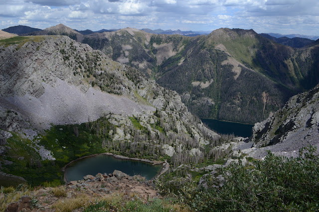
The trail really is supposed to end by a slide area at the north end of Dollar Lake, so I head off that way to see what is so grand about that view point.


From here, there seem to be a series of hills on to Mount Oso. They aren't really hills, Mount Oso stands at 13684 feet. If I was hanging up here for a long weekend, I'd find my way up there. It has looked a nice enough walk if a bit, well, hilly. Instead I look for a bit of trail to follow back. There does seem to be some, but it runs out quickly. Or I lose it quickly. For my practical purposes, there's no difference.


I follow some cairns until something nearby looks like somewhere I was, then find the trail again. It looks like the horses didn't get any further than the lake although the trail is still clear there. I guess faint and missing trail wasn't one of the challenges they were up for today. Someone else did get this far. I can see the footprints. If the hunters, they probably made themselves at home by one of the lakes high in Dead Horse Creek far off trail and I'll never see them again.

As I return to Cave Basin, I'm looking around for promising areas for caves. On down Hell Canyon or Cave Basin Creek seem much more likely than anything near the trail. I wander a little bit to see if a bit of trail can be found heading for Hell Canyon, but nothing looks like such. Anyway, the trails on the old map and new have already diverged at this point, but there are some hints this current trail is plenty old.


Something else to do up here if running around for a long weekend. I've actually noticed less elk scat than usual up here. There is a big pile of grassy bear scat. I feel like that should be full of berry pits by this time in the season. Grass should be much earlier, but then I'm used to grass being brown and stiff and ready to catch fire at the slightest whiff of a hot wind this time of year.

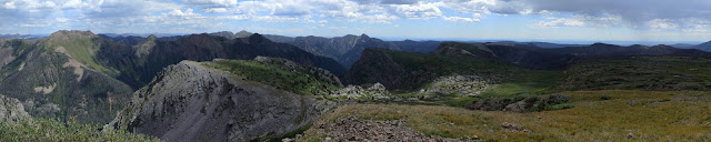
Rather than find caves, I decide to pop up to a high point. Maybe this is really the "top" of Middle Mountain. It's hard to say. There's really a long series of low peaks that gain until suddenly it's Mount Oso instead. Nothing really stands out much. I head for one with a sharp corner of wilderness boundary by way of a saddle decorated with sign posts that once held more bright yellow signs pointing out no motor vehicles means you on that snow mobile. Another further down in the trees has been unmolested.

This one has some faint road up it too, but the trail along it seems more likely to be animal trail. There is no register I can find on the general, wide top, but the undergrowth and dead trees would make anything hard to find. It has no view except what is pieced together from between those trees, so is no better a peak.

The travel is much easier, since it is shorter off main trail, and I don't miss my way on the way back down again. The other has more prominence. I'm thinking it has the better claim of top of the ill-defined mountain.

Back on trail, I walk up to the saddle it uses. There is another pair of bow hunters coming over the top. I bump into more as I go down. There must be at least a dozen getting into the basin, and that's just what I see. One guy is carrying just a big water jug. One further down says he's with that guy and another, they're on their second trip to camp. Nobody has a stitch of bright colors. Bow hunters have to get too close to go mistaking humans for prey. Still, I'm glad to be getting out before the compound bows start springing and I can't seem to help having a bit of a Tom Lehrer song running though my head.
I stop by the register to mark myself out and see how many are in. Nobody has registered except me, the horses, and the group of 3 on their second trip. Oh, and the guy just starting who sees me looking at it. No clue to the rest how many people are already up there. Well, except the really full parking area.
©2019 Valerie Norton
Written 17 Sep 2019
Liked this? Interesting? Click the three bars at the top left for the menu to read more or subscribe!


Comments