Vallecito to Windom: Silver Mesa and Endlich Mesa
San Juan National Forest
DAY 1 | DAY 2 | DAY 3 | DAY 4 | DAY 5
Click for map.
Morning and as I cook breakfast, I seem to have a minor mountain goat infestation of one male. These goats are far too comfortable around people. I watch him, and it becomes clear he's looking for a rock I might have peed on for the salt. Ew.

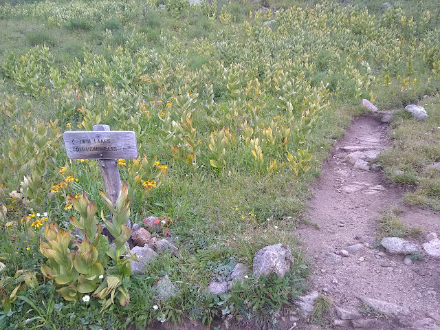
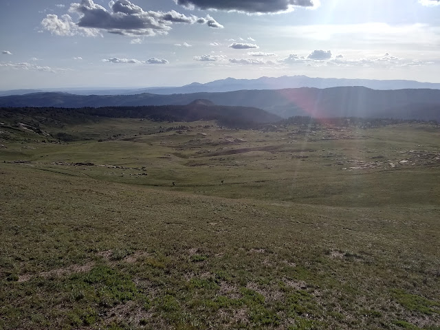
The weather is already threatening, although I get a sense of rain without thunder somehow. The threatening weather is reason number one it might not be a good idea to take Endlich Mesa back as planned since after climbing to 12.6k feet, I stay near that and then over 12.8k feet Thimble Pass. That first bit of staying high is at least under a tall ridge, but the next miles high on Silver Mesa are above tree line in the flat. The next reason to avoid it is that fire warning at the start. The trails I came in on are hardly affected by the fire, but Endlich Mesa will come down through what I could see from below was heavily burned. The third reason is that the trail only goes to a lake just past Thimble Pass on OpenStreetMap although the other trails seem to be there in closer to accurate form, including the one up to Twin Lakes and beyond. I'm worried about what circumstance has left it off and thoughts go back to the fire. I can't even be certain that it goes through. On the other side is long miles of ridge walking with lots and lots of view. That's a pretty strong argument. If it really does only go to the lake, I should still have all the time I need to return via Vallecito Creek instead. So I'm still going to give it a try. First I need to get back to the main trail. This time, I'll take the better trod and built way.

Once back at the main trail, I just have to follow it back the way I came. That's easy. I go up to some view points of the valley, past a mine pouring out water, the mine with the cabin remains, and the large camp sites with a bit too much beetle kill nearby. Up into the upper meadows with the morning light being especially good for picking out the old trails to the big holes in the ground that are more mines.


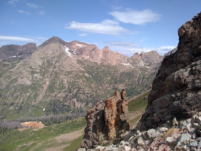
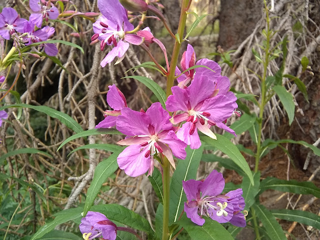
Then over the top. The trail I want to take back is distinctly the lesser used. By a lot. But it also has footprints on it. Someone has thought it worth taking in the memory of loose dirt. I can pick out quite a lot of it as it crosses along below the ridge and above the valley. The end to Thimble Pass looks a bit like a slide, but same as yesterday, take on what is in front of me and work it out then. Brush is grown a little way over, which is surprising. So high up, it feels like brush just shouldn't be.

Just short of the tunnels, the trail splits upward and over the top. The remnant of trail that actually goes to the openings doesn't look used anymore. That's one possible use for this trail that is certainly not the main use.

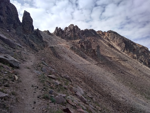
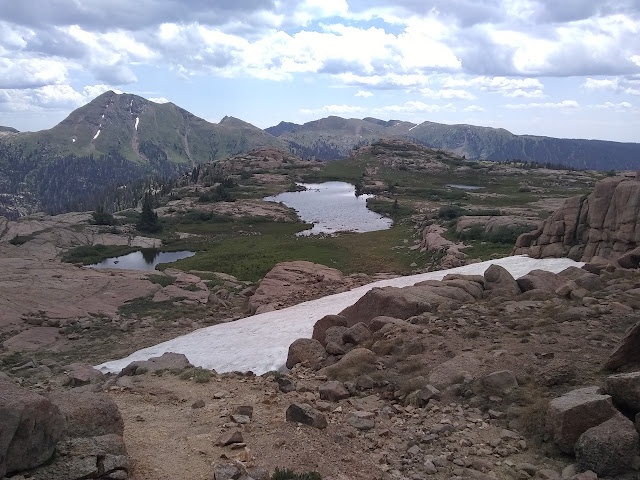
Some of the best trail is the stuff I couldn't pick out from afar. After the mine, it is all quite good trail. Maybe the connection was added later to the mine trail. What looked like a slide to the pass is solid trail, too, if a little bit steep. There are cairns marking a way down to Lillie Lake (Durango Reservoir #3), but in spite of the claims of whoever added the trail to OpenStreetMap, that is definitely not where the trail goes. I am tempted to follow the track up Florida Mountain or tag where PeakBagger says the high point of Silver Mesa is or even find my way up Bullion Mountain except that I'm still making up miles I didn't do yesterday. Oh, and the weather. It hasn't produced anything, but the promise seems so very clear and it's still a few miles across the top of Silver Mesa to treeline.


While it is easy to see where the trail is over the pass, it is a little harder out on the mesa. I just start strolling over to the posts marking the trail to find that they have bits of marked metal nailed to them. Mining claim markers. All those mines, there must be some claims here and there. The map has clues there will be more. The little Lillie Lake is a city reservoir for Durango and is marked within a vast inholding, but not a very complete one. It has rectangles and intersecting rectangles and other odd ball shapes cut out of it like those were once other inholdings. All of it looks a lot like mining claims.


I'll just have to try to follow only trail markers. That does seem somewhat difficult since both can be sticks in small rock piles or large rock piles on their own and a few things in between too. The electronic map is handy to be sure I'm somewhere near the trail, but the terrain doesn't really require one anyway. As I'm following some large cairns, it asserts that I'm following some prospects while the trail is a few hundred feet to me left. My eyebrows suddenly become all lopsided and I bet the thing that when I get down to where it shows the trail going off further that way I'll find some track. Which there is, but a thing can't agree to a bet.


As the weather seems to let off on its threat of rain, with only two raindrops reaching me, it becomes a more relaxed walk down the mesa. As there are more plants and dirt, there's more trail to follow making it easier again. Eventually, I make it down to the spattering of lakes with a thinner spattering of trees that I had hoped to call camp last night except that I spent none of the afternoon moving camp from where it was the night before.

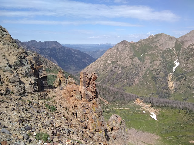
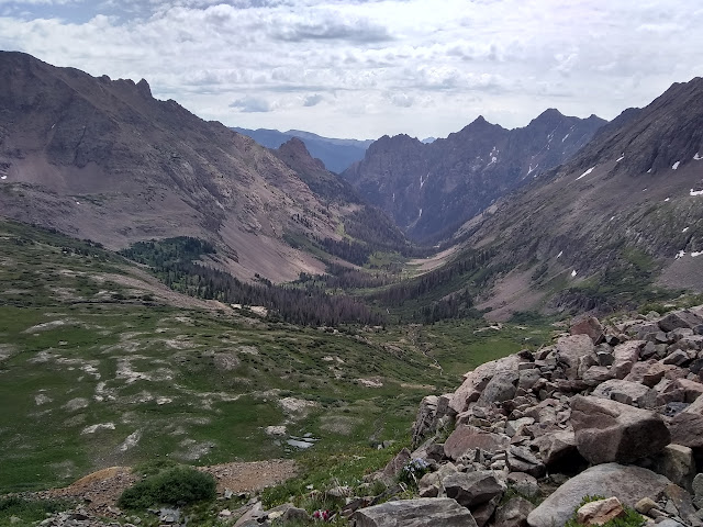
Lunch time, for me. I sit at the top of a cliff overlooking the Florida River and another reservoir in Crystal Valley. The next one along, I'll be crossing the river on the dam to get to Endlich Mesa.


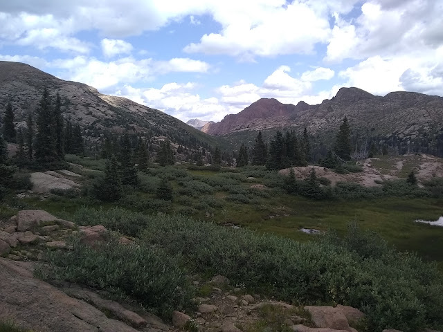
From the lakes, down it all goes to the reservoirs. Sometimes very steeply. Seeing the "reservoir" designation and all the inholding around them, I assumed that there would be no camping by them, but there is no indication of that. There is a strong trail crossing the river a short way below Lake Marie. Perhaps a camp. Perhaps a way to "Logtown (site)" marked on the map. Some hooves went that way and on down the trail some time recently. Seems like a good indication of access being very possible.


At the dam, I just have to know there is a trail across. The only trail that is obvious is the City Reservoir Trail, which climbs up and connects into stuff I haven't looked into yet. If I look closely, I can see where the rocks have been slightly adjusted by many walkers. It looks a bit rough for stock.

The dam is the lowest point for the day. Now I have to go up. It seems like there are cow paths to compete with the trail, but it might be old trail. The current trail likes making rather direct excursions up the hill. It certainly gets the feet climbed quickly.

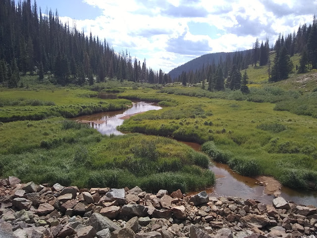
A creek crossing is the last water on the map for quite a few miles. In fact, I will probably be camping before any other chance of water and the rest of the trail looks like water is seasonal and iffy. Ridge lines and mesas can be, well, dry. There aren't any ponds even. I get a bit more to drink, then fill the dirty water bag for camp and another quart for good luck. I won't bother to actually filter them until there. Now I'm a bit heavier as I climb. A fellow leading stock down confirms that once up on the top, there's no water, but there are some small chances before. A big tent at treeline looks like it might have been his work, dropping someone off. Indeed, the trail gets close to a single little stringer with just enough water to grab before looping around to a dry side and up to the top. I didn't need to carry all the weight up quite so many feet after all. It's only about 300 feet anyway.

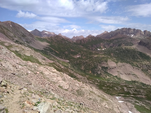
There seem to be all kinds of extra trails in the area. Some I suspect of being the old trail as it starts to go very steeply again. Some could be game trails or maybe heading off for the local named peaks.


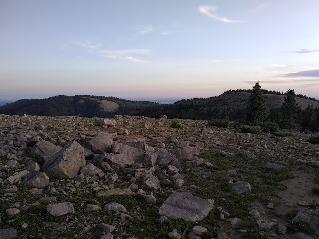
Once up on top, I am slightly preoccupied with where the high point is. There area a few that look like they might be and people have built cairns on that the trail goes around. I give them a miss.


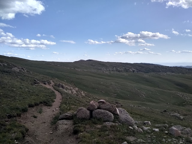
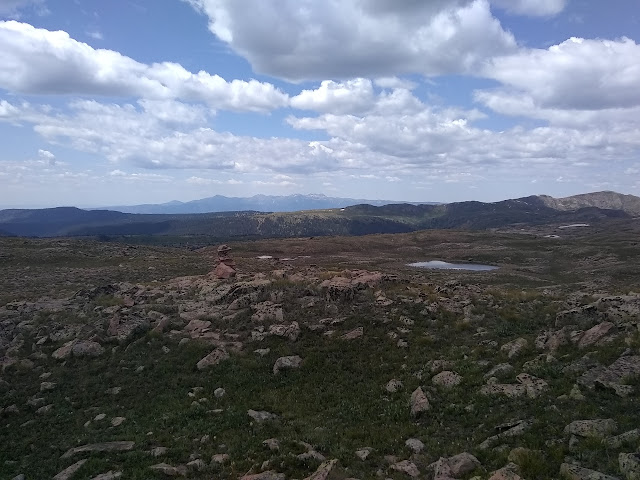
As the trail gets around the second false peak, there seems to be the perfect route up to the high point. It's just a couple hundred feet extra to go for it, so I do. A pair of hikers pass going north and a second pair with a dog heading south stop to chat with them for a bit. Guess I missed the news, whatever it might be. No one has adorned the high point with a cairn, but a few feet further along to a second point that sticks just a little further out into the view has a small cairn and a register.


I start to go down the same way I came up, but that just seems silly, so I turn and start down on a more direct route back to trail. I may as well have a little distance done for my excursion. Elk that have come up since the hikers passed head back down just in case I'm out for them. Maybe I shouldn't have gone up the peak. It has delayed me a bit while I want to make miles. I was looking to only have 10 trail miles left at the end of the day and the peak is up around 13 miles left. The miles across the mesa do go quickly although the trail keeps splitting. There was a thin high route I noticed as I came down, but there are also very well pounded random excursions. I just follow the footprints.


A shallow saddle has a pair of posts left from something. The only thing I can think of is wilderness sign, but it would be a little late as it is already a mile in, give or take. The sun is setting as I get to small stand of trees. One spot looks promising for a camp and a second spot has an old, overgrown fire ring. Not that I'm going to try to find enough wood around here to light a fire, but it tells me I'm not the first. Anyway, I can make it work. Winds seem unlikely, but if they go it would be very cold and my gear seems to be just warm enough so far and this is the highest camp site yet. Being able to tuck myself in trees is comforting.
The whole place is dry as a bone. Good thing I grabbed all that water. I guess sometimes Colorado really doesn't offer the stuff every quarter of a mile. I'm sure glad I didn't chicken out of coming this way. The miles along here have seemed like so very much more than the miles along Vallecito Creek.
ON TO THE NEXT DAY ⇒
©2019 Valerie Norton
Written 10 Sep 2019
Liked this? Interesting? Click the three bars at the top left for the menu to read more or subscribe!


Comments