Vallecito to Windom: Johnson Creek and Columbine Pass
San Juan National Forest
DAY 1 | DAY 2 | DAY 3 | DAY 4 | DAY 5
Click for map.
Morning comes without any night rain. I totally got away with leaving the rain fly off. I didn't get much star gazing in, though. The camera said it had taken its last picture on the battery it had, so I pop in the charged one for a picture of the sunrise light on the mountains. The camera promptly explains that it has taken its last picture on that battery, too. I tested that battery before I started! I couldn't remember when it had been charged, so I put it on the charger. The light went red, then a couple minutes later it was green. I start to think that big camera plus 14er doesn't mix, but it went up Quandary just fine. It got up Uncompahgre and Wetterhorn just fine. It was only Williamson where I had a different problem. I seem to be rather emotionally attached to taking photos with the big camera because I feel a swirl of depression coming over me.


So I pack it up and find my way back along the animal path to the trail. It does not plunge into the willows like I thought it was about to, but follows along the side and then up the hill as the valley gets narrow again. There was no stream over there after all and I had been about to lose all chance at a camp site. I get to wondering if the area was a vast lake after the glacier melted, a lake that finally topped off and started carving the valley below. It must have taken an incredible length of time.


The trail drops and a carved post marks the junction with the Needle Creek Trail. It says Johnson Creek on one edge and Vallecito Creek on another. My time to hang a left and cross the creek for the last time. There is a bridge for that, but within a quarter of a mile I know that is the last one and the last of the recent trail maintenance.


There are a couple trails that look like they go off to camp sites just on the other side of the bridge. Well, junctions are typical places to find such, especially if there is water. I can't see the actual sites, so no idea if they are legal. The trail promptly crosses Johnson Creek and I decide to swap my socks back to the ones I was wearing yesterday first. They are the thinnest I have with me and still aren't dry anyway. Well, first I try a few hops doomed to failure including some attempt to balance on a jam of thin logs, then following trail up the side of the creek that doesn't seem to do anything but avoid the creek. Then I swap my socks and take the short plunge.


And so I climb. The map shows little wiggles here and there, but what is actually making up the trail is comical. Trees are down on the trail and the wiggles are so small that most of them require a hop twice get get over. Of course, a few can't be bothered and just cut the switchback. There are a few trees that are hard enough to hop that there is getting to be a very strong "walk around" that cuts the switchback.

The first roll of thunder comes through at 10:40AM. It seems a little soon, especially as I have a pass above treeline to cross. The trail is often away from the creek as it climbs, but when it gets near there are interesting details. This side of the creek meets the water, but the other side is a deep red cliff. It stretches for a good distance as the creek drops quickly. Then it changes to cascades. Then it is a sharp, deep canyon looking like it broke rather than was carved. Above it all is the carving of ancient glaciers.

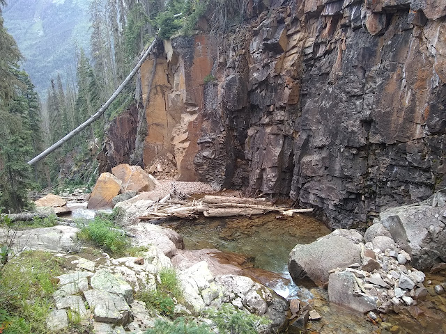


I notice it is approaching an avalanche chute that obviously carried a little more than usual down its route recently. The trees at the side are bent and broken. There is a little worry, but besides a few minor obstacles, it goes through perfectly well. The crossing hasn't been washed out either. There is not much rain and even less thunder, all of the later being down in the valley I left, as I climb. It is comforting as the trees thin.


The map notes many mines, tunnels, shafts, and prospects in the area above tree line. Those are probably what this trail was originally built for. I expect to see some sign of some of them. Here, they stand out, usually by the yellow tailings scattered down the slope. I can find all of the ones noted on the map and a few more.


There are a couple of shoulders above and I find myself predicting which one the trail will go for. A long flat and then switchbacks up to another level. It is actually making me feel quite at home even though the Sierra Nevada cannot really be said to be my home. I choose the one on the left, start to hedge because it looks more like right the way the trail is going, then settle more solidly for left. It is still gloomy and sometimes with light rain, but no thunder, as I climb up the left.


Passing the lip of the next level, there is a lovely little creek in a minor gorge, but it takes a little longer to get a view of the lake. It is surrounded by mines, yellow rocks spewing out. I can match the ones across the lake to marks on the map. Once I locate the rest of the trail and am climbing, I can match some more that were hidden from the first view.


Another 300 feet or so to get up the pass from the lake. An old, less steep trail is clearly visible, but not walked. Everyone sticks to the track that climbs just a little bit faster now and the other is becoming a rough and difficult thing. The junction with Endlich Mesa Trail is just a few feet below the top. It is obvious, but not signed. I hope it isn't just that some wander over to check out those holes in the rock. It certainly looks a lot less traveled. Five more steps and I'm at the top. The weather is almost good, although I have to duck away from the breeze to be warm enough.


A less steep trail pops through a pillar and around, but no one takes it to the point that it no longer connects with anything. The used trail is dry as I start down, but there are still a few more rain drops for me as I continue down through more of the shapes of glacial carving. There is more mining here with the same tailings, but some of the bright yellow rocks also come from steep chutes that serve as stream beds coming down the tall mountains.

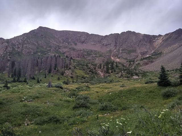
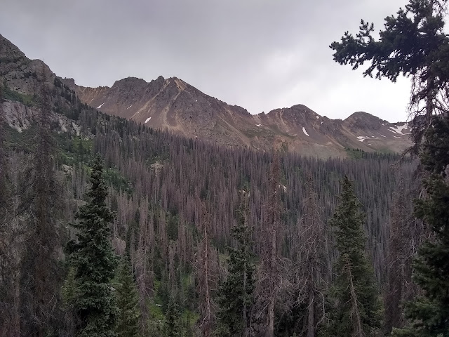
It's a long way down. I finally hit treeline, which has far too many beetle killed trees to anyone's liking, and then there's more down. There are a couple nice camp sites along the way, but it is still a mile to where I think I'm going.

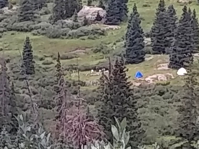

There's a lot more people in this basin. Besides day hikers, one camper, and a group of 5 with their dog coming down Johnson as I went up, I haven't seen anyone. Now here are a bunch of folk all hanging around. Well, they could be on a mountain or looking through the mines. There don't seem to be as many to look through the mines although the trails out to them are still generally there.

Once down to the meadow, I've basically gone as far as I plan to today. I still have energy, so when I see the water sheeting over the rocks as it comes down from Twin Lakes and a use trail to get up to see it more closely, well, I just have to take it. Somewhere up there is another "no camping" sign, but I'm not sure where.

I've clearly not come up the main way. There's a perfectly good trail that looks to get maintenance just a little way above where I am going. The goats know and use it. Two are coming up as I get close and I let them by before getting on it. They are wary, but not quite scared. They only keep a minimal distance as they go.

An iron rod in the rock shows that this trail has some official history of some sort. Still, following the goats helps pick it out as it crosses some of those sloped rocks like that with the cascading water. It is also interesting watching how deliberate their muscle movements seem to be as they slowly push themselves up the mountain.

I'm getting out of the trees, so to the last place I want to camp, when the no camping sign shows up. Everything beyond it is off limits, especially Twin Lakes. I saw a couple thin trails going off away from the water and a well used site far too close to the water, so head off away to see what comes up. An almost site. It is not flat for the size of my tent, but it is flat enough for the area I need to sleep in and drops off past that.
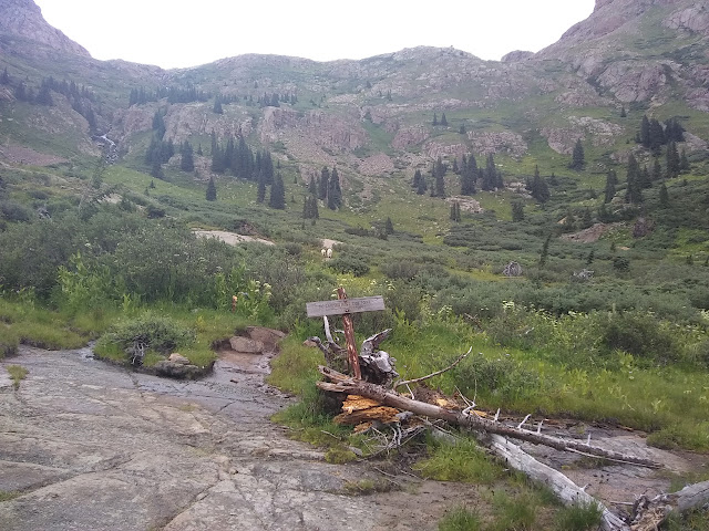
I can make this work. It even has a nice stove stone, big and flat and can be leveled. Rain fly on this time. I have to untie the guy lines. This is the first time I've properly put the tent up. Well, two that are only for dealing with high wind are still left as they were. I don't think it'll be windy. I do make sure the rest of the stakes are set well.
Then off to get water and the rest of the camp chores. And wonder if I'll really add to my 14er total tomorrow. I only have the one day to take my chance and I really should get in another 4-6 miles of the walk out if I really want to keep days around 12 miles.
ON TO THE NEXT DAY ⇨
©2019 Valerie Norton
Written 7 Sep 2019
Liked this? Interesting? Click the three bars at the top left for the menu to read more or subscribe!


Comments