Vallecito to Windom: Vallecito Creek
San Juan National Forest
DAY 1 | DAY 2 | DAY 3 | DAY 4 | DAY 5
Click for map.
It's probably the last time, at least for a while, that I can leave Timmy with the lovely woman who has been looking after him when I backpack, but we have decided we can trust him a little longer so I can go out for five days. Five days is what I think it will take me to find my way up a new 14er fabled as one of Colorado's "most remote". Typically, people will just ride the Durango Silverton Scenic Railroad out to Needleton, then 6 miles on trail to a camp site to be ready to climb the peak the next day. So it isn't all that remote. Except for being constrained by the train schedule, people would day hike it like Mount Whitney. Oh, and there are the two harder 14k peaks nearby, so if you "gotta catch them all", you might as well hang out an extra day or two. Since I have no business on class 3 on my own, I'll leave the other two peaks to people who own climbing helmets. Windom can be kept to class 2.
I'm not planning to take the train or starting at Purgatory Trailhead, the other suggestion on SummitPost. They say that is 15-16 miles or so. I'm aiming at going up Vallecito Creek to the other end of the Needle Creek Trail as it follows Johnson Creek to Columbine Pass, then drop into the usual camping area for the peaks. To return, I am set on taking Endlich Mesa Trail from Columbine Pass down to Vallecito Reservoir. The route up is about 20 miles and the route down is about 24, but it puts me down about 4.5 miles from the parking for Vallecito Creek. It's already early afternoon, but I want to get in 8-9 miles today to keep the rest of the days around the 12 mile mark.

There is parking for over a dozen cars and a few horse trailers at the trailhead. Happily my trailer is hanging out by the cat, so I can fit. There is a bathroom and a notice board and a warning sign for entering a burned area. Down here doesn't look burned, but the nearby slopes look like they may have had a second fire to clean up the mess a previous fire made. Notices along the trail as it circles around Vallecito Campground state that I am responsible for knowing the information on the notice board. From reading it, I learned that I must not camp within 100 feet of water, about 35 adult steps, for fear of a $100-300 fine with a note that it does get patrolled; there are no fires allowed in the Needle Creek drainage including the Chicago Basin, the typical camping area when setting up for the 14ers; the third bridge across Vallecito Creek was taken out by an avalanche in 2006 and is unlikely to get replaced; and if I'm hunting lynx, I better not accidentally shoot this other cat that looks similar but is endangered. (Wait, you can shoot lynx?) I already know toilet paper is trash and needs to be packed out and San Juan has a blanket ban against camping at trailheads. Plenty of that is relevant to me.
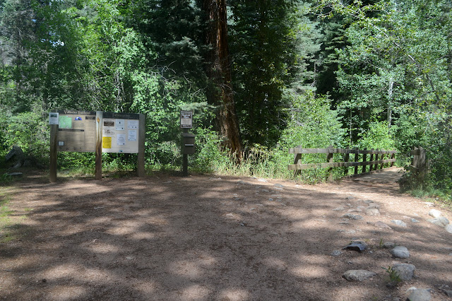
The wilderness edge comes with typical wilderness information, another notice board with most of the things that were on the first, and a register. I fill in my expectations of the trip among the many day hikers, some of whom are starting as late as I am. Across the bridge (what luxury) over Fall Creek, there is a wilderness sign, still in sight of the old trailhead parking at the end of the campground. Always good to get into the wilderness promptly. It then splits into horse trail and hiker trail, with the hiker trail becoming a wide ledge high in the narrow granite canyon that Vallecito Creek flows through. There were no glaciers cutting this.


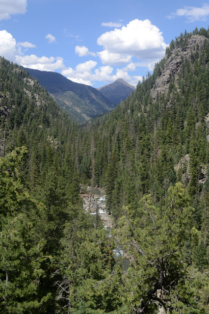
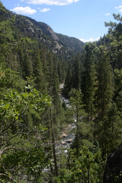
The creek below looks suitable to call a river in my experience, but is very much a creek around here. The sign about the third bridge says the crossing is unsafe in high water, which surely this isn't. The bridge comes around mile 7, so it could be smaller by then. The first bridge is yet to come up. The trail drops down for a closer look at the flow.


Fall must be coming on. The few flowers look like long lasting ones that exist partly dried already on the stalk. Down by the water, ripe berries seem to be the way of it instead.


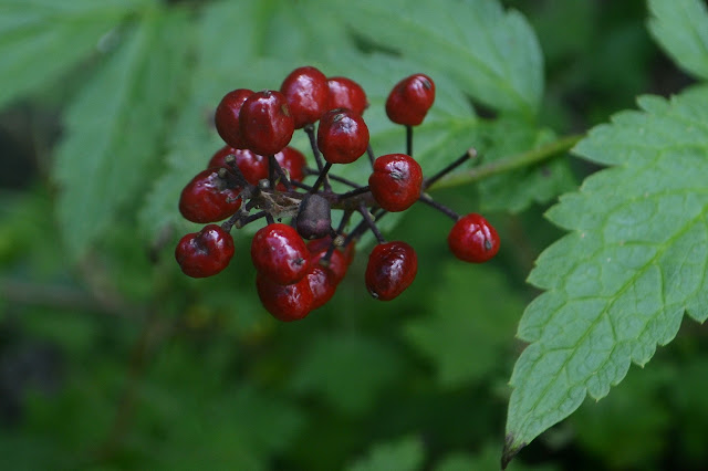
All the berries are unfamiliar, but I bet if I'd brought along my edible plants pamphlet, a few would have become familiar. Since we're all taught to beware of red berries, they all stay on the bushes for now. The first bridge comes a little more than 3.5 miles along and looks a sturdy thing as it crosses an old channel to a rock pillar, then the creek itself in a second piece. Maybe not survive an avalanche sturdy, though. It wouldn't be an easy spot to cross without the bridge.


On the far side, the trail seems to follow along part of an old, wide flat that is high enough to make getting down it for water difficult if one were to chose to camp along it. Not that I have any desire to. The mosquitoes are thick here and I am constantly waving and slapping an otherwise thinking about mosquitoes and how to get them off me. I foolishly left the bottle of repellent. My pack felt so light that at first I put it in even though it's rather large for the trip, but then I thought "better" of it. It sure doesn't feel better now. I do have my big head net. Once out, it proves brilliant for walking in. Easily makes the insects not worth thinking about without making me hot. It's really quite hot out. So I can pay more attention to the scenery. Admittedly, that is mostly trees with some beetle kill.

There is thunder and somewhere rain as I walk through the trees, but none of it seems to be here. The second bridge comes around mile 6 and crosses another narrower chute of water between pools. Another that would not be easy without the bridge. The mosquitoes are not prevalent on this side and I can roll up the net again. The valley is opening up quite a bit now. There is some dread. I haven't seen a lot of camp sites and those I have seen were illegal due to being too close to the water. There was one camper around 4 miles. She had selected a wide meadow but still gone with somewhere less than 100 feet from the water to place her tent. Mostly my dread is the crossing. The creek almost looks bigger now.
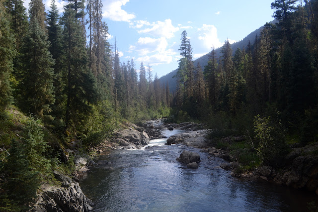

The vegetation crowds in onto the trail as I get closer to the third crossing that is now a ford. It wouldn't be so notable except that the rain I was sure was happening somewhere earlier was happening here and it is doing a good job of getting me pre-wet. Any day hikers must not get further than this, deciding to keep their feet dry. The crossing does not look so bad except that it is wide and I sort of wish I'd got here before 4PM. Now everything is in shadow and feeling cool. After the slosh through the cold water, I get to walk through the cold air.

The water is slightly swift, tends to be below my knee, and cold enough to be uncomfortable by the time I'm done carefully taking each step across. Maybe not worth all the dread. There is no proper trail on the other side, so I just scramble along one of the use trails that gets up and connects with something more solid. A few feet further, there is a cable across the trail. Part of the vanished bridge. I follow it to the creek and am surprised by how overgrown the old trail has become. I walk quickly to try to warm up a little although I have never found it to be very effective. Not on something as gentle as this, anyway.

And the valley just opens up. Now, this was definitely a glacial valley. Even with the walls so far away, I can hear the roar of waterfalls coming down the side. Another reason it might have been nice to be here earlier: so I could pursue those roars and see more of the waterfall. As it is, I keep looking and eventually spot the evidence that the roar is what I think it is.


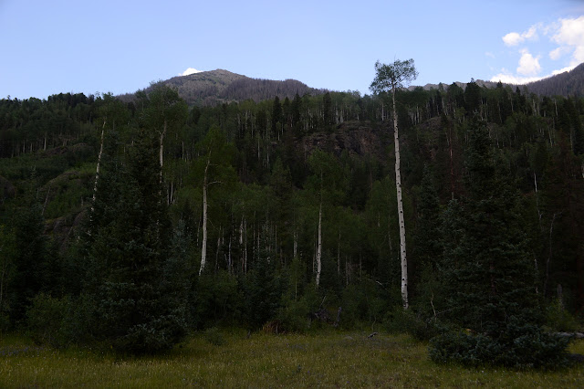
It is interesting to note where avalanches have come down the other side and caused a bit of damage as their momentum died on the way up this side. It is nice to see that the work to clear it has already been done.

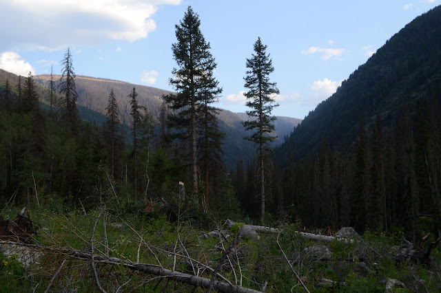
I see no impacted sites here as I come to want a spot, but plenty of legal room. I think there are streams off to the right and the creek is quite a ways off to the left, so when the trail seems about to plunge into a section of willows, I follow a game trail toward the creek. A flat spot well over 100 feet from the water and without too many beetle killed trees nearby is easy to find, even hidden from the trail. I hope this is the sort of area that just doesn't become very impacted by a single use, at least not after a single night.


Getting water is a quick walk along some more of the game trail and then down a rocky bank. I filter some for the camping and some for the hike tomorrow. It looks like a wonderful night will be coming, so I leave off the rain fly. Somewhere in the back of my mind is a nag noting that Colorado is sneaky and rains more than just in the afternoon. On the other hand, stars. Lots and lots of stars. There isn't much of a moon tonight.
ON TO THE NEXT DAY
©2019 Valerie Norton
Written 7 Sep 2019
Written 7 Sep 2019
Liked this? Interesting? Click the three bars at the top left for the menu to read more or subscribe!


Comments