Mad River Rock and Devils Backbone
Six Rivers National Forest
(map link)
One goal I had when starting out on this trip was to meet Mad River Rock. I searched on this old lookout location once and found its listing on California Lookouts. They have an article from the Oakland Tribune about it. Visibility mappers (This is a job? Can you imagine?) located it and decided it would be the perfect point for a lookout. This rock that sticks up 200 feet from the ridge was scaled via a chimney. When they did decide to build a lookout, they decided it must be done quickly. The road was 2 days late, but the powers that be asked for it in 8 days, so that's not bad. Then the trucks rolled and construction happened including 230 wooden steps to access it. Today, the lookout is gone so perhaps it wasn't the Bestest Place Ever™ for one. The steps are gone. It's considered a class 3 climb, which is not all that hard but beyond what is wise for me to climb alone. Thus, I do not wish to bag this peak, but I would still like to meet it.
Now, technically, if the Mad River Rock Road (1N03) is up to standard, I can just drive out to Mad River Rock on that. (It's had a few more days of work put into it and is suitable for passenger cars now.) But where's the fun in that? Especially since the "Devils Backbone" is just a couple miles away? And it has trails on either side of it that practically meet on the other end. I planned a loop on those trails with a spur out to the rock. I expected these trails were actually for Jeeps since a lot of them are road on USGS. I was mostly right, as it turns out. You can probably guess where I was wrong.
I suspected that dispersed camping might be had around 6E01, the southern trail to the ridge, but not much at 6E26, the northern trail. Indeed, there is a corral next to 6E01 and lots of room. In fact, after I walked around, I decided I could drive the little car back to a nicer camp. I was particularly motivated by a logging truck passing and playing with its Jake brake. (It did turn out to be the only one. There were more logging trucks, but only one needed noisy braking.) There was a lot more traffic on Van Duzen Road and retreating quieted things down nicely. On the other hand, all those clouds building in the morning while I walked the nature trail loop broke in the afternoon and the nice dry 4x4 road I drove in on became a muddy, puddled mess with one big one I wouldn't be able to avoid. Something to worry about tomorrow. Today I just needed shoes and lunch and plenty of water. A bag of 3L and another of 2.5L and that makes 12 pounds or so of the stuff. Plenty of water. I expected to see none along the way and it could be long and hard and hot. Trail conditions? I can't even find the names of these trails!

There is a much larger camp beyond where I made mine, but it had a gravel spot where the creek had washed the road away on the way and everything was generally softer, so I hadn't wanted to go that far. After that it begins climbing steeply. Even hiking trails usually don't go climbing quite that steeply. It was determined. Up! Up further! Oh, actually, drop. Just a bit, and just as steeply. Then UP! And all of it through the burn because this is in the footprint of Gobbler Fire 2015. At least it's not part of the August Complex?


With a little work, I got to the top, but it could have been a lot more. The track was rough but clear of any blocking trees. Someone had been up there this year and made sure of it.

And which way did they go when 6E01 finished at 6E24 at the top? I really hoped they went my way. Unfortunately, they went some third, unknown option going back down the other side. I turned north and had a few trees to navigate on the road. The initial few hundred feet were particularly bad, but once expectations had been sent through the floor, it decided to be clearer.


The Jeep trail quit, replaced by an ATV trail. This improved its quality as a hiking trail. Although narrower, it was somehow less brushy.


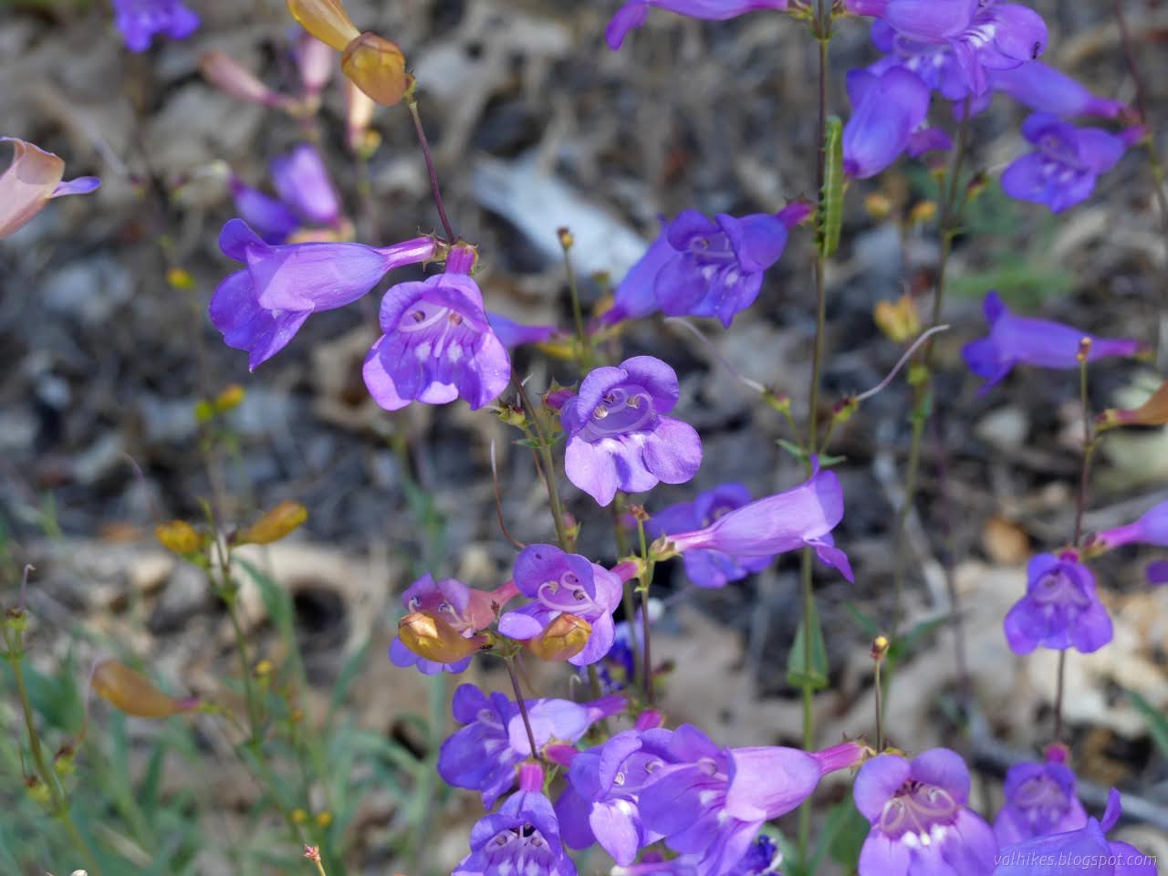
I stopped by a nice shady high point and snacked, noticed I was just a few feet from the junction with 6E27, then got up and walked right past it. This gave me the best view of the Ruth Lake of the day, but I was following the wrong ridge.

So I paced back. On second glance, snack was already past the junction, which was at the penstemon patch. I battled a little brush, then backed off. Any sign of trail there is long gone. I headed back up and found a reasonable opening with a faint idea of trail to get to the Devils Backbone. This actually is a hiking trail and the ridge does live up to the name, at least as well as those Devils Backbones with trails on them.


I found a nice bit of trail around the side of one bump, but for the rest, I tended to be sorry after trying to go around instead of over. For the last one, I probably just went around too low and eventually climbed up to meet old road. It's wide again before arriving at the intersection.


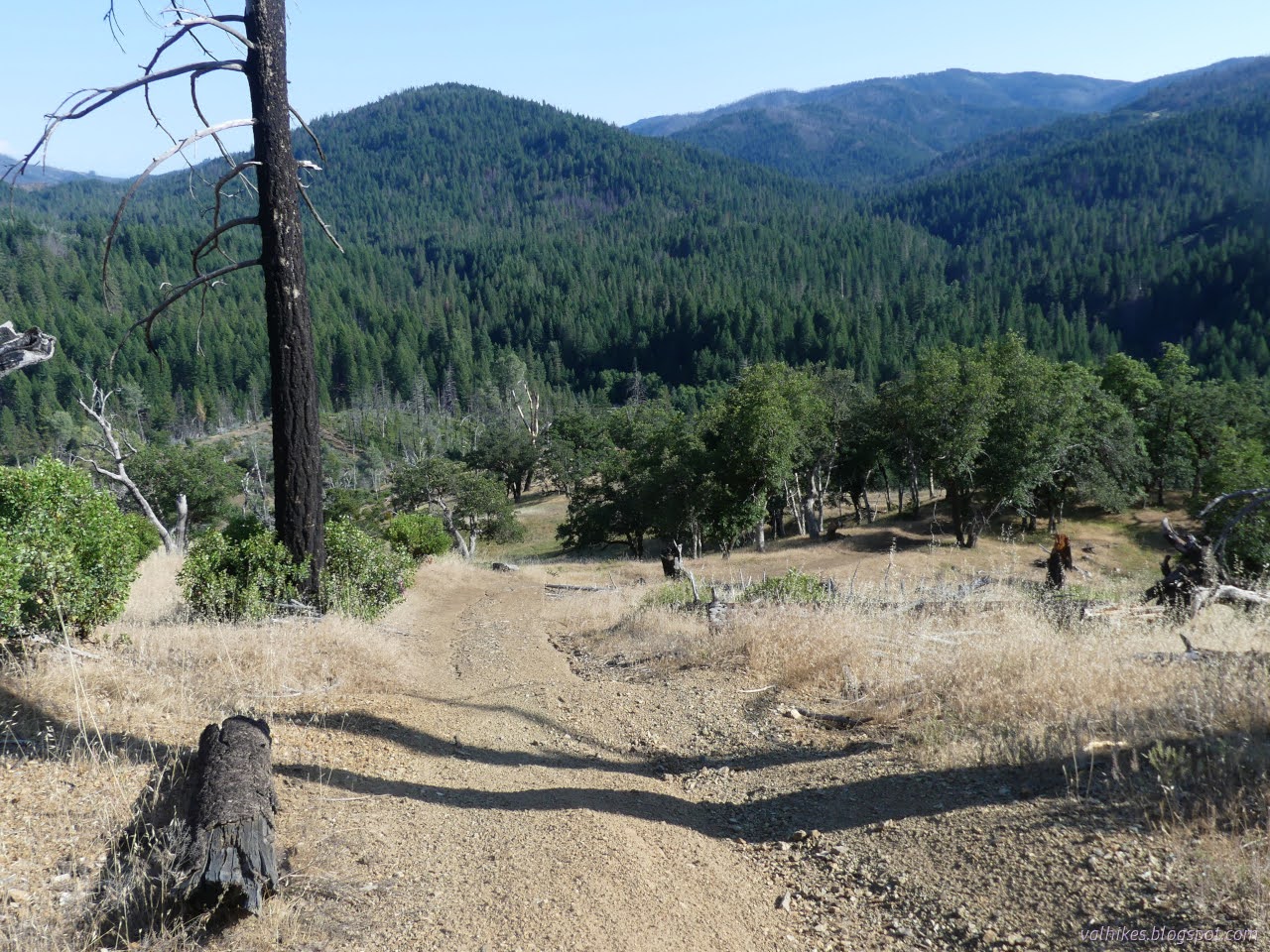
I met the ends of 1N03 and 6E26, rough road transitioning into Jeep trail, on the far side. Mad River Road climbs with a little steep spot here and there and soft bits and then comes to a gate. Above the gate, the road is pretty good and once it stops climbing and just traveling the top, it's narrow but excellent. The forest at the top and down the west side looks good, but that down the east side burned badly. It was clear and easy travel and the 2 miles along it to Mad River Rock seemed shorter than the just over 1 mile across the Devils Backbone. I zoomed along in trees with very little view, but lots of irises.


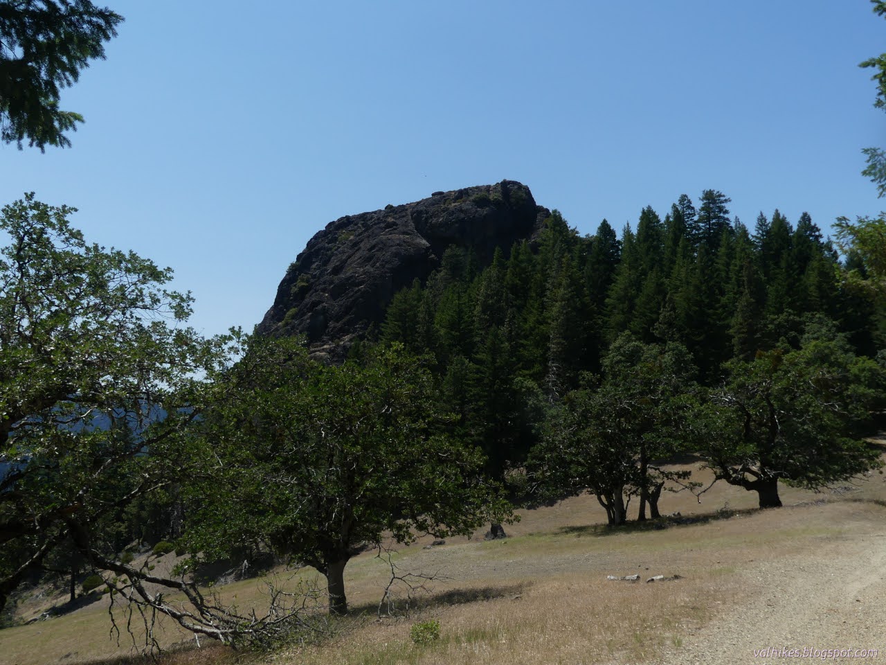
And then there was a big rock visible through the trees. There are other rocks along the whole of the ridge, but this did happen to be the right one. A few steps more, and there was a big rock visible across a big meadow. Does it rise 200 feet from the surrounding ridge? Maybe not considering how high the trees come on it, but they can get that tall.
Across the meadow, the road climbs again. At the high point, I found a little bit of trail and followed it up. It twists a little, got buried under fallen branches at one point, then becomes a path of rocks cemented together with a collapse spot. I'd found the old trail to the lookout. It ends in the scrap remains of the old steps.


I followed a use trail around the edge. I'm not sure how far it goes, but the view and the gardens are nice along it. Perhaps it even gets around to a better climbing point. Perhaps it is just for those looks.

I did climb a little way up the rock, a few feet further than I intended just to "meet" the rock. The rope certainly felt solid and there are plenty of handholds, but even as I sat in a safe feeling bowl in the rock looking out, I felt the fear boiling up. That fear can make it dangerous even if it isn't particularly. It was a fight not to go for it. Surely I could make what I could see with enough care and thinking calm thoughts, but that might not be the end. (I estimate there's two more similar climbs to get to the top based on the view from across the meadow.)

I crawled slowly backward from that spot where the stonecrops were so comfortable and it definitely wouldn't be the right day for that climb. Back where one can walk around a bit, I found a little more than steps. There's thick yellow glass which probably wasn't so yellow when it was lookout windows. I found a bolt in the rock for attaching the steps too.

Having met the grand rock, I headed back to my loop to continue down. A Forest Service Jeep pulled up and stopped. A pair piled out and started discussing a particular tree off the side of the road. They had marked another large tree for protection from heavy equipment. If there's a thinning project to come, well, the trees already seem thinned.


Heading down 6E26, it was more clear road all the way down, although the first gully and possible stream crossing had washed out badly and a new road further down had been constructed. There actually is water up here. A little flowed through the deep gouge out of the old road. This route is much more open with greater views. It made an excellent route down, but might have been too sun exposed for the climb.


Like the other Jeep trail, this road takes some very steep approaches to climbing hills. This one even had rubber dug into the surface to push water to the side.


I think surveyors had been at work near the bottom. They'd scraped out a trail to the nearby ridge where I'm pretty sure there was a new marker. There'd been ribbons showing the places of other markers along the way, too. I considered taking their trail, which would get me halfway back to camp from that road, and without walking any pavement. I took the slightly longer road route instead. As it turns out, there is a camp along 6E26 very near the paved road. It's not as nice a spot for a camp.


I got back having only delved a little bit into my second bag of water. It wasn't so hot and certainly not so hard as it might have been. The puddles didn't cause any trouble driving out the next day, either. Everything worked out beautifully for this meeting with the Rock.
*even more photos in the album*
©2023 Valerie Norton
Written 14 Jul 2023
Liked this? Interesting? Click the three bars at the top left for the menu to read more or subscribe!


Comments