Blue Jay Mine and Red Mountain
Six Rivers National Forest
(map link)
One goal completed, I moved onto the next: finally visit Yolla Bolly-Middle Eel Wilderness. I once made extensive plans from Boundary Trail going all over, but then got discouraged as it looked like a bunch of trails might have fallen out of inventory, and then it all burned over in the August Complex. Yes, I could have seen this wilderness before the big fire but dithered too much. This epic loop still remains to be done. For today, I had a much smaller loop planned: drop down Blue Jay Mine Trail and then climb back up on Red Mountain Trail. This is the entirety of official trails in the extreme northwest corner of the wilderness. In actuality, there's a trail connecting to roads in the west and Blue Jay Mine Trail extends south to (private?) roads there. There's no connections with the rest of the wilderness trails. I'd been told there were some CCCs (out of Fortuna) enlisted to clean up the trail. They passed me when I paused to ponder how close I was getting to the short road to the trailhead, so they got the parking at the end of the rough road. I got the parking off the paved road beside the Trout Creek Mine access instead, as planned. It's about a tenth of a mile to connect with the loop from there. The CCCs were still sorting their gear, which was a little more extensive than mine, as I passed the parking and started on the trail.

It's badly burned. This is more of the Hopkins Fire 2020 that was part of the August Complex. All of it was set off by a single storm that did a few more besides. At the time, I was looking at Red and Salmon off the same storm at the other end of the counties. That became Red Salmon and one part started half a mile from the trail I'd walked one day before. Resources were stretched far too thin and this is wilderness. It burned with little interference.

Trail after the trailhead is also old road. This road served the Blue Jay Mine in digging up manganese for the war effort in the 1940s. The CCCs had already been at it getting rid of a lot of vegetation, but they hadn't got far. A large log was only 3/4 cut for clearing. (Yes, they started a cut they didn't finish. They're back around the next day, so it won't have collected too much dirt.) It winds a bit then crosses over a small divide to wind some more along the other side.


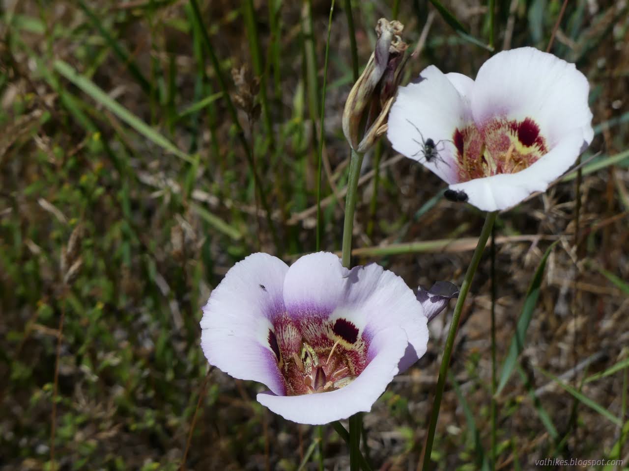
There was no more work nor any boot prints by the time I finished crossing on the divide. All there was was flagging, which came in very handy at a couple of places. This part was easy to follow, but it took me a while because there were so many flowers out. There were even some lilies and a couple of the hummingbirds these big flowers try to attract.


Since that little hummingbird didn't seem ready to hang out with a flower some more and I was just starting on what should prove to be a fairly long hike, I finally wandered away from the profusion of flowers. Getting down to the mine was quick once I stopped taking all the flower photographs.

The old road splits at the mine with the track of trail following along to the left. I followed the one to the right to have a look around the old mine. There's not much there except digging and that road. It wraps around the ridge and then there's a bit going up and another bit going down. I didn't try out the down spur.

Then I followed the way down to the spring shown just a little further on the map. There's a sign, not a bit burned but nailed to a very burned tree, pointing left saying it's 100 feet off. I tried finding it, but ultimately found a pool on the right side of the trail where the map said it would be.

Finding my way out of the spring was one of the places where the flagging came in really handy. From here, the trail is just trail. It follows along the ridge, usually a bit below, until there is no more ridge.


There's a bit more green once down in the valley.


Across the creek, the grasses were full of mariposa lilies. There was also the first sign of cows. An old road joins from the west. That is still seeing use as trail and is much clearer than the Blue Jay Mine Trail I was following.
I spotted some big cairns that mark the bottom of the Red Mountain Trail. This is the end of the Blue Jay Mine Trail now, but trail used to continue south to the Red Mountain House and beyond. This was a small roadhouse from the late 1870s. The map just says "site", but I wondered what can still be found of it and continued on.


It looks like a lovely place to stay on a backpacking trip and has certainly seen some use in that way. I found a couple sites as I wandered a bit wondering where the old roadhouse might have been. The only thing anomalous seemed to be some big cedar trees. There were also some pines that drop cones to rival the Coulter pines that hadn't been at the higher elevations either, so the biome had changed.

I followed a ditch back up to the old road and that back to the junction. Then I had a chore because it was hot. I made sure I had lots of water. In fact, I nearly filled my 3L water bag. It was actually about half a liter more than I'd planned, but whatever. The more the merrier on a hot day. The less, the better on a steep trail, on the other hand. The start of Red Mountain Trail is certainly steep. Between ribbons and cairns, I eventually even stayed on it.


The trail gets a lot easier to follow at the ridge. I didn't. I turned to tag the peak following no trail at all. Red Mountain is really just a super long shoulder, but it's close and easy, so I may as well. Someone mined up there once.


I snacked and found that I'd nearly drunk 2L of water coming up the steep hill. That was surprising. I was happy for the extra then. Most the work was done, but I still had a mile or so to the road and two more along it back to the car. The high point of this hike is actually along that last bit.


I was rather surprised to find a Pacific madrone coming back from its roots along the ridge. There's even flowing water when it gets back to Jones Ridge.

Once under the road, the map shows the trail following the road below it for a half mile. That's true. It does that. In the direction opposite the one I wanted to go in. There had been some work on this end too. They had scarped some of the area around the trail bare, but hadn't done that nice bench that was the only thing showing trail for that first part of Pickett Peak. I was a little disappointed, but they weren't done yet.

If I'd gone a little further out of my way, I'd have found the constructed dirt parking with a trail register for Red Mountain Trail. I would only have found loose paper scarps inside with the latest left by that CCC crew. I got going along the road the other way to find my car once more. It's quick miles and I didn't have to share the road with anyone.


So that's it, one tiny corner of a big wilderness visited, as well as explorations of the things that supported the trails once. Now there's a big meadow and cattle grazing and a bit too much burn, but a lot of wildflowers. I even got to add a new mariposa lily to my iNaturalist collection. My parking area was dusty and not attractive for camping, so I continued along the ridge a little and found a nice spot just past Mikes Rock, which happens to be the trailhead for Boundary Trail.
*even more photos in the album*
©2023 Valerie Norton
Written 6 Jul 2023
Liked this? Interesting? Click the three bars at the top left for the menu to read more or subscribe!


Comments