Dry Lake and Not-A Lake
Six Rivers National Forest
(map link)
I found a few explorations at the south end of the Mount Lassic Wilderness, then had dark thoughts about just doing them some other time. The thing is, one was labeled "Dry Lake". Something tells me that this is the prime time to visit. In addition, I found another lake that had been expunged from the Forest Service topo for reasons unknown. The space in the green vegetation layer was still there, but the water has become a dot. So that shall be "Not-A Lake". I parked at the intersection of Coffee Pot (2S08) and its spur C, which is surrounded by, but outside of, the Mount Lassic Wilderness. I actually started out on an abandoned Jeep trail a few feet west.

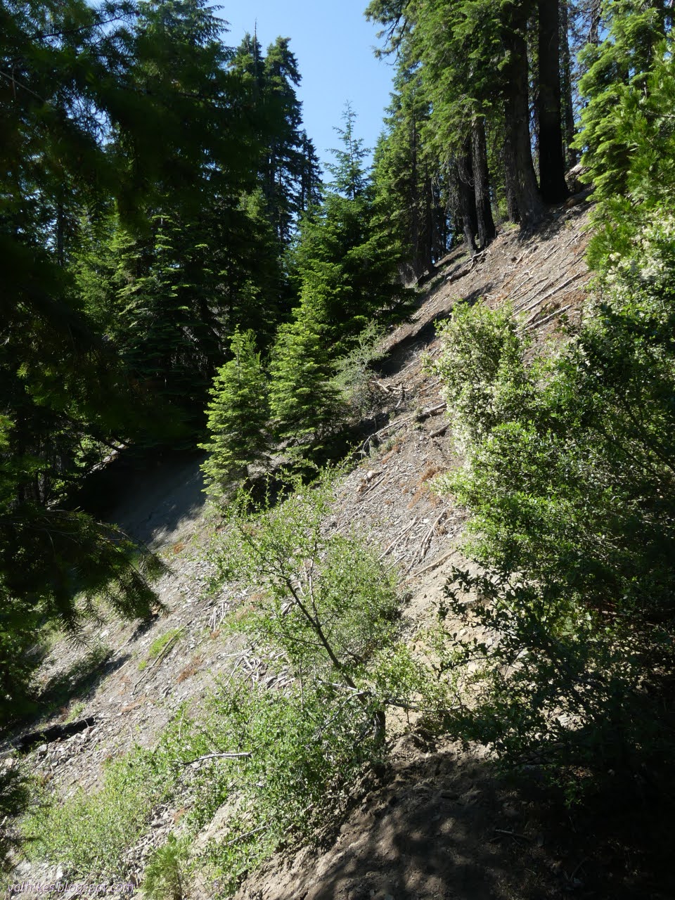
Trees line both sides of Coffee Pot, but if I looked too closely, I saw there weren't very many of them behind the most obvious trees. This is the southern edge of the 2015 Lassics Fire. I hiked up through the trees and flattened out into a devastated area.


Where the old road goes is not always obvious. I found myself more imagining where it might go instead. That might be an edge of it there and in between the trees are open along that line. Sometimes I just got up on a fallen tree and walked it because that was the easy thing to do. It's been a long time since that road saw any use and the ceanothus was happy to cover it. However, while under forest that survived the fire, the old road was faint but there to follow.


After a first stretch that was a lot of work to walk and a second stretch that just involved a few trees to hop over, there seemed to be a reflective surface ahead. Dry Lake was certainly not dry.

The map shows two lakes here with the old road crossing between. Today it's just one lake, but it is a bit shallower where the road crosses.

Since visiting these ponds was partly inspired by hearing others were out to find brine shrimp, I stepped to the edge to see if there might be something unusual. There's "sticks" that move on their own and a few other odds and ends that are pretty standard. I filled a clean bag and there's a few small things to see that way. Sea monkeys aren't all that big.

I'm not the only one to come visiting. The gravel leaves the edge not too muddy, but someone managed to leave a few prints recently. I suspect the normal way to arrive is following the outlet.

I walked around the gravel edge pondering the northern grassy end, then followed the road out the other side. Again, it is hard to follow, but the effort isn't so bad at first.


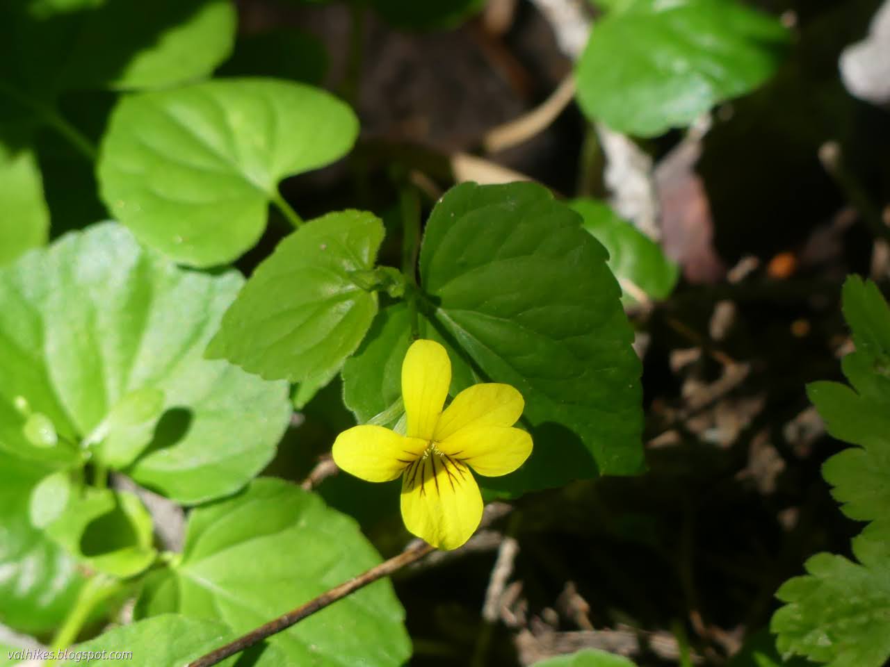
Higher and drier, I started to find the violets.


Travel got difficult along what might be old road and I spotted a ridge that would be much easier to walk plus a route to get to it. I must have got turned a bit at some point because I turned north of the road and ended up south of it. That part doesn't matter because I got what I wanted: nice view and easier walking.


Someone else has liked this spot too. I turned toward the nearby road and there was a large fire ring. Soon after, I came to some trail. This pops out onto the road next to a small stream.

I had thought I might go out to Goat Rock and see what's there, but decided to turn back instead. There's more water to visit along the way.


Where one would start to follow the outlet up to Dry Lake, I found a very faded sign for the Lassics Botanical Area, the designation before the Mount Lassic Wilderness.


I almost got back to the car, but turned down spur C instead to visit Not-A Lake. It shouldn't be too hard to get to since it's maybe a quarter mile from this road that is legal to drive. The Little Van Duzen River headwaters are somewhere below and before long I could hear them flowing.

There is a marked spring about a quarter mile down the road. After this, it bulged a bit and then there was a dirt mound of the sort that often marks a closed road. The current MVUM doesn't say it's closed. Oddly, few people challenge this little bump. After it, there's a big tree, then there's a complete washout. That could explain why no one bothers to go further. The cows have felt motivation to continue, so I had a solid track to cross that washout.
Road was easy to travel for a little while further as it was quite open and the cows have been traveling it.


After a half mile, the road is rather covered in trees. Considering the size of them, it probably hasn't had a vehicle on it since before the surrounding land became Wilderness. Why did they bother to cut out a hole for it? I found some of the travel difficult, but there were still paths, sometimes more around the road than along it.

I came to an expected road split. Right is the legal route for vehicles, left is the way I wanted to go and not legal. There's never been any attempt to block off the left. Why would there be when it is all inaccessible?

There's a bit of water over the road as it climbs the short way remaining over a tiny ridge. I avoided it to the left and the road came around to meet me again, but there seemed to be more road off to the right. Later, I spotted the lake through the trees to the right when it was expected on the left. I had found a different road past it.

The lake is a marsh with a little flow in by where I arrived and flows out the far side. The water I avoided on the way up isn't related to it as it flows the other way. I crossed over the marsh on a long log to get to the mapped road. It exists too. It likely just loops around the lake, but there could be more.

So that was unexpectantly tough. I had some lunch before turning back on the mapped road. Now to retrace my steps, give or take. At least it would be getting steadily easier as I went.

After getting back to the car, I went off to see Goat Rock after all. It wasn't worth it. Then I stopped by the little stream where I'd gotten to the road and found yet another violet. That's fully four different sorts of violet.

*even more photos in the album*
©2023 Valerie Norton
Written 19 Jul 2023
Liked this? Interesting? Click the three bars at the top left for the menu to read more or subscribe!


Comments