Fir Cove Nature Trail
Six Rivers National Forest
(map link)
One of my goals for this trip was to visit the North Fork Wilderness. The north fork it protects is of the Eel River. Officially, it has a single trail which starts at 3000 feet and drops to 2000 feet, but for me it would start at 4000 feet because that's the last of the good roads. Well, the good roads if they are being maintained to standard. The firefighter I chatted with after hiking up Horse Ridge was very clear that this last winter really hit this area hard. Mad River Ridge Road (2S05) across the top was a mess even. I'd not be able to travel that no matter how much I was looking forward to it. The roads up to it all had sunken spots. You might be able to get up there with some high clearance. Secret Gulch (27N34) was definitely bad as was Deep Hollow (2S12 right out of Ruth). But I'm not sure about the shortest one, Double A (3S13). It had no "road closed" sign, but it certainly climbs steeply on the side of the hill in a single lane covered in forest duff. I thought about how hot it would be at the low point and decided against trying it. It was time to go running for some high points. Another time. Goal 3 would remain unmet.
Also out was the Ruth-Zenia Road, the "good" county road that would get me over to Van Duzen for goal 4: visit the Lassics and see the lupine. That was disappointing since it would have been different landscape to drive through on the way. I had to drive back out to CA-36 instead. The road wiggles around so much, it probably isn't any further. While I was passing anyway, I stopped in the gravel parking area next to Bailey Canyon Campground once more, this time to hike the 2 mile loop through the campgrounds. My 2009 forest visitor map says it's an interpretive trail, but of course I wasn't starting at the right place to pick up a brochure. There's none online either. I started out the same as a few days before, but at the quick fork, I headed up the hill away from the bridge to hike a trail that could use some brushing, but had been cleared of logs. This first trail is the Lake Vista Trail (7E29) and it swishes its way upward to earn that vista.


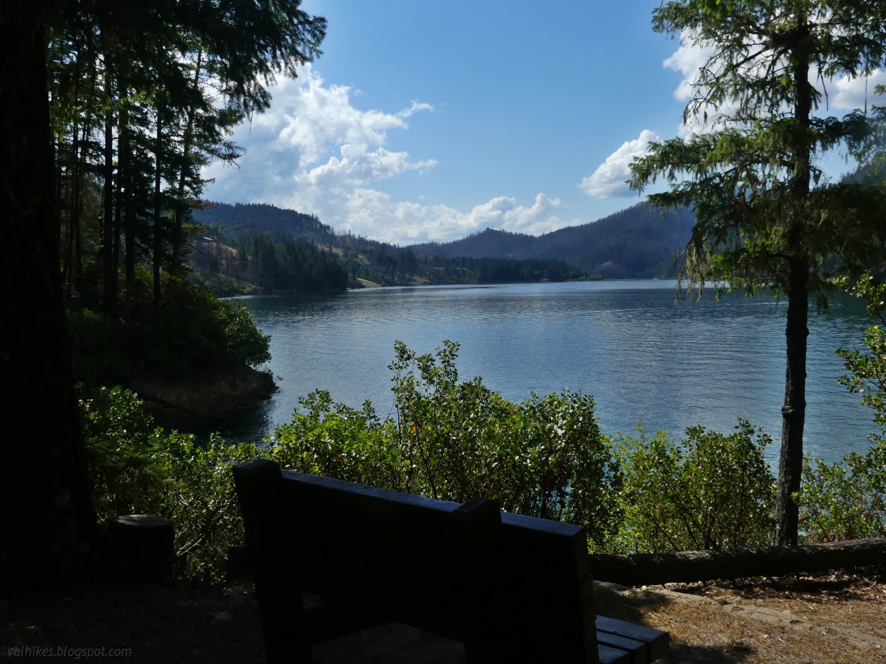
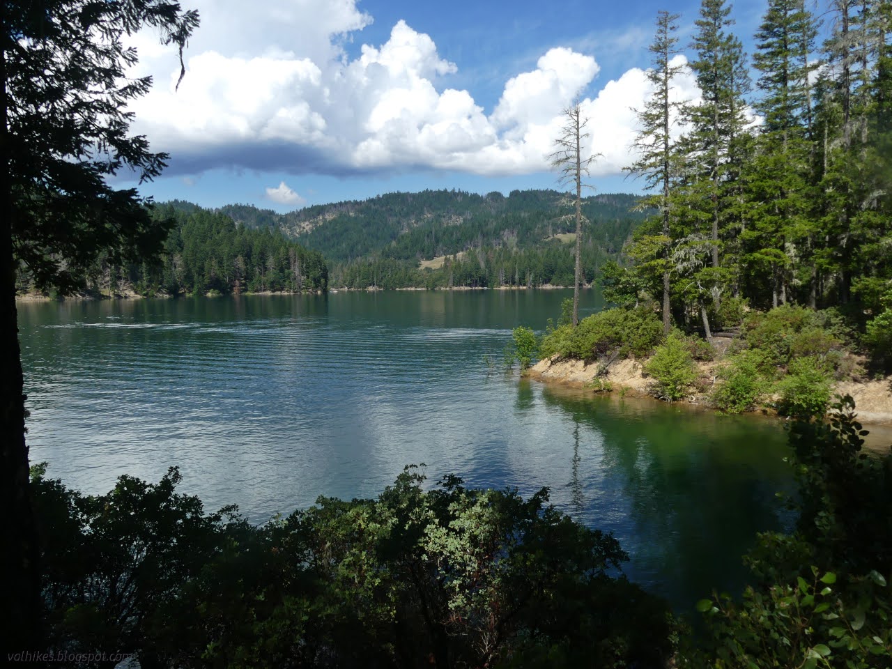
The trail runs into a bit of utility road and there was a split. I decided to check out the extra bit with no idea if it was official or not. There was a post for stop "8" of the interpretive trail along it, so it must be official. There's also two benches at the end (there used to be three) to take in the view of the lake.


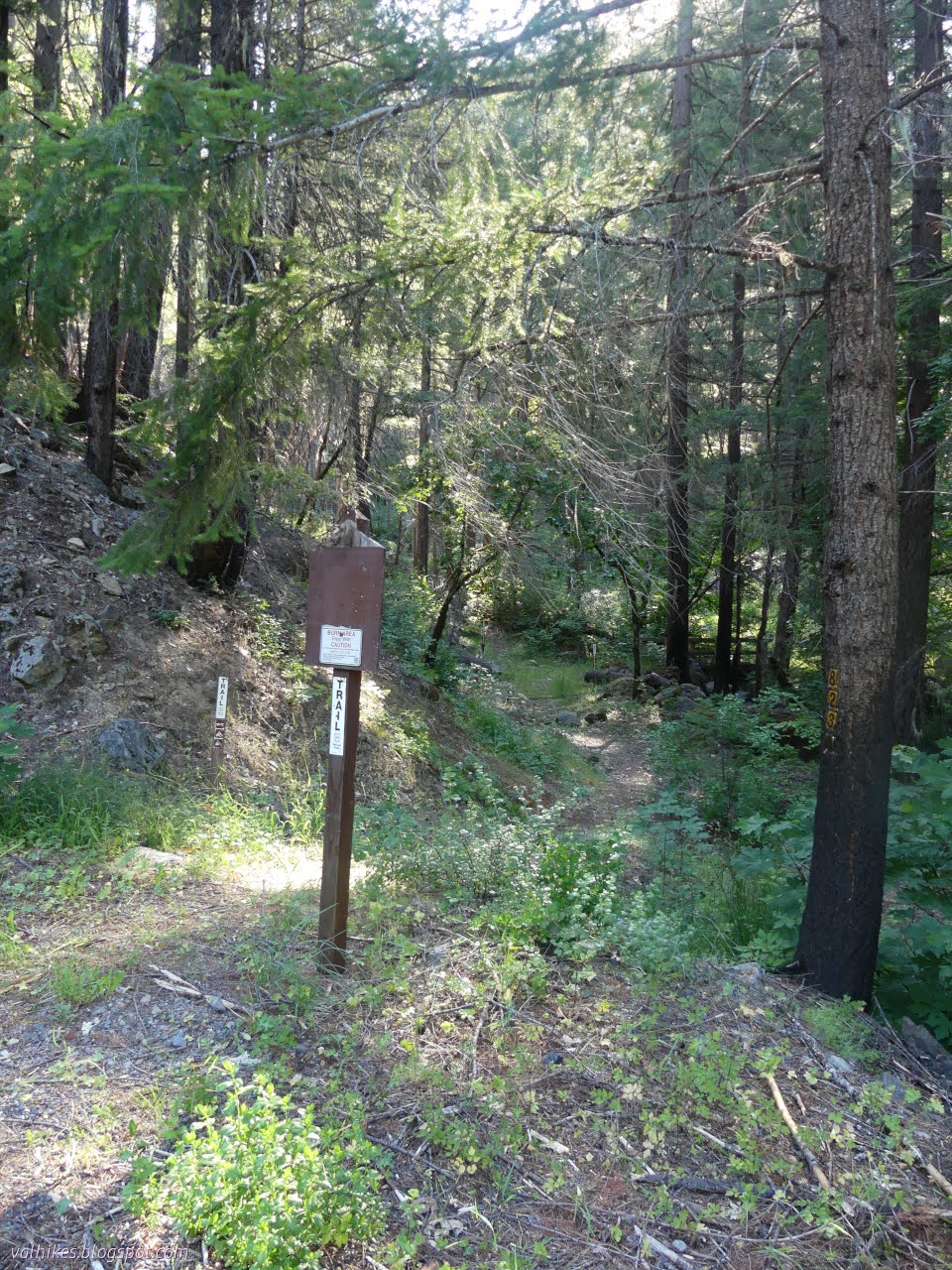
I headed down after snacking. There's a "4" post along the way, so I knew I was going in the "wrong" direction. Where the utility road gets to the main road, there's another short piece of trail to cut across to Fir Cove Campground below, then paved campground road to get around to the start of the Fir Cove Nature Trail (7E23). Both trailheads had photocopied FS topo maps of the area to show the trail, which doesn't show the spur to the view point. The nature trail also had a little trail name sign and a whole lot more building work as well as a lot more use. It did not have any sort of brochure, though.
I found post "16" along this bit of trail. It was on the other side of a tree and manzanita aimed to be read by people standing much lower than the current trail. I guess things got rebuilt at some point without the interpretive trail in mind. There's another well marked trailhead at Bailey Canyon.

From there, the loop is completed on the paved campground roads. Travel is much easier on the lower trail but the flowers are better above.
Incidentally, all the benches are mapped above. You can see them by clicking on the "POIs" tab and selecting them. They're easiest to find using the search. Some map styles show them automatically.
*even more photos in the album*
©2023 Valerie Norton
Written 12 Jul 2023
Liked this? Interesting? Click the three bars at the top left for the menu to read more or subscribe!


Comments