Horse Ridge Lookout
Six Rivers National Forest
Shasta-Trinity National Forest
(map link)
I had gone up Horse Ridge Road (3S12 and even has a little horizontal sign at the bottom of the road) and found a camp area without too many dead trees in the immediate vicinity near the first big intersection of roads. That gave me a little over 4 miles to walk to the lookout, so that's where I started in the morning. At the next intersection, there would be (according to the map) a trail option for a short way. At the intersection after, there would be a trail to the road at the top, leaving just a short bit more on road to the lookout itself. The area is still in the footprint of the Hopkins Fire 2020, part of the August Complex that burned over 1 million acres. A firefighter who stopped in the afternoon to talk and educate said there was also an incident where some fool set off the piles, but that fire doesn't seem to be recorded on Caltopo.

Travel was quick along the smooth, gently rolling road. There's not a lot of elevation gained on this part of the road getting to the next junction.

That next junction comes with a big, slanted meadow on the east side and view through the burned trees on the west. It didn't come with a trail splitting the difference between the two roads. I headed up the middle anyway. It's possible the "trail" is the mystery gated road that comes up from the left road (spur A, 3S12A). It certainly became decommissioned road by the end. It was likely used in some recent year as a logging road and wasn't getting much more interest to challenge the dirt mounds blocking it.


I didn't really want the trail up to the lookout to be similar to the start of the first trail. After the short way to the next junction, I found it wasn't. It is, in fact, a Jeep trail. This junction represents the end of anything maintained for lower cars, but I probably could have driven that Jeep trail right up to the little loop of road about 2 miles from my camp. After that, it gets steep and soft and you might not even want to run your AWD on it. I didn't regret walking instead of driving. The day's hike was short enough already.


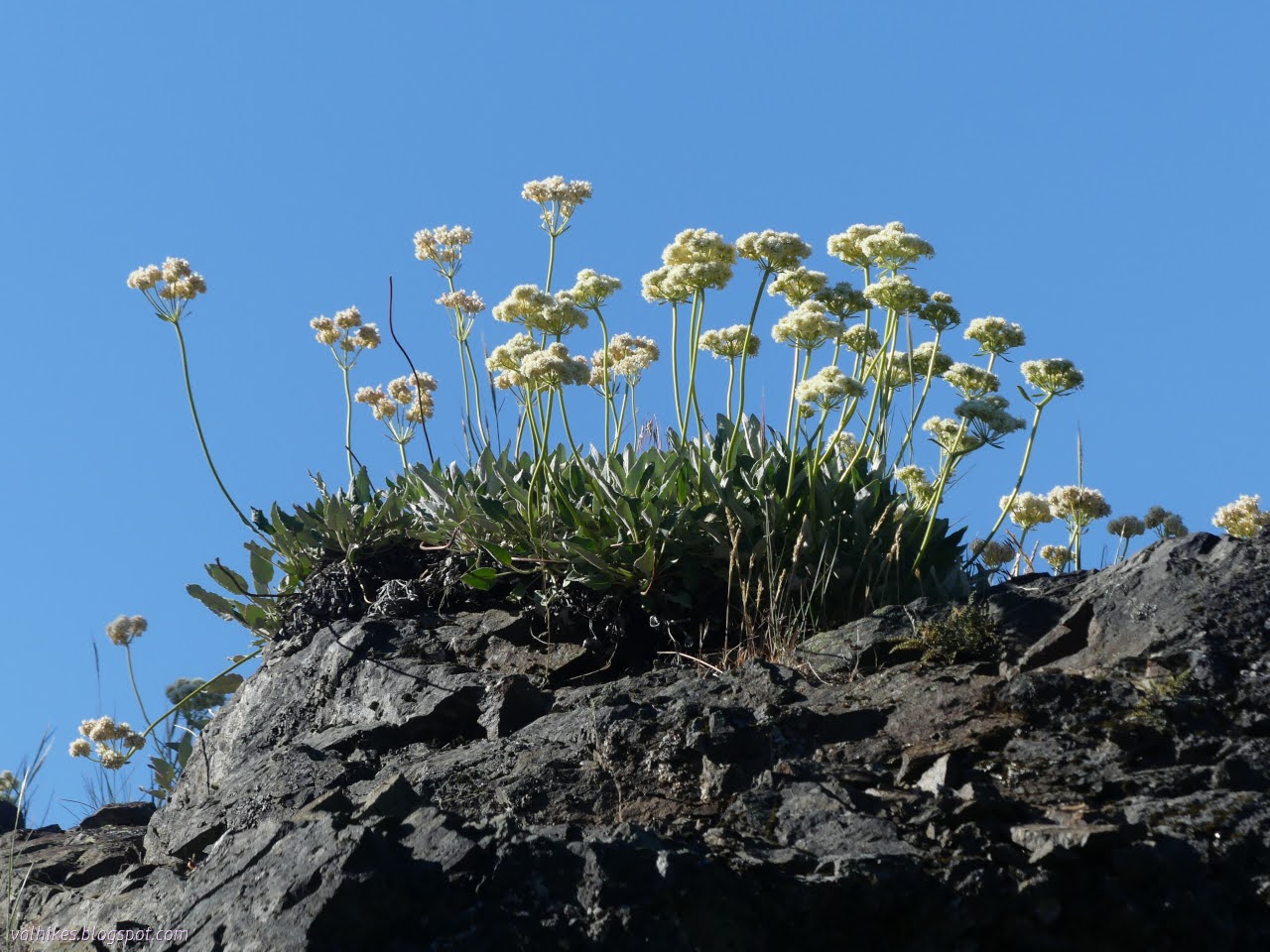

I started on the steep trail, much harder than the walk up until then. I found frequent excuses to stop a little, though. First was the marked spring. I didn't find it, at least not on the way up. It's marked a little too far up the hill. I did find plenty of monkeyflowers and other things that tend to moister areas.


I reached the top of the Jeep trail without even having to jump over a fallen tree. The rest of the road was just as clear in spite of the bad burn that had taken the nearby forest.

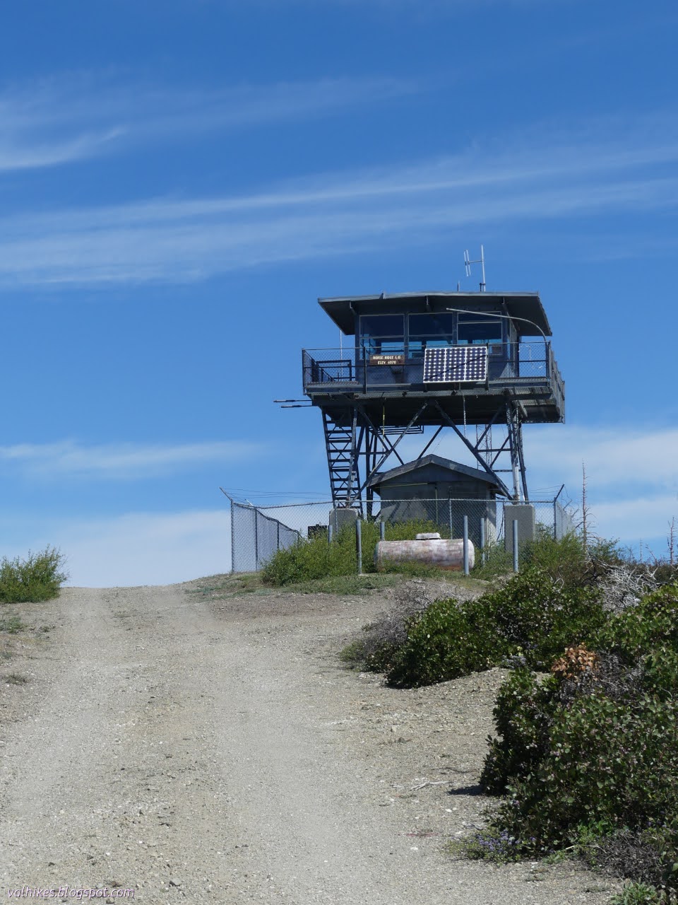
Horse Ridge Lookout is still manned, which means you can get to look around a working lookout, but only if the person is around. The shutters were up and the radio squawking, but the gate in the fence and in the observation deck were locked quite tightly. No one was home, so I was restricted to the ground. As suggested by the height of the lookout, you can see quite a lot of the view from the ground.


It was only noon, loads and loads of daylight left, when I turned down. A much quicker hike than the day before. Admittedly, I got started earlier without the 2 hour drive to get there, too.


I followed the hints rather than the map and found the running water of the spring on my way down. The area is crowded with flowers.


I looped around on the extra loop of old road, which wasn't any longer than the used road. The purpose of it? I'd guess a mine. It didn't get on the map.


Once back to the good road, I stuck to it all the way back.


So that's all the lookouts on South Fork Mountain visited. It was still mid afternoon, giving me plenty of time to read, boil up a pot of beans, and chat with the aforementioned fireman out of Ruth who gave me the low down on all the roads. This last winter hit some of the roads hard and there's some random drops of a foot out there. I think it's the first wet one since the big fire.
*even more photos*
The other lookouts on South Fork Mountain:
Pickett Peak Lookout | Cold Springs Lookout | Blake Mountain
©2023 Valerie Norton
Written 5 Jul 2023
Liked this? Interesting? Click the three bars at the top left for the menu to read more or subscribe!


Comments