Grasshopper: Homestead and Baxter to Whiskey Flat
Humboldt Redwoods State Park

DAY 1 | DAY 2 | DAY 3
I decided the perfect way to celebrate Earth Day was to launch myself on a three day, forty mile backpacking trip after not really having any proper hikes since November. Or perhaps it just happened to be the day after quite a few days struggling with what might be my route and two hours of packing to grab the three day window before rain started again. I preferred to be hitting new-to-me trails, lesser seen trails, and stop by the Children's Forest. I got some of that. The thing is, you must stay at one of the five trail camps that have been built, which can be a bit limiting. There's a three night max, which isn't so bad. (Per camp or total? I didn't ask and this requirement isn't mentioned in any of the online material.) No dogs allowed, as usual in the State Park. (Nor cats.) They're so emphatically against wood fires that they stamp it on the map with the name of each trail camp. All rules I can deal with. I got myself registered and paid ($5 per me per night) at the one open campground after making the mistake of thinking the Visitor Center might be useful for that. It's not. Then I headed off to the bottom of the Look Prairie Road to park. The campground attendant promised that my car would be broken into and wheels stripped if I didn't hide away at the usual backpacker trailhead at the bottom of the road to the Grasshopper Mountain Lookout. I'm not so sure a place where people can expect unattended parked cars and privacy is the best backpacking parking choice.

Since packing, I had decided to stop at Whiskey Flat instead of Hanson Ridge, so I purged my pack of the bear can because both camps would have boxes. And I was off! Heading west on Homestead Trail. I've done it before, but it's a nice and easy trail under big old growth trees and makes an excellent connection. I'm quite willing to hike it again.

I was almost immediately rewarded with a patch of fairy-slippers right at the edge of the trail. Try finding that one a trail with dogs allowed. They're much too delicate and dogs much too casual about where they step.


When I said I'd be going this way, I was cautioned that the trail could be in any shape after the winter. It looked like it had already had maintenance. Curiously, no worries about the state of the upper trails.


There's a little winding past roads to be done once at Albee Campground. The overflow parking is a possible safer option for parking once it opens in May. From there, I was on new-to-me bits of the Homestead Trail. I should have noticed while planning that it crosses over Bull Creek briefly. ("Probably still too big to cross.")
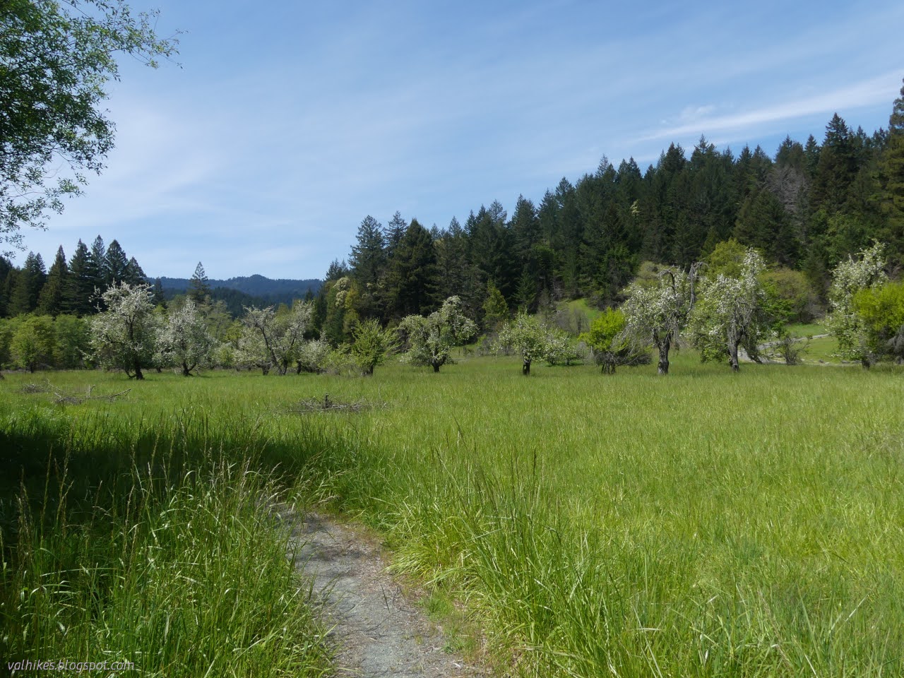

I was only expecting to deal with one ford right at the end when I wouldn't care about wet shoes. Here were two right at the start. Crossing the meadow had been so warm, I elected to step right in.


Once I had my feet really wet, I was back under forest where it could be cooler. It didn't seem as cool as when I started, though.


Trail split left for the Hamilton Barn Environmental Camp and right for the trail. The camp is closed and will stay that way this year for some work, but I went around. There's a tree to cross Mill Creek on, but also some strong encouragement to jog over and use the camp bridge instead.


I found a poster about stream restoration as I landed on Mattole Road. The area around Bull Creek had been closed for it. I lucked out and had no cars as I took the quarter mile of shoulderless main road over to the access to Baxter Environmental Camp.


I stopped and ate at the first site table. The gate was open, but the sites are closed until May. Then I wandered around a little. On the far side of site 2, I found a closure notice illustrating the recently closed connector trail I could have taken instead of the road. (The closure expired in November, but the sign still waits to be picked up.) It would have meant one more ford of Bull Creek. Oh well. Upward!


I came up to Grieg Road at one of the few signs displaying its old, derogatory name. It promised a little over two miles to the camp. Grieg Road, or Grieg Multi-Use Trail or Grieg MUT, is not a public road, but parks trucks use it for official business. It's wide and compacted and smooth and very obviously road.


The road left the vicinity of the ridge and the temperature seemed to drop around one turn as I got closer to where Whiskey Flat Trail Camp was marked on my map. Water was seeping from a few places and a slow flow crossed the road.


But then there wasn't a camp after all. In the defense of the person marking it before, they did put it exactly where the park claims it is. It's not that much further.


No big worries that it is misplaced slightly on the map because the camp is easy to spot. Just as the trees get even bigger, there are the trappings of the place.

So what's a backcountry camp like at Humboldt Redwoods State Park? Well, they've gone through the trouble to build a spigot for easy water gathering and a trough below for horses. Unfortunately, the spigot wasn't going to give any water and the handle on it was broken anyway. It is right across the road from the outhouse, this one without any traditional moon/sun style light holes and getting quite full. Flat ground is most abundant on the road, but you might want to be wary about using that. There's a couple flatish spots below it. A small stream passed nearby with a delightful and solid flow that was swallowed up by the ground about 200 feet below the road. Three camps have bear boxes and this is one of them. It was a very solid and new looking affair.


So, a middling camp with luxury extras, until you add in the location, and that's really what it's all about, right? I set up among big, old growth trees high on the mountain. Happily, the mildly windy weather prediction didn't pan out and it stayed nice and calm.
Same trip, next day ⇒
*photo album*
©2024 Valerie Norton
Written 3 May 2024
Liked this? Interesting? Click the three bars at the top left for the menu to read more or subscribe!


Comments