Grasshopper: Hanson Ridge, The Excursion, and Grasshopper Peak
Humboldt Redwoods State Park

DAY 1 | DAY 2 | DAY 3
I didn't have very far to go for the second day, just around from Whiskey Flat Trail Camp to Grasshopper Trail Camp. However, I had a few excursions planned for the day. First would be out along Hanson Ridge (or Hansen Ridge on the map). Second would be something off toward Bull Creek Trail Camp. Exactly what, I wasn't sure. The proposed route on my map was following a decommissioned road past a likely gone barn to the camp, then back up following the South Prairie Trail. It annoys me that there's only one route connecting the trails that come up from the Perimeter Road to those around Grasshopper Mountain. Third would be a quick round up to the fire lookout at the top of the mountain after getting to camp. Since Grasshopper is a dry camp, I would have to collect water on the way. The most reliable option is a stream that Grieg Road crosses shortly before arriving at the junction with Grasshopper Road. I could grab it and leave it at the junction during the second excursion.

I had a CalParks truck past before I got started and a grader by after. Good thing I didn't opt for the flat road to camp. My weather report before I started had fog for the morning and it was reliable. Silly me to be headed for the views on Hanson Ridge.


The signed junction with Hanson Ridge is easy to spot and the road it marks much less used than the one I was on. It probably got the trees cut out of it sometime last year. Certainly no one had been driving over it today. There's a sign about watershed restoration next to it and irises growing right across it.


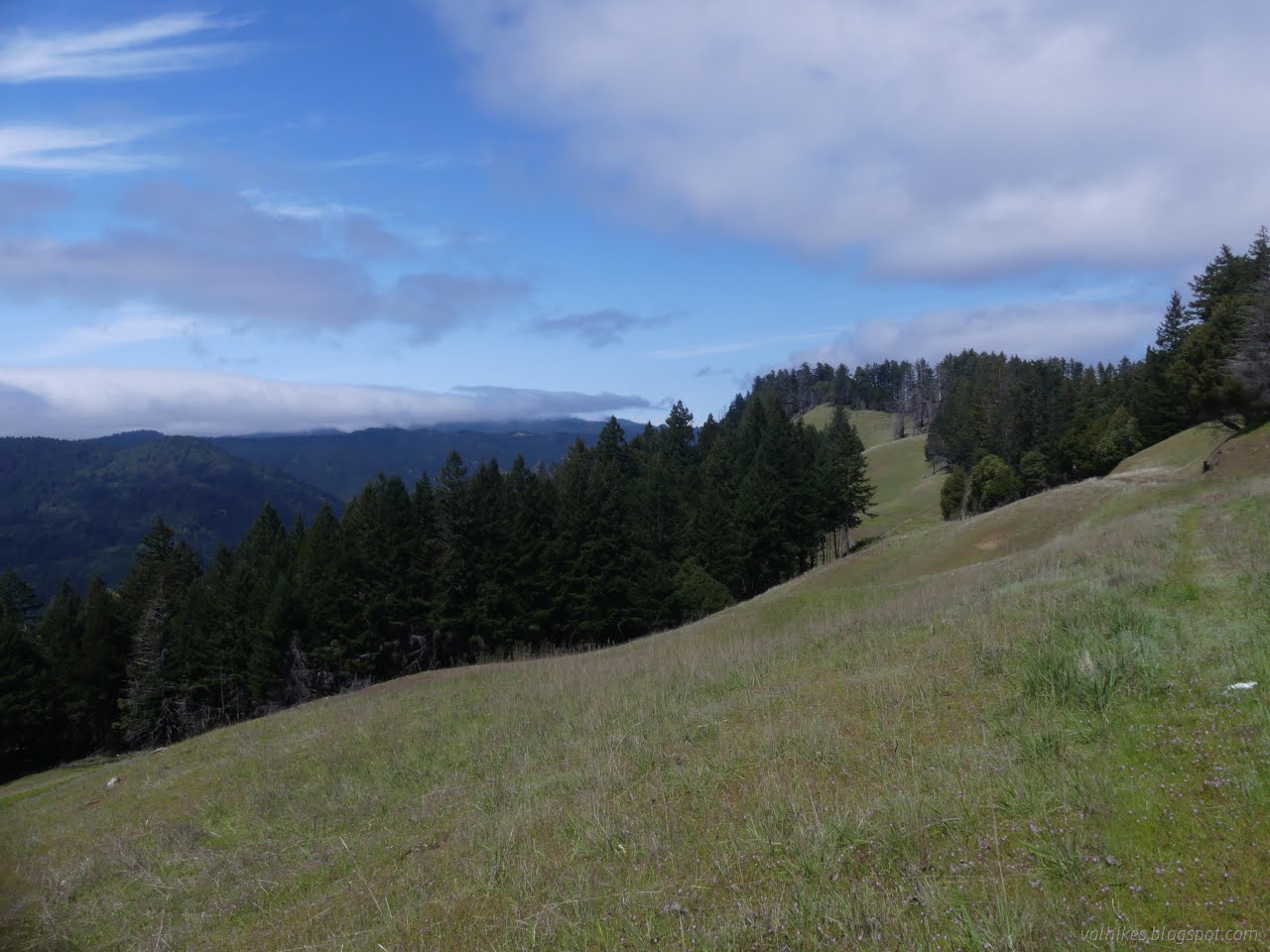
The trail follows near the top of the ridge, often on the east side, through a bit of prairie and sometimes a bit of forest. The prairie was full of little blooms, although I'm sure a few aren't really supposed to live here.


Maintenance ended at the junction sign for the trail camp. Perhaps a few of the trees right at the start of the trail had come down since the maintenance was done, but the one that was cut to clear the road but not the trail seemed a little odd.

I headed down to check out the trail camp. The downed trees are quite a problem for about 20 feet, but then it is back out on the prairie where the problem is just finding the trail. I found it on the way up by the little bit of cut into the hillside. The outhouse at the edge of the trees below provides the best marker for where to go.


From the outhouse, I followed faint trail downward to find water. The official watering hole, since it has a spigot that doesn't do anything when turned on. It's in the bottom of a steep little ditch. More trail goes downward, which might be to more reliable water. On the other side of the camping area, I found more water flowing in the bottom of an even deeper ditch. All this water is said to dry out. There is no bear box, so you have to bring your own food protection.


I headed back up to the trail above in the sun. The sky had obligingly cleared while I poked around the camp.

I continued along the ridge trail to the end. As long as it stayed under the trees, there were trees to step over, and it spent most the time under the trees. I almost turned back twice. But the views! Good luck to the horses and bikes who are also allowed to use this trail.


I wouldn't be surprised if there wasn't once road continuing down the ridge. There's the suggestion of one dropping through the stand of regrowing madrones at the end of the little prairie. More clear is a little loop to take one back. Somehow, the return was a whole lot easier than the outbound journey.
Back at the junction, I turned right, away from the so-called "trailhead". It's even signed as simply "trailhead"!


The road did pass by some water. There were a couple spots including one with a trough (but the hose needs set up again to get water into it). Unfortunately, I had decided I didn't really want to carry all that water up that hill. I wanted to try to find some at the top of North Fork Canoe Creek. It is a heavy blue line on the park map, which is a claim of perennial flow, and almost next to Grasshopper Trail Camp. There's another a little further off trail on the other side of the camp for backup. I could get water there. Or at least I desperately hoped I could.


The grader and truck, well spaced, came back by. I think if I'm going to share the trails with others, I'd rather they weren't driving heavy machinery. Even the high pitched electric mountain bikes that passed me on Look Prairie Road weren't so loud.


The junction came, so I turned for whatever my second excursion would turn out to be. The sign mentioned that Bull Creek Trail Camp was 3.6 miles off, so actually going all the way to it seemed mildly unattractive. It would make the day a little long. Just doing a trail and road loop sounded good.

Still, when I got to the saddle where once one could easily cross over to another road, I had a look over. It's definitely been removed. But it initially passes through prairie and it's passing through prairie over by the possible barn (according to the satellite view). I yielded to the temptation and wandered off that way.

I found a little more trace as I got to the end of the prairie and there's definitely old road once in the forested areas. It has plenty of wood downed on it. Animals are still using the route. It was slow, sometimes vanishing, but generally usable until the stream crossing. This looked a bit like there had been a crossing that washed out and was replaced by a higher crossing. The possible higher crossing was no longer usable. Animals were using the lower one. It was a big climb down from road bed to creek and then back up to road bed. I wasn't sure I'd be able to find a hand hold for the way up, but it was merely difficult once I tried it.


I found stumps from logging and an old culvert pipe and even pink ribbons with black polka dots marking some way, but I didn't find much road and where it did look like a road bed, it was covered in downed wood. The ribbons seemed to run out. I had somehow eaten through an hour already just getting past easy prairie and a short bit of woods and all I saw in the direction to go was more woods. This attempt would just have to end.

I toyed with trying to connect with the South Prairie Trail, but the sight of a rocky cliff by the creek further down put an end to that. I followed the ribbons shortly, then let them go off to whatever crossing they favored while I crossed at something I'd seen a little lower than the first crossing. It was a bit easier except that animals hadn't been using it.

Again, the return was a whole lot easier than the outbound journey. It was still another hour to get back out of the woods, across the prairie, and back up to the junction with Grasshopper Road. My second excursion had really not worked out and I was kicking myself about the fact that the laziness regarding water probably wasn't going to work out well either. There's a bit of detail about this and a few other roads that used to be legal multiuse trails on Redwood Hikes in the Historical Notes on the Bull Creek Trail Camp page. Bridges were damaged in a big rain year and the trails were ultimately removed rather than repaired. The South Prairie Trail was added as some sort of compensation, but it really only supplies a small variation of route possible, and that only for hikers and equestrians, so the bikes are still left out. The old roads went to new places and provided a second connection between the upper and lower areas of Grieg Road.

Grasshopper Road is much less used by CalParks vehicles, perhaps because it edges along the Bull Creek State Wilderness. It was grassy in many places and there was a small log to step over and sticks to avoid. So, nothing worth mentioning after the previous struggle. I kept an eye and ear out for running water at each crease, but it follows near the ridge top the whole way and there was nothing.


Happily, as I drew nearer to the upper reaches of North Fork Canoe Creek, I could hear water flowing. I still didn't see so much as an animal trail over to it, but there should be a way to water without going halfway back to Hanson Ridge. The trail winds higher near the creek to a point I had identified as the best chance for easy water. There I saw what I sort of expected but didn't dare hope for: not just trail, but old road bed. The road splits and the clear road goes up. Road covered in 10 foot madrones drops a little. There was still plenty of room to scramble along it to a concrete spring box, locked tight with iron. I'm not sure if it serves its purpose anymore as water flowed past it, but not out of the crack at the top. My water gamble had paid off!


The spring box had pipes going up as well as down. The lookout above would likely have had a water supply that didn't need to come up in a tank, so maybe this was it. It would have taken a bit of effort to pump it up there. Maybe there's just another spring box for whatever is below. I have no idea how reliable this source is since many things should be flowing this time of year.

I filtered a bag for camping and grabbed some more for the hike down the hill in the morning. Then it was back up the madrone choked spur and around a corner to camp.

I dumped gear and food and freshly obtained water into the bear box at Grasshopper Trail Camp, then shouldered what was left in my pack and turned to excursion three: a second trip to the top of Grasshopper Mountain.

The trail is getting used, but there were a couple big trees to step over and some annoying brush on the way up. It could use some maintenance.


By the time I got to the top, it was even foggier than the first time I came up to bag this peak. Maybe I should have left the water for later once I'd confirmed there was some reachable nearby. Maybe I just shouldn't have bothered with excursion two.


I didn't stay long at the top since it was already late and there was getting to be even less to see. I headed down via the road where the bikes and horses are also allowed. It isn't as nice a route.

Back at camp, I settled to making some food and set up the sleeping arrangements while it sat heating after the flame was out. As I ate, I started to heat big plops onto my tarp. The trees were bringing down the fog or actual rain? I'm not sure, but it got a lot more regular just after I got everything cleaned up and put away and it didn't let up all night.
Same trip, next day ⇒
*the photo album*
©2024 Valerie Norton
Written 6 May 2024
Liked this? Interesting? Click the three bars at the top left for the menu to read more or subscribe!
Comments