Boulder: Fire Hole Lakes, Full Moon Lake, Junction Lake, Dream Lake, Rainbow Lake, and Middle Fork Lake
Bridger-Teton National Forest
(blue line, map link)
DAY 1 | DAY 2 | DAY 3 | DAY 4
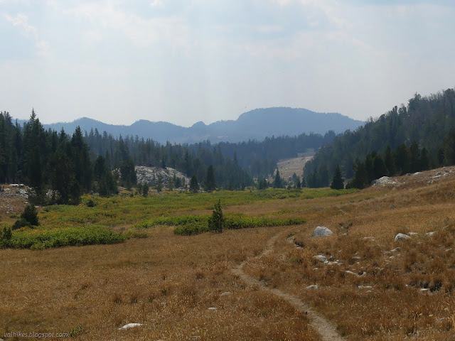
I wandered up the hill to the east of my camp and found what looked like a better option until I noticed the one huge hazard tree that looks like it wants to fall over the whole camp any minute now. Then I packed up and got on to the Highline Trail going south. On the way up, there were a few trees on Boulder Canyon Trail, especially on the highest bit. There were even walk arounds trying to get one a little lost in the last mile. It wasn't too bad, though. The little bit of Highline I'd walked north along the lake was looking less maintained. I hoped once I got going south, it might get better, but just past the junction is a mildly extravagant walk around. Only mildly. Hardly anything compared with the worst of the day. The main camping area appears to be to the southeast of Lake Vera. I didn't explore it enough to evaluate the hazard tree situation. It's probably just as bad as everything I'd looked at and discarded along the west side of the lake. Once I left the lake, there seemed to be a tree down every 200 feet, but getting over or around each was only a small task. The overall effect was a much greater effort than the miles would suggest. The trail to Lake Isabella came much earlier than expected as I hiked, checking the Forest Service map, but the OpenStreetMap users had marked it correctly.

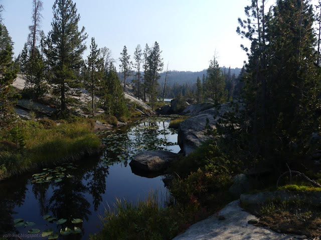
That work brought me to a particularly lovely lake. I had to step off trail a little to get a really good look at it, but it was worth it. I grabbed some more, easier views of it as I walked around the edge.

It was in the approach to the next of the Fire Hole Lakes that I found the worst piece of trail for the day. Trees full of branches covered it repeatedly along a hillside and I just had to give up on it entirely for a while, walking much closer to the stream and lake. I was watching where the Highline traveled when I found two lines to track instead of one. The lower one was a bit of extra trail that circles through the Fire Hole Lakes. It almost caught me except that OSM warned me it was there. I still used it to get a good look at that second lake.


From there, it was back to a tree every 200 feet, but only requiring a hop or a drop or a little walk around to get past. I passed some small lakes, but mostly there were just trees (and too many fallen) for view.

The fallen trees thinned as I got near Full Moon Lake. I navigated one last one on a switchback on the way down to the water and encountered a pair of hikers coming up. I asked if it was a hurdle-fest up ahead and they just gave me confused looks. It wasn't the last tree for the day, but there weren't a lot more! So I ended up warning them about what was to come, but assured them that even if it couldn't be walked, it could be followed all the way. Maybe that wasn't reassuring after all?


I settled down by a fire ring so old it was sinking into the grass. I found a fancy Thermarest sit pad next to it and called up to see if the hikers had left it. There was no answer, but the mouse bites suggest it had been there a while. So I found a space to pack out the trash, which turns out to be a much better sit pad than the plastic bubble mailer I had with me already.

Then on to Junction Lake with much easier walking.


I came upon huge Junction Lake and wondered what it was named for. There's usually a big junction next to lakes of this common name. No official trails still junction here. OSM shows a trail going north and perhaps that is still a major junction because that's about where it started to be very hard to find the trail.


The trail confusion started out innocently enough with finding a camping area and not being sure which trail out of it was the correct one. Just sort of going the right way and looking for a well used crossing at the nearby creek found the trail again as well as the second one going north to connect with Fremont Trail (which is what the Continental Divide Trail follows in this area). I had trail again for a while, but it gradually faded. I was following cairns for a while and there were almost enough of them.
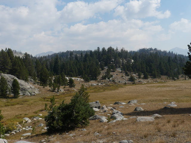
As I passed through these meadows, I was delighting in the yellowing willow leaves and the nice contrast with some red leaves I was thinking of as "the other willows". I finally took a close look at them and found they're not willows at all. They're blueberries! Or huckleberries! One of those round edible things and there's berries on them! They were almost too small to taste, but what was there was yummy.

My trail had lacked tread for a while and I was following cairns when I ran into a very clear and well used track running at a right angle. None of my maps could tell me what that was. They all say I should keep going straight on Highline to get anywhere. I followed two more cairns and ran out of those, too. Looking carefully in all directions, there were two that paralleled the mystery trail, but on the other side of some trees. I decided to give the mystery trail a try.

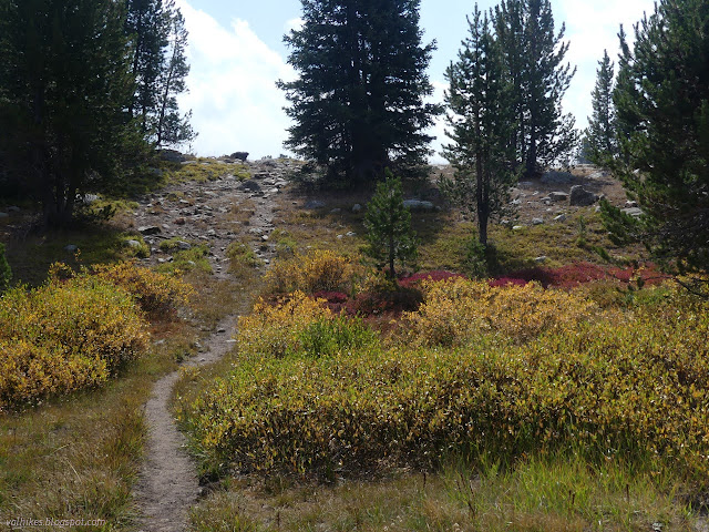
The trail just continued directly south as my nearest destination continued being directly east. It would start to tilt that way, then tilt off again. It seemed like it was a version of Dream Lake Trail that shortcut Dream Lake, which was entirely not what I wanted to be on. I told it it could go wherever it goes on its own and took off across the easy landscape for Dream Lake. I can't imagine anyone wanting to shortcut that lake. It was the finest lake of the day and there were some pretty good lakes.

I found a nice rock for lounging and took in the view of the lake and peaks with a snack. I noted there was a well used camp site off to my right. I wandered down toward the junction of Highline Trail, Dream Lake Trail, and Middle Fork Lake Trail. That last is the continuation of Dream Lake Trail and I found it right where it was supposed to be north of the junction. I didn't notice when I crossed Highline Trail again.


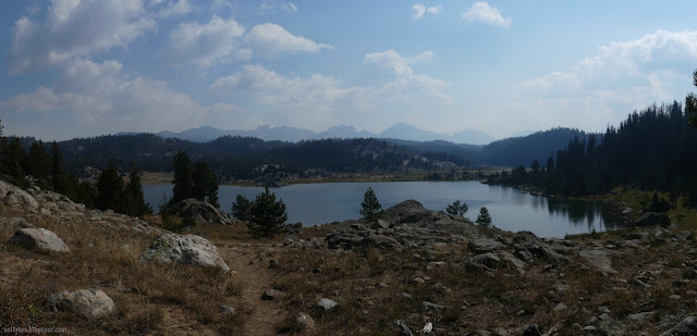
There's a lot of extra trails in the area and many have been recorded on OSM. I noted one beside a stream that was likely a shortcut to Rainbow Lake Trail. That's the other end of Middle Fork Lake Trail, or was when that went all the way over a minor pass. Rainbow Lake was my minimum goal for the day. I wound my way along a different shortcut, then on Fremont Trail (and the CDT) to get to it instead.


Rainbow Lake Trail 112 is thin, but very clear. It only gets one to the lake, according to the Forest Service. Beartooth mark trails on both sides of the lake and a bit more continuing up and over. OSM marks a bit less.


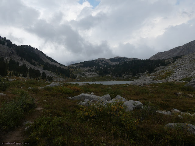
While Rainbow Lake was my minimum goal for the day, I really wanted to get to Middle Fork Lake. I just wasn't sure I would have time for the extra 3 miles of unmaintained trail between them, particularly since there was weather expected for the afternoon. I was early enough to the lake that I decided to go on. The east side trail is clearly the better used, but I went west because it's slightly shorter. I noted a few camp sites on the east side.


Trail was easy to follow until it started rounding the top of the lake. I think there might be one heading up through the left pass visible above. It might not be going the same place. I worked my way around to join the trail shown on OSM. There were actually two at first, one on either side of the creek. I followed the one on the east side until is clearly crossed to join the west anyway. Then up into the approaching weather. The trail wasn't so bad. As long as it gets feet, it really doesn't need maintenance up here.


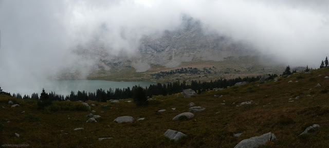
The line on OSM ends shortly after "Graces Lake", but I had trail all the way to the top of the minor pass. I also had the distinct smell of smoke and generally became convinced that when I got to the top, I would see flames. Well, if the clouds cooperated. The clouds, which were clearly not all smoke, were billowing something fierce over the pass.

Right at the top, the smell of smoke was strong and fresh. Dropping down again, it vanished, but I really couldn't see anything. I followed trail only shortly before losing it, too. I doubt I'd have been able to follow it much better with better visibility, but I might have. I found bits and pieces that might have been trail on the way.

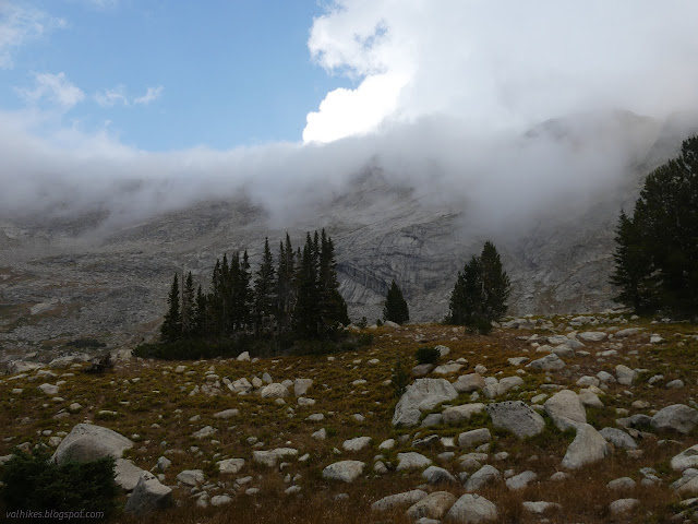
I found a big, beautiful squared off boulder to hide behind. A sleeping bag could be squeezed in next to it and it would shield from the wind. My hoped for camp was on the north side of the lake. I pulled on all my puffies, pants and jacket, and pondered if I really wanted to stop by the boulder. I watched the clouds developing across the lake and then turning the corner to power up and over the minor pass. At least half of them were lake effect! It wasn't passing over the north side, so I continued on. I wouldn't have been the first to squeeze in next to that rock.

I'm pretty sure I was on trail as I crossed the inlets. There were two thin ones and then a major one that was excellent for collecting water. I climbed up and poked around the trees to find a spot to camp. My coat got another nick from a branch as I found the spot I ultimately used. I had climbed from the trail to find my camp and there was another trail above me. One might have been the abandoned official one.
On my way to collect water, I noticed I had neighbors. There were three tents, though I could only see the little red one, up on the crest by the next lake, taking on all the weather. The wind wasn't that bad and it only snowed a little.


And there wasn't the slightest hint of a flame anywhere. Wherever the smoke I smelled at the top was coming from, it wasn't this valley. I just hoped the weather would get rid of the murk of smoke my views were suffering from so far. The storm was supposed to be quick moving. I also got a little worried about being warm enough. Here I was, camping near the highest point of the trip as some cold weather barreled through.
same trip, next day ⇒
*Bridger 2022 photo album*
©2022 Valerie Norton
Written 22 Nov 2022
Liked this? Interesting? Click the three bars at the top left for the menu to read more or subscribe!


Comments