Boulder: Boulder Creek and North Fork Falls to Lake Vera
Bridger-Teton National Forest
(purple line, map link)
DAY 1 | DAY 2 | DAY 3 | DAY 4
My original plan for backpacking in "the Winds" was to hike out of Boulder Lake where there are two trails for easy loop making. The road is nice as far as the county maintains it, but after the driveway for the Boulder Lake Ranch, it gets narrow and rougher. I took one look at the rocky hill down to the hiker parking and decided I liked the nominally 4x4 road to the corral better, so that's where I parked. It has an extra hill to get up at the end, but there's a bonus toilet. Both trailheads have registers. The comments gave hints that the level of trail work might not be as high here. These trails don't get quite as much use as the ones at the end of Skyline.


There's a shortcut trail that drops down to the road and the actual trailhead inside Boulder Campground at the end of the road. I had basically the same stuff packed up as before. I couldn't get rid of any of my rain gear because now I was expecting some weather to roll through even if it had just been hitting more record highs the day before. It would get quite cold indeed as I hit the highest places.

After a short distance, there's a junction marked with Blueberry Lake for that other direction. Then it's across a bridge to hang out beside the ranch on some rough roads on the way to the wilderness. There's clearly been some parking of ATVs next to the sign, likely from the ranch. After that, it's back across another bridge and properly into the wilds.


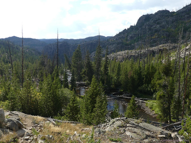
Then on beside the creek under the trees for a while. There's open spaces for views and hints of the season to come on the aspens. A marshy spot fed by tributaries on the map. At first it was dry, but the beaver dam filling the space under a little bridge probably tried to make it otherwise. There was a little more water behind another dam, then a great expanse. Perhaps the successive dams make the last lake drain more slowly.


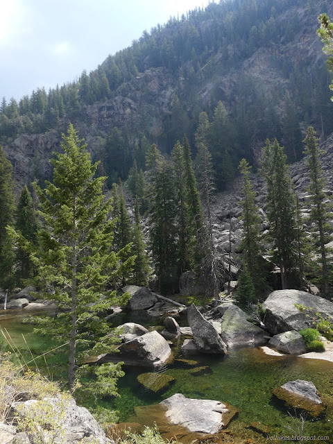
One stretch looked particularly popular for camping. Big rocks surrounded by blue waters and more pools looked like they might be a great place when the summer weather was really kicking in. It looked like there was a large camping area tucked into the trees.


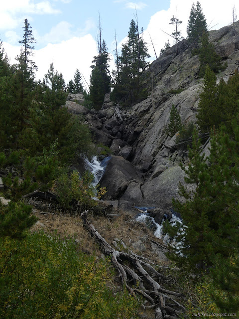
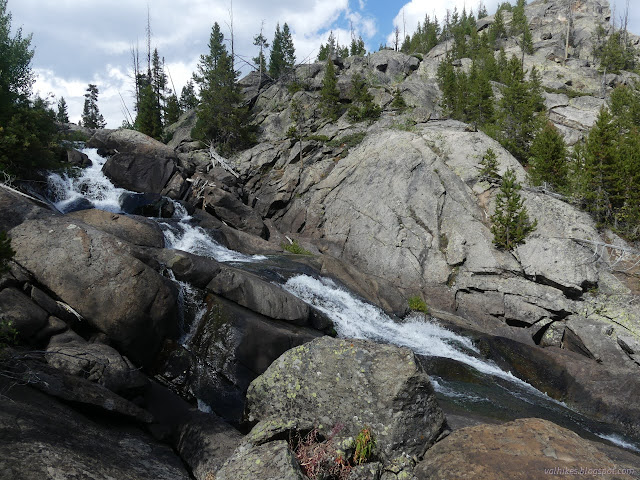
After the camp, the trail gets into a climbing mode. It's not a bad climb, but it does keep going a while. I was trying to make sure I caught the North Fork Falls on the way. They're right at the top, but there's plenty of falling water on the way that one could go calling lots of places "falls". There wasn't any established trail out to those near the marker on the map. I guess not many visit them although they're a nice cascade and not far off trail.


I'm willing to say that those who don't stray from the trail along here are really missing out. Not far past the falls, the trail comes to a junction and Lake Ethel. Take a left and you get to see quite a lot of the lake. I went right to cross back over to Pipestone Creek. I probably missed out for not wandering over to look.


I was walking through an old burn area then. The trees were generally sparse and now much sparser from dying in fire and blowing over.


Boulder Canyon Trail ends when it hits Highline Trail next to Lake Vera. That was my planned camp area. It seems to be just outside the old fire zone, but that doesn't help. The map shows open areas on the north end, but that didn't match the reality I saw. It might get there because a lot of the trees are dead and ready to fall over. I looked over the western edge finding nothing I was comfortable with.

This was the first time I failed at finding a good camp. I finally decided a spot at the north end of the lake would just have to work. It's too close to the water, there's still a few dead trees, but they don't look like they're waiting for the slightest breeze to tumble over. Admittedly they can easily be ready anyway and there was a fresh green tree down on the west side because green trees can fall too. It's had a few horses staying there in the last few months among the likely many users. Anyway, I could find a place to cook and a place to sleep. That's really all I need.

same trip, next day ⇒
*Bridger 2022 photo album*
©2022 Valerie Norton
Written 21 Nov 2022
Liked this? Interesting? Click the three bars at the top left for the menu to read more or subscribe!


Comments