Skyline: Seneca Lake and Photographers Point
Bridger-Teton National Forest
(red line, map link)
DAY 1 | DAY 2 | DAY 3 | DAY 4 | DAY 5
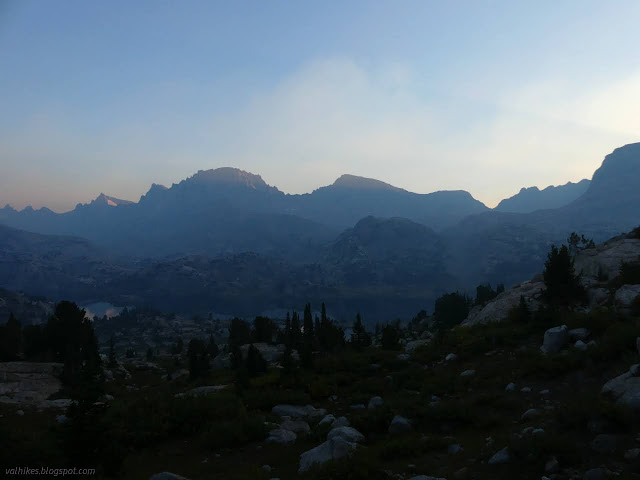
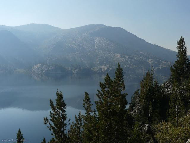
It was smoky again when I awoke. There were no long tendrils to watch floating in. It was just sitting there over everything already.
I got my breakfast and packed up and headed down to rejoin the Continental Divide Trail as it follows the Highline Trail.
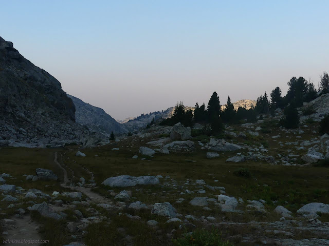
I didn't stick to it very long. The trail winds downward for a bit and then there's a junction. Good bye to the CDT and Highline.

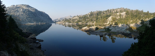
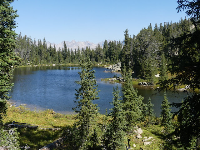
Around the northeast side of Little Seneca Lake, I found another cold spot. The little plants were all covered in frost.
Many people were camped along the trail below Little Seneca Lake. Quite a few were well within 200 feet of the trail and the waters. There's so many new signs stuck up on trees and posts along that trail that there's no way they didn't know the rules. They just don't care. I was definitely getting better sites for complying.


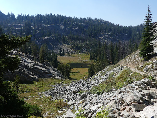
The trail leaves Seneca Lake early to roll along toward Hobbs Lake past some little unnamed things. There's lots of little trails on the way that likely lead to less visible camps for those who know better.


I came upon some of the most attractive water on the trail, a beautiful little running steam. I knew I would need more water soon and foolishly passed it up because I was about to take on the biggest climb of the day. This climb is all of 300 feet, so not exactly a challenge.
Then I passed up some more water because it comes from still water.
Then I didn't bother to go a short way down a trail toward some more water because not only was it still, but it was out of the way. The trail from there only passes by the very smallest of ponds for the next 4 miles, which I had noted already. So it was very much my own fault as I drank my last bit of water before arriving at Photographers Point, a place that does have water, but it was a small pond with a golden retriever bouncing around in the middle. I passed that up, too. I wasn't going to suffer much from this embarrassing foolishness, but it was leaving my lips chapped.
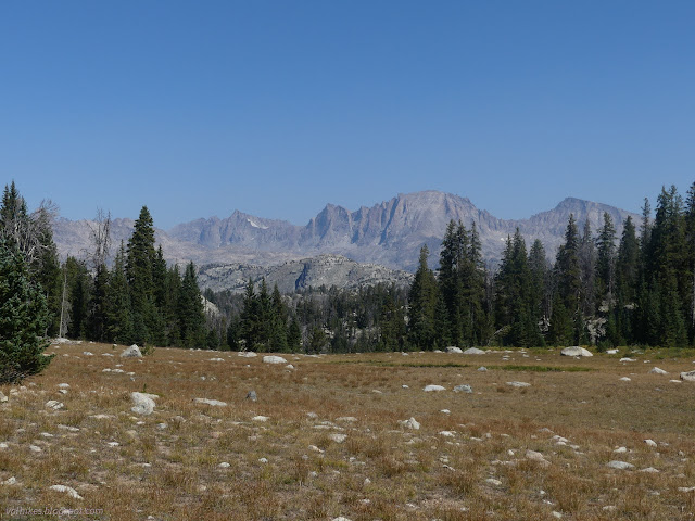
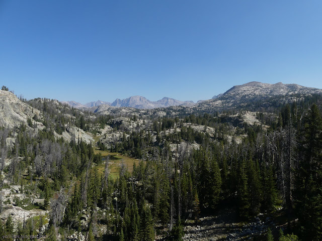
Photographers Point is really something. There's a little bit of trail in need of maintenance, but that just gets a pretty good view. For the really good view, you've got to keep going down the hill out to a slight rise of a point. From there it drops of and you can see all of the canyon below. I went down to take it all in. Hey, there's still emergency (fun for the dog) water at the top if I get too dry.

Someone had encouraged me to keep going for the grand view, so I passed it on to the next fellow. He wasn't quite so incorrigible. We got to talking about other things, like how there's some resemblance to the Sierra Nevada out here, although on a somewhat smaller scale. It turned out I was talking to someone carrying a great excess of water for training purposes and he wouldn't take "no" for an answer, so I ended up with a liter of water that hadn't recently had dog playing in it. I must admit, it tasted very good indeed and most of it vanished quickly.

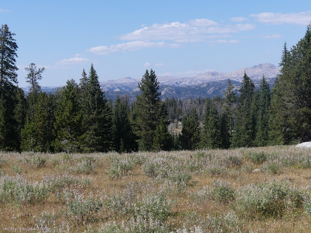
At the junction for Miller Lake, I spotted some peaks of a new shape and wandered a short way along that trail to have a better look.

From there, the trail drops, getting enveloped in trees. I was told there were more epic views on this trail versus Pine Creek Canyon. They don't start very soon, though. There were views on the other side right from the start. This is a few miles of well maintained trail through beetle killed forest. I grabbed some more water from Faler Creek once it was evident and flowing beside. It has some little meadow areas to break up the rather frayed forest look.

It's a little anticlimactic right at the end, not to mention quite crowded even with the bulk of the long weekend crowds gone. Had I spent longer planning, I might have put in some more food and roamed a little longer along the west side of the divide, especially to the south where there's a web of more trails. Oh, and visited a glacier! I had a good trip with what I did.
*Bridger 2022 photo album*
©2022 Valerie Norton
Written 17 Nov 2022
Liked this? Interesting? Click the three bars at the top left for the menu to read more or subscribe!


Comments
Hey, there's more to come, too! And then more places I had been wanting to visit for a long time.