Sacred Rim
Bridger-Teton National Forest
(map link)
I stopped by the Pinedale Ranger Station where I bought a Bridger-Teton National Forest visitor map, Beartooth's map covering all of the Wind River Range, and picked up a free rental Garcia bear can. My bear can's lid is just not fitting all the way on anymore, even when it's warm out, so I couldn't pass up a free rental. Then I headed out to see what something called "Skyline Road" has to offer and have a little hike at the end of it. I was told I wouldn't find parking at the top with Labor Day weekend getting started, but it was still Friday morning and I can read a map. As I went by, I craned my neck at the Pole Creek parking area and saw that it was quite full but the people who went in to park weren't coming back out. It still had spaces. I continued on through the campground to the parking for Pine Creek Canyon, which I incorrectly thought was the closer one for me anyway. I'd not quite figured out where exactly this unofficial trail actually is. I guess they carefully don't mention Pine Creek Canyon so that the equestrians are more likely to find parking. There is staging for horses here. There were only three vehicles and a Forest Service trailer when I added my tiny car and tinier trailer to the mix.

I had a look over Pine Creek Canyon and decided that probably wasn't the right trail after all and had another look at my resources. Sacred Rim is on OpenStreetMap and splits off from Pole Creek Trail very early on. Since I'd very specifically been encouraged to try to squeeze onto the side of the road rather than park in this large lot, I looked carefully for any reason not to park there on the sign. I then started for the other trailhead and looked over all the campground signs on the way. I chatted with a few of the backpackers finishing before the crowds of the holiday weekend and found some of them were coming off loops, but nothing about parking. Then I got moving toward my goal.

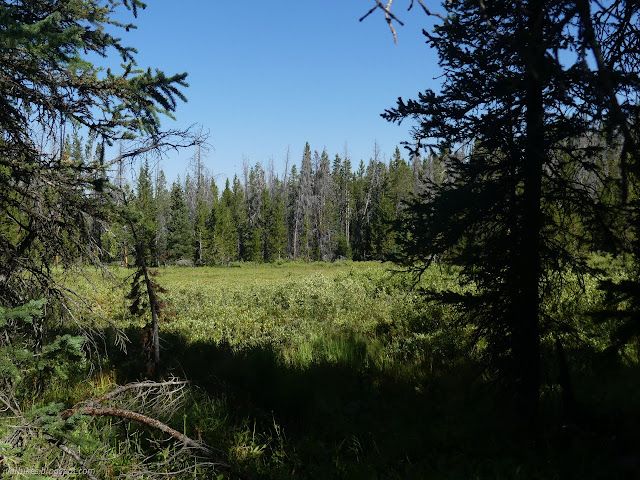
The junction is the second unsigned one from the trailhead. It was very obvious. There's beetle kill and plenty of fallen trees, but the trail is clear of them. The only rough spot is right at the start when it drops to cross small Faler Creek.


It's just under 2 miles to the end where the views get much better indeed.

There's a narrow bit to cross to get out to the best views. It's easy to get some anxiety going about the drop-offs on the way out to this lookout point. The walkway gets thicker again after and the narrow bit isn't that narrow. It was still setting off some irrational fears for me.


I hadn't seen many people on the way out, but apparently I was just ahead of the lunch crowd. There were all sorts of people coming up after me and as I headed back down down. On the way back, I took the first unsigned trail from the trailhead and found it to be a more direct route back to the other trailhead typically used by horses (and well covered with the evidence of that). Sacred Rim is a short hike with a little elevation gain and a grand reward at the end, so no wonder it's popular.
*Bridger 2022 photo album*
©2022 Valerie Norton
Written 13 Nov 2022
Liked this? Interesting? Click the three bars at the top left for the menu to read more or subscribe!


Comments