Skyline: Long Lake and Fremont Lake
Bridger-Teton National Forest
(purple line, map link)
DAY 1 | DAY 2 | DAY 3 | DAY 4 | DAY 5
I had Labor Day weekend coming on as a motivation to run away into the wilderness and a brand new Beartooth map of the Wind River Range to facilitate the running. This is grizzly country, so when it was mentioned that bear cans are rented for donations, I jumped at that. (It's really come down from the $3 a day we paid Yosemite in 1998.) The lid on mine isn't screwing on properly, so I get to remember how much nicer the Garcia opening mechanism is. It's offset by being smaller, heavier, opaque, and the opening is just small enough to be annoying, but right then the opening mechanism is feeling all important. They also rent bear spray, but apparently I have a deep emotional disdain of the stuff. After about eight "no"s, I never found out how much that costs. There seemed to be a lot of bear spray on display for the short hike, but a significant minority were without.
I'd not noticed a loop option from the end of Skyline, but people were returning from such a thing. They mentioned one of the trails is "unmaintained". That's a black dotted line on the Beartooth map making it easy to miss among the colors. I expect a dad and his youngish sons didn't go on something too dangerous, so decided not to worry about the "unmaintained" status. Then I pondered some options for the rest of it, estimated the total length, and started packing up food. Oh, and everything else, but food seems to be the greatest part of the time. Besides adding in a proper bear can, I swapped the warmer, heavier mat back in. Had I paid more attention to the monthly rainfall averages printed on the map, I'd have trusted the weather report more and chucked the roof and raincoat, keeping bivy and skirt. Weather predictions gave assurances that there was no chance of rain. Having just been rained on for two out of the last three trips, I had excessive feelings it was needed. It wasn't. I finally got a mid-afternoon start with plans to visit Long Lake and Fremont Lake, then camp by the trail junction near Pine Creek.

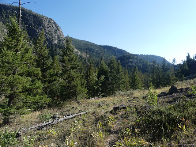
This trip starts off downhill, crossing that big canyon I'd just been looking over from Sacred Rim. They've got one post to say start counting your steps, then a second to say that's 100 feet: far enough from streams and rivers for camping, then a third to say that's 200 feet: far enough from trails and lakes for camping. No mention why running water doesn't need as much protection as still water. There's been some pile burning in the area to deal with the beetle kill, but that doesn't last long. There were four trees down over the two miles dropping to Long Lake, clear compared to the fresh memory of Zirkel. It's actually quite bad compared to Pole Creek, the main route off the end of Skyline.


The trail follows Faler Creek down, somewhat, but the water isn't particularly accessible except at the top when crossing into the wilderness. I noted that the trail on the Forest Service topos randomly varies from reality, but at least shows similarity. OpenStreetMap has the trails well traced out and a few extras.


I decided to try one of those extra trails. OpenStreetMap shows a trail going directly from Long Lake to Fremont Lake. It took some searching, but I found a track out the back of a camp site. It gradually resolved into a trail. It was logged out once, but not recently. It was faint in one spot in the middle and quite obvious as it joined with Long Lake Trail at the bottom.


The Forest Service claims there's Upper Fremont Lake Campground by the lake, but there's only a well used site with log benches and such. Everything else is vanishing into the ground. A sign well off the side of the trail told of destinations for any coming by boat to start their hike. There was one extra trail no maps mentioned on the way up which might be access to the gaging station. It's an impressive amount of water to gage.


I found a little camp site practically on the trail right at the junction. Not quite what I was hoping for. Trees were thick. I thought about heading back the way I'd come or back up toward Long Lake, but decided to go across the bridge and look as I climbed.


"Trail abandoned, not maintained" says a sign on the far side. Why? Maybe the one above it "trail not recommended for stock" is the answer. Some forests just don't want a trail if you can't ride it. A few steps up, a tree looked like it had been logged out not more than a year ago. I found a patch off trail that could serve for a camp and stopped. So, that 200 feet from trails, does that apply to abandoned trails? I went and got the water I'd need for camping and the next morning, then got to looking around and found something oh so very much better. The trees stop and there's a rocky meadow sloping off to the west with views and a flat spot near the top. It wasn't impacted, but requiring 200 feet off trail encourages that in most places. It would have been even more brilliant to be there before sunset, but my start had been quite late.
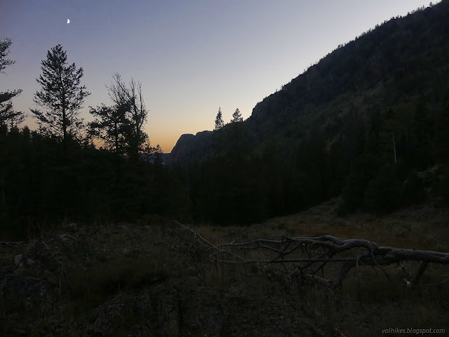
I found a flat rock for cooking and set myself out cowboy style for the night in grizzly and wolf country. A little bit of tent fabric isn't going to protect from those; might as well enjoy the stars.
same trip, next day ⇒
*Bridger 2022 photo album*
©2022 Valerie Norton
Written 14 Nov 2022
Liked this? Interesting? Click the three bars at the top left for the menu to read more or subscribe!


Comments