Skyline: Upper and Lower Jean Lakes, Island Lake, and Titcomb Basin
Bridger-Teton National Forest
(orange line, map link)
DAY 1 | DAY 2 | DAY 3 | DAY 4 | DAY 5
I slept well, but woke up to smoke wafting along high in the sky. It inspired less outright fear than the stuff wafting over 14ers in the spring had, but did make me grumpy. I'd managed to stay out of smoke for all but that one day without any effort, but that was about to change.


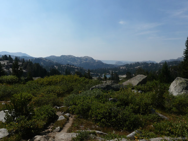
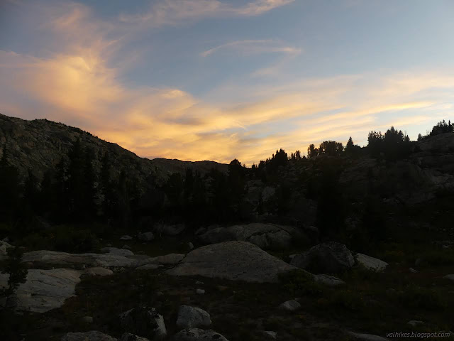
There was a little glow on the peaks in the morning sun, but not quite so impressive as the evening glow had been. The smoke was settling down over everything and was obscuring the view by the time I got started.

Just short of a well used and signed junction the Forest Service had taken off their map, I found a fellow meditating upon his proposed route for the day along that unmaintained trail and then up and over a pass to come into the Titcomb Basin. We discussed the smoke which he assured me was coming off California and I assured him that just because Idaho doesn't make the news, that doesn't mean it's not burning. As it happens, there was a little coming off northern California, it was gaining some in Oregon, but the bulk was from Idaho. Oh, and there was a little locally sourced from the eastern side of the mountains.
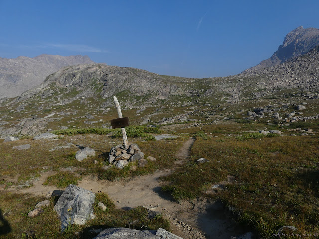
More interesting was this route, since I had decided to check out this place (Titcomb Basin) where "everybody" was going according to people at the trailhead. I would see more of it if I looped through it rather than an out and back on currently maintained trails. Not only that, there's the glaciers. Glaciers! Do you know how long it's been since I was near a glacier? I was expecting to maybe see a little of one, but this route would mean a lot more seeing and a little interaction with a glacier. The route is halfway marked on OpenStreetMap. I pondered it a little and eventually came to the conclusion that he was right, it's a scary route, and I didn't want to do stuff like that today. I didn't ask him if he needed company. At the same time, I felt a little guilty leaving someone who thought AllTrails is a great app to do it on their own. AllTrails hasn't even got the sense to do round number contour lines and the map it offers is someone else's and includes a lot of imaginary trails. But someone added this one... He might have said "no" to company anyway. I hoped his plans fit within his abilities as I left him to his continuing meditations.
So rather than exploring difficult passes among a multitude of named peaks, I was wandering along Fremont Creek and it's many lakes, often unnamed.

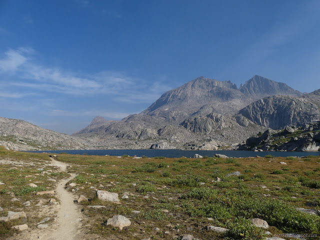
I found myself with an impression of pleasant warmth as I followed this creek, for there were quite a few flowers still blooming along it.

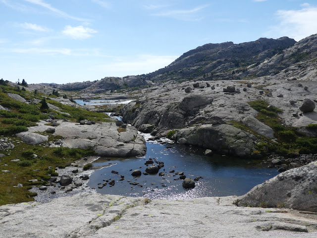
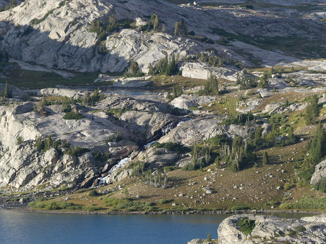
Between the Upper Jean Lake and Lower Jean Lake, there's a multitude of streams with cascades and little waterfalls.
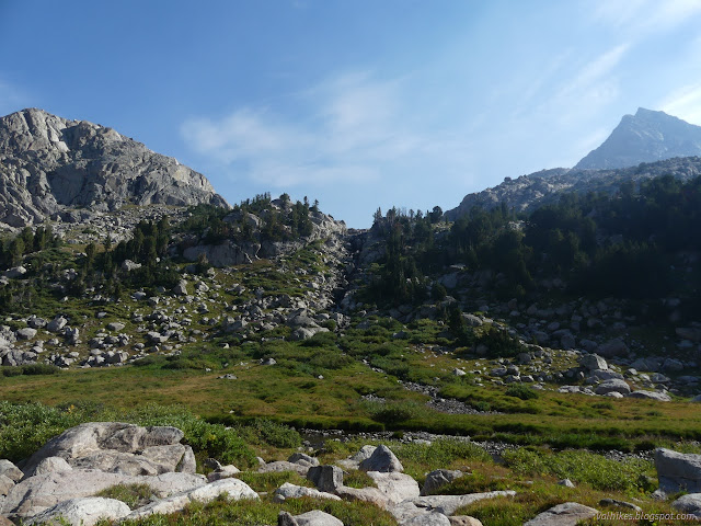


I thought about cutting across to Island Lake instead of dropping to "Fremont Crossing", which just happens to be a crossing of Fremont Creek. I stuck to the trail. The creek grows quite a bit in its visit to Island Lake. There's a nice bridge over it dated July 2022. Whew, was the stink of creosote ever strong on that.

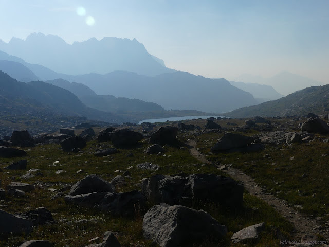
There's a lot more hills to hike up and over by the way the trail goes. More lakes to visit and probably more views. The smoke was gradually thinning as the day wore on.


When I got to the junction, I still was thinking to go see the Titcomb Basin. The surge of people visiting for Labor Day should have left the area that morning. I was specifically thinking I'd find a camp near a high point about half a mile in, then hike with only part of my gear until I felt like turning around. It worked out well.
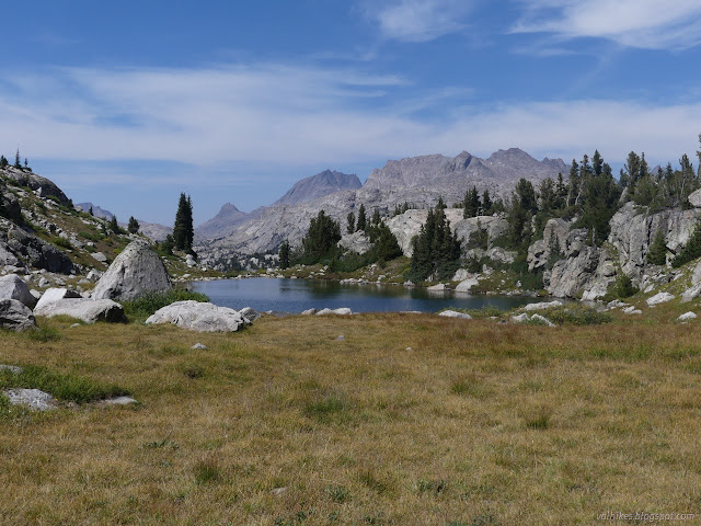
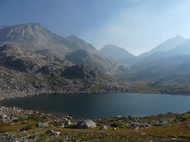
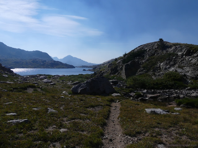
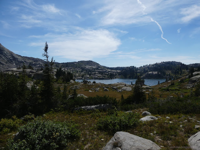
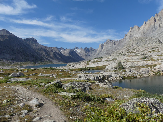
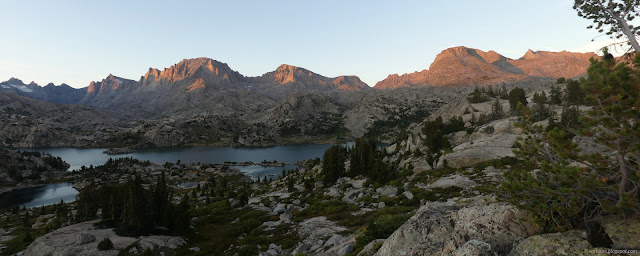
Near the high point, I followed a thin trail out to an impacted camping site. A few steps past some trees got me a grand view out over Island Lake. There was a fire ring I could ignore and a nearby pond for water if needed. I dropped much of my gear by a tree and took off for Titcomb Basin.

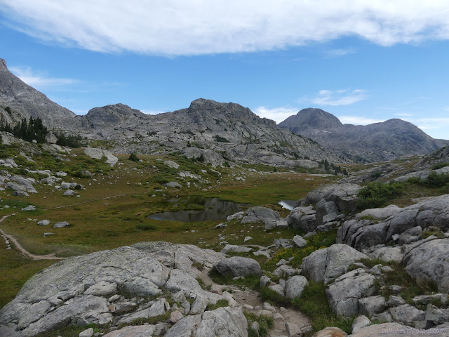
It's a long way around the side of Island Lake and it passes by a bunch of good streams. There's quite a few more trails out to camping areas, too. There's a lot of extra trails in the area.

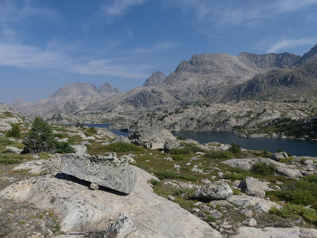
The trail up to Indian Pass was relatively tiny, but very tempting to me. It claims to go nowhere once it reaches the top, but there's glaciers to see when you get there! Too bad for me, I didn't have the time before my turn around hour to get all the way to the top. I continued on the flatter trail to the basin.

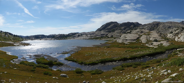
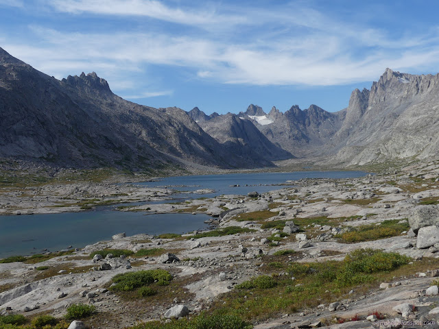
There's a spot of narrow rock passage and small scramble that very decidedly puts a stop to any stock travel into Titcomb Basin. No worries for me.

I was just 15 minutes to my turn around time and about 3 miles from camp when I got to the edge of the Titcomb Lakes. That was about enough. I headed off trail for a nice snack spot to take in the lakes and ponder if any of the edges of ice I'd seen were bits of glacier.

Then I headed on back.


There was someone out wandering the lake in a packraft. It looked like they were enjoying themselves. I'd been meeting maybe 4-5 groups a day, which I consider a lot. There were at least a dozen scattered about this area and I saw loads more people on the way back the next day. Apparently someone counted 75 campfires around the lake the night before, so it wasn't nearly as bad as it could be. I grabbed water just before leaving the level of Island Lake and had gained no nearish neighbors when I got back to my chosen camp.
I found a sheltered spot to make my kitchen and had everything sorted in time to enjoy some more lovely alpine glow over Island Lake.

same trip, next day ⇒
*Bridger 2022 photo album*
©2022 Valerie Norton
Written 17 Nov 2022
Liked this? Interesting? Click the three bars at the top left for the menu to read more or subscribe!


Comments