Hayden: Uinta Highline to Four Lakes Basin
Uinta-Wasatch-Cache National Forest
Ashley National Forest
(orange line, map link)
DAY 1 | DAY 2 | DAY 3
Much of the parking along the Mirror Highway (UT-150) requires a permit. For short term, you can buy 3 days for $6 or 7 days for $12. I wanted 4 days and since this forest claimed they were honoring the fee free day on Saturday (AKA "tomorrow"), I should have been able to get it. Nope. I got to pay for the free day, too. It doesn't seem honest to me. So I had a 1 week permit to park for 3 days plus an extra night at Hayden Pass, the western terminus of the Uinta Highline Trail. I couldn't find my GPS anywhere, which was disturbing. In fact, I remembered that I had set it on top of my pack in the passenger seat one day and then hauled the pack into the trailer, forgetting about the item sitting on top of it, the next. I was worried I would have to drive back to Wyoming to find it as I swapped out the lighter extra AA NiMHs for my brick of a charger that wasn't even fully charged. I'd just have to track this trip on the phone and I wasn't sure how much extra battery that would take. All that was coloring my disposition negatively as I started off into another forest with far too much beetle kill.

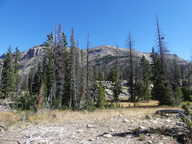
But the beetle kill is the only legitimate gripe now, in the moment. The trees are fairly thin and the trails clear, so it could be worse. I detoured off the path to a rock outcrop to check on what view could be seen among the trees.

Then I trotted off past a signed junction and into the High Uintas Wilderness once more. I would spend the next three days on a tour of the local lakes. This first day would be spent mostly on the Uinta Highline Trail, only diverging at the end to find some of those lakes.


Then I ran into the 2018 Murdock Fire footprint on the way to the first lake. Oh, yes, it could be worse. Sometimes its important to think of the future rather than the now.

The trail does not stay long within the fire footprint and is quickly back to where there's just quite a lot of fuel waiting.

I passed by junctions for spur trails to more lakes. In the back of my mind was a deep suspicion that I was missing out particularly for not turning up Naturalist Basin.


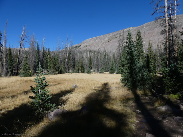
As the trees thinned, I'd reached the end of my time on the Highline for this trip, except for the little bit of return. I did all the work to get to the high bits and then got no high bits. Ah well, lakes were the goal and lakes were coming soon.

Trail sneaks around the edge of an arm of rock left by the glaciers that carved this place. I passed a shortcut trail for people who don't want to see any pretty lakes, then had to get off trail a little to get a good look over them.


I took the Cyclone Pass Trail down into the Four Lakes Basin. It is clear at first, but mostly vanishes at the edge of the forest. There's multiple trails through the next bunch of trees. I didn't see much past obvious camps. According to my Forest Service topo, it goes over the pass and down into the valley where it just runs out without getting anywhere. OpenStreetMap says there's a spur to Sea Lion Lake. It probably once connected with Rock Creek. I think I'd be wanting to go to Thompson Lake if I went over.


I watched a bald eagle over the lake, then settled on a site. Finding a spot has the typical difficulties. The meadows are soggy. I went a little east and suddenly there's the creek that flows from Dale Lake to Daynes Lake. By the trees, there's standing dead in range of every flat spot.


So there was standing dead over my camp, but there was a great kitchen rock and as nice a sunset as can be had with no clouds to fancy it up.

Tracking the hike on my phone took about 10% extra battery, so that's not so bad. I probably wouldn't even need the extra battery over the three days.
same trip, next day ⇒
*Wasatch 2022 photo album*
©2022 Valerie Norton
Written 29 Nov 2022
Liked this? Interesting? Click the three bars at the top left for the menu to read more or subscribe!


Comments